MyTopo
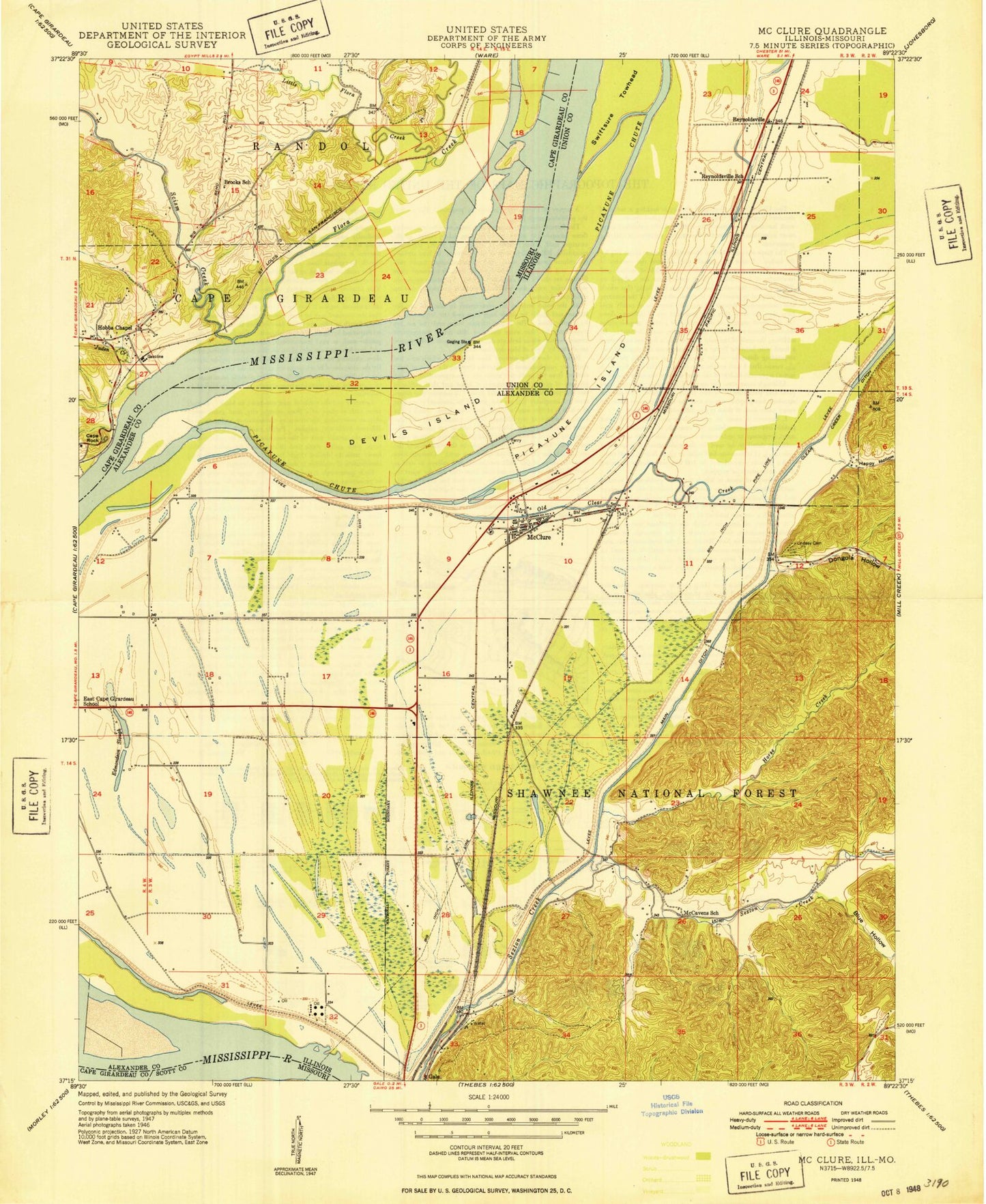
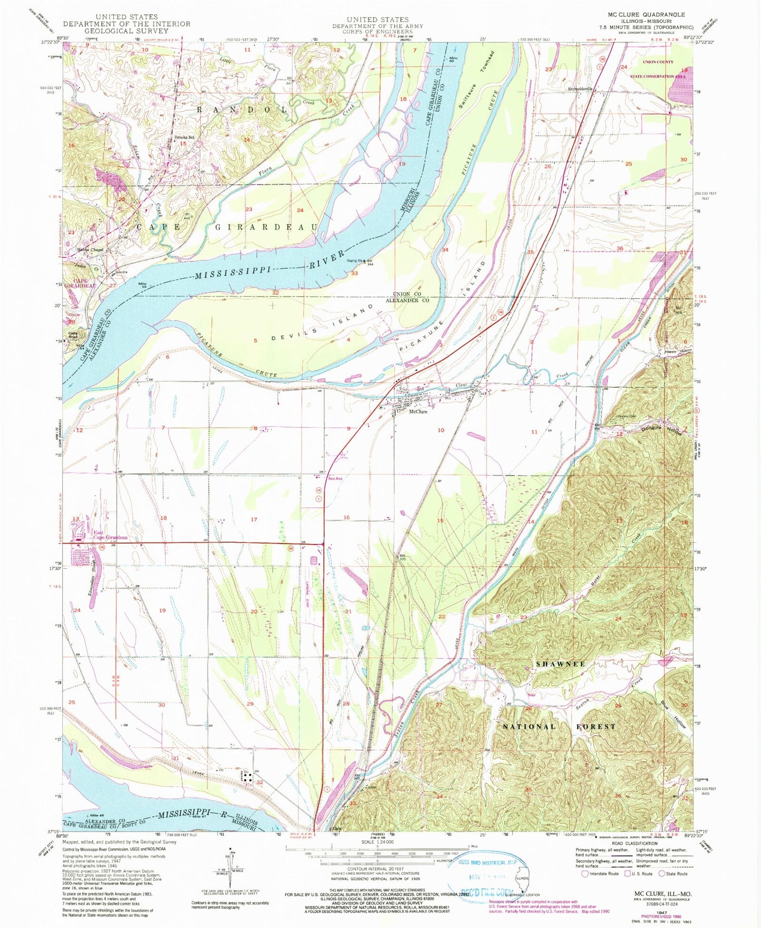
Classic USGS McClure Illinois 7.5'x7.5' Topo Map
Couldn't load pickup availability
Historical USGS topographic quad map of McClure in the states of Illinois, Missouri. Map scale may vary for some years, but is generally around 1:24,000. Print size is approximately 24" x 27"
This quadrangle is in the following counties: Alexander, Cape Girardeau, Scott, Union.
The map contains contour lines, roads, rivers, towns, and lakes. Printed on high-quality waterproof paper with UV fade-resistant inks, and shipped rolled.
Contains the following named places: Big Inch Pipe Line, Blue Hollow, Brooks School, Cape Rock, Clear Creek, Devils Island, Dongola Hollow, East Cape - McClure Fire Department, East Cape Election Precinct, East Cape Girardeau, East Cape Girardeau Airport, East Cape Girardeau School, Edmondson Slough, Flora Creek, Hacker Bend, Happy Hollow, Hobbs Chapel, Hobbs Chapel Cemetery, Horse Creek, Juden Creek, KGIR-AM (Cape Girardeau), KZIM-AM (Cape Girardeau), Lindsay Cemetery, Little Flora Creek, Main Ditch, McCavens School, McClure, McClure Election Precinct, McClure Post Office, Old Clear Creek, Picayune Chute, Picayune Island, Reynoldsville, Reynoldsville School, Scism Creek, Shawnee Elementary School-South, Soakie Creek, Swiftsure Towhead, Village of East Cape Girardeau, Village of McClure, ZIP Code: 62957