MyTopo
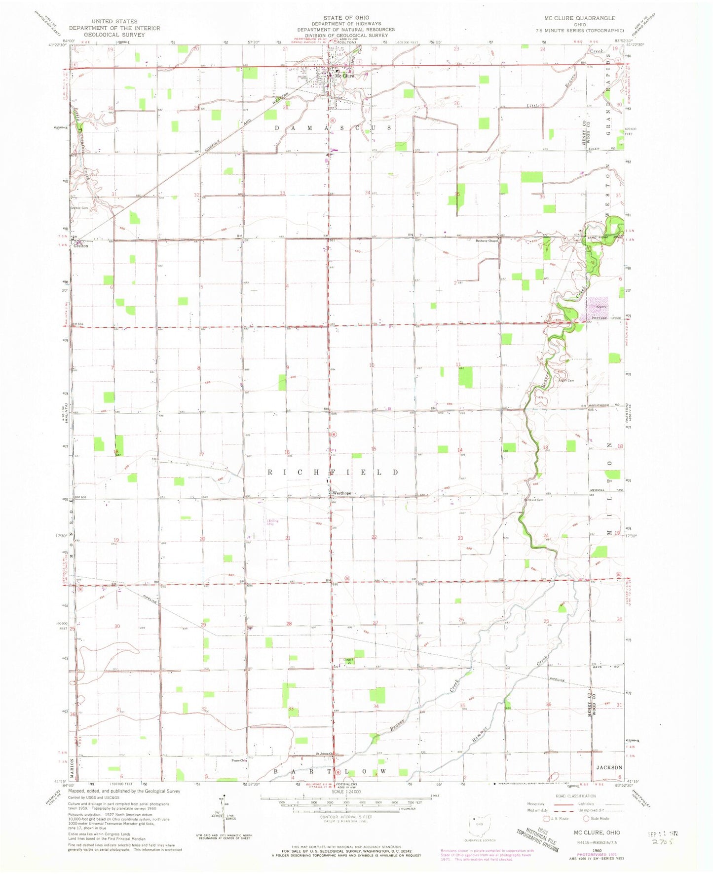
Classic USGS McClure Ohio 7.5'x7.5' Topo Map
Couldn't load pickup availability
Historical USGS topographic quad map of McClure in the state of Ohio. Map scale may vary for some years, but is generally around 1:24,000. Print size is approximately 24" x 27"
This quadrangle is in the following counties: Henry, Wood.
The map contains contour lines, roads, rivers, towns, and lakes. Printed on high-quality waterproof paper with UV fade-resistant inks, and shipped rolled.
Contains the following named places: Angell Cemetery, Bethany Christian Union Church of Christ, Custar Stone Quarry, Damascus Township High School, Damascus Township Volunteer Fire Department, Eickmeier Airport, Grelton, Grelton Post Office, Hammer Creek, Hope School, McClure, McClure Police Department, McClure Post Office, Peace Church Cemetery, Peace Lutheran Church of Deshler, Richfield Cemetery, Saint Johns Lutheran Cemetery, Saint Johns Lutheran Church, Township of Richfield, Trinity United Brethren in Christ Church, Village of McClure, Westhope, Westhope Church, Westhope Post Office, ZIP Codes: 43523, 43534