MyTopo
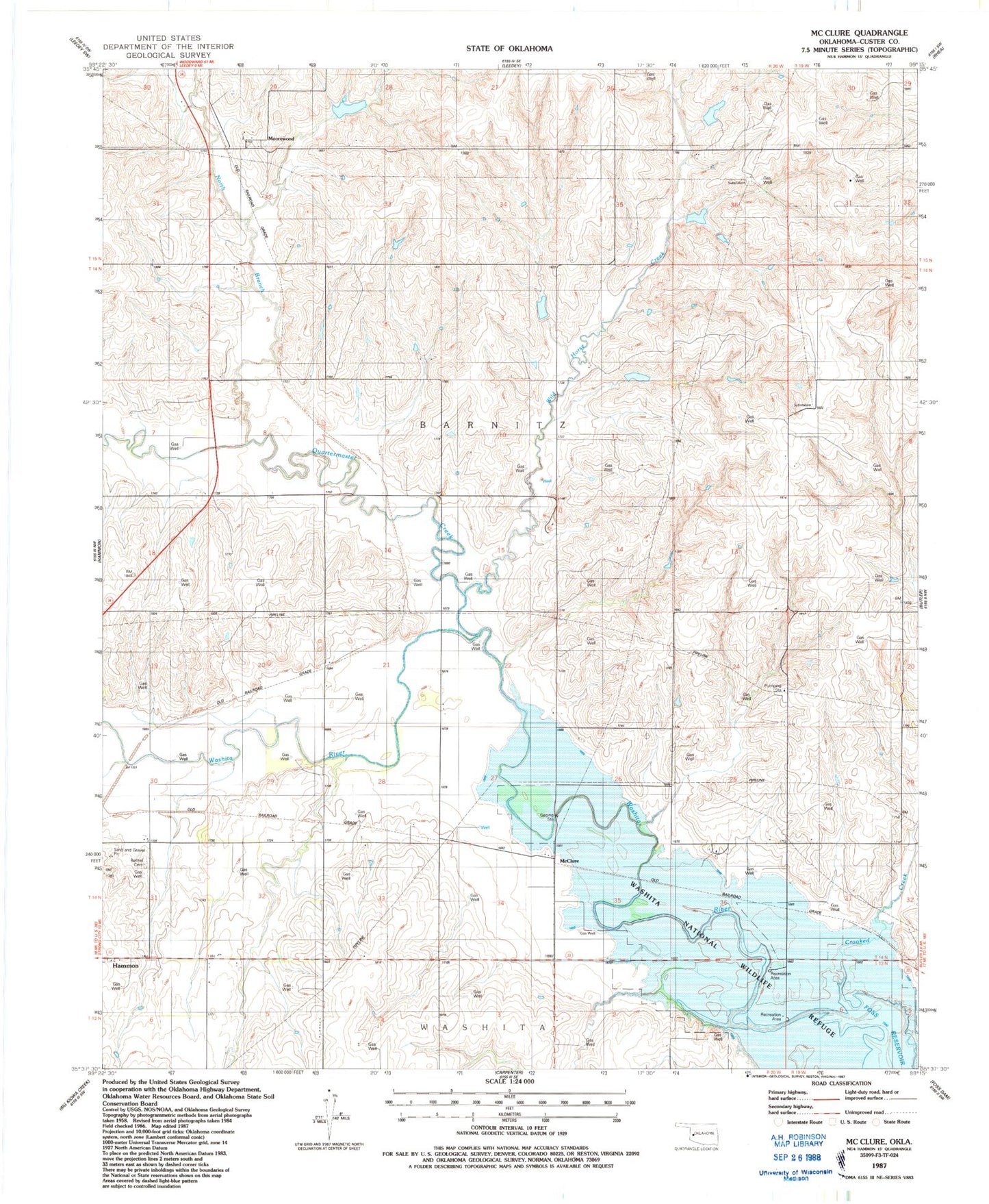
Classic USGS McClure Oklahoma 7.5'x7.5' Topo Map
Couldn't load pickup availability
Historical USGS topographic quad map of McClure in the state of Oklahoma. Map scale may vary for some years, but is generally around 1:24,000. Print size is approximately 24" x 27"
This quadrangle is in the following counties: Custer.
The map contains contour lines, roads, rivers, towns, and lakes. Printed on high-quality waterproof paper with UV fade-resistant inks, and shipped rolled.
Contains the following named places: Bethel Cemetery, Butler Division, McClure, Moorewood, Moorewood Cemetery, North Branch Quartermaster Creek, Oknoname 039001 Dam, Oknoname 039001 Reservoir, Quartermaster Creek, Quartermaster Creek Site 28 Dam, Quartermaster Creek Site 28 Reservoir, Quartermaster Creek Site 29 Dam, Quartermaster Creek Site 29 Reservoir, Quartermaster Creek Site 30 Dam, Quartermaster Creek Site 30 Reservoir, Quartermaster Site 25 Dam, Quartermaster Site 25 Reservoir, Quartermaster Site 27 Dam, Quartermaster Site 27 Reservoir, White Shield Creek, Wild Horse Creek