MyTopo
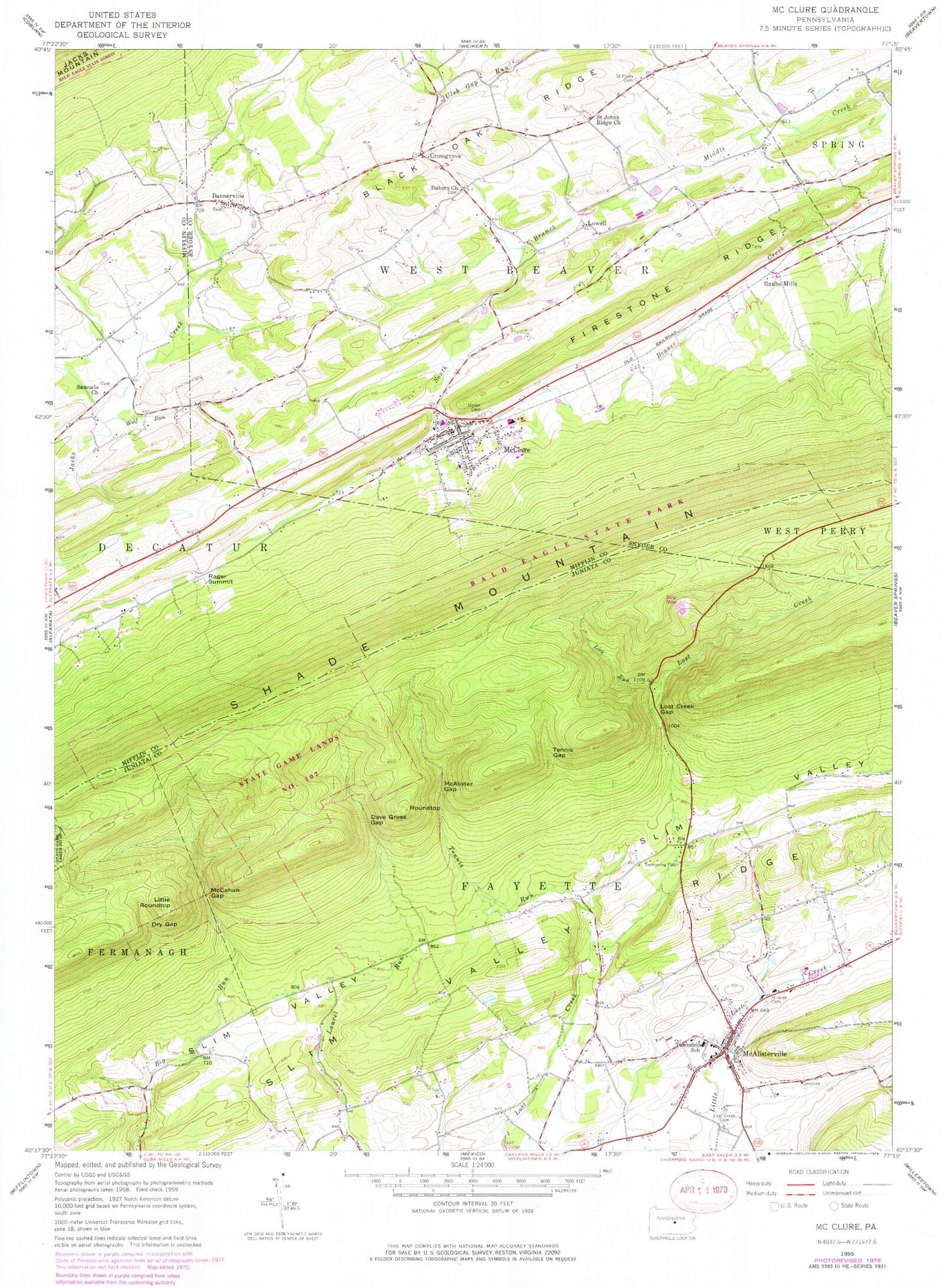
Classic USGS McClure Pennsylvania 7.5'x7.5' Topo Map
Couldn't load pickup availability
Historical USGS topographic quad map of McClure in the state of Pennsylvania. Map scale may vary for some years, but is generally around 1:24,000. Print size is approximately 24" x 27"
This quadrangle is in the following counties: Juniata, Mifflin, Snyder.
The map contains contour lines, roads, rivers, towns, and lakes. Printed on high-quality waterproof paper with UV fade-resistant inks, and shipped rolled.
Contains the following named places: Bakers Church, Bannerville, Bannerville Fire Company Station 140, Black Oak Ridge, Black Oak Ridge Cemetery II, Black Oak Ridge Two, Borough of McClure, Bowersox School, Crossgrove, Dave Gross Gap, Dry Gap, Fayette Fire Company Station 4, Fayette Township Emergency Medical Services Station 4, Hillside Cemetery, Krick School, Lick Run, Little Roundtop, Lost Creek Cemetery, Lost Creek Gap, Lowell, McAlister Gap, McAlisterville, McAlisterville Census Designated Place, McAlisterville Post Office, McCahan Gap, McClure, McClure Fire Department, McClure Post Office, McClure Volunteer Fire Company - Station 40, Rager Summit, Raubs Mills, Roundtop, Saint Johns Ridge Church, Samuels Church, Samuels Church Cemetery, Slim Valley Ridge, Snook Airport, Tennis Gap, Tennis Run, Township of Fayette, Township of West Beaver, Union Cemetery, Wolf Run, ZIP Codes: 17049, 17841