MyTopo
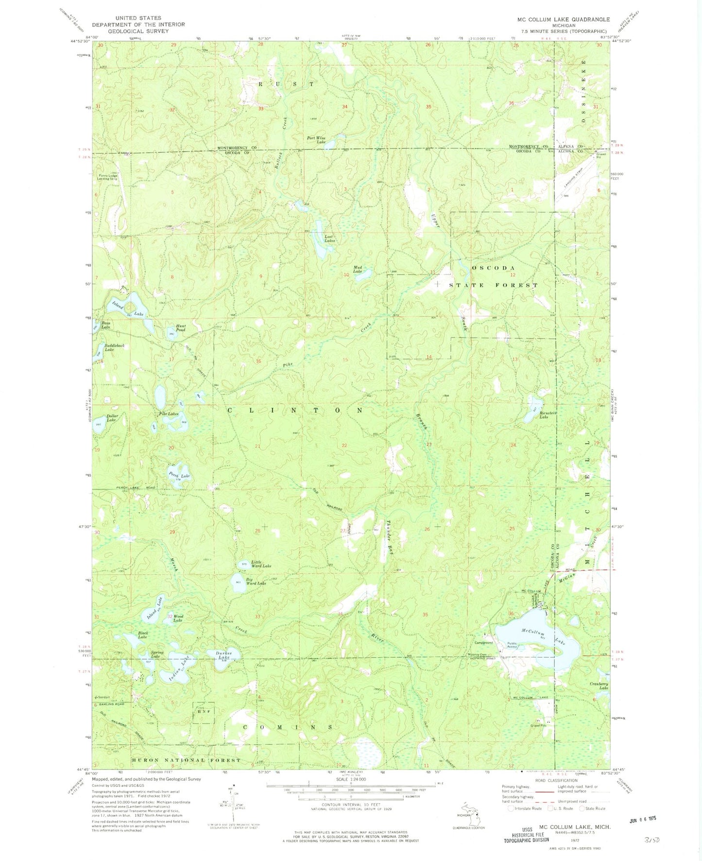
Classic USGS McCollum Lake Michigan 7.5'x7.5' Topo Map
Couldn't load pickup availability
Historical USGS topographic quad map of McCollum Lake in the state of Michigan. Map scale may vary for some years, but is generally around 1:24,000. Print size is approximately 24" x 27"
This quadrangle is in the following counties: Alcona, Alpena, Montmorency, Oscoda.
The map contains contour lines, roads, rivers, towns, and lakes. Printed on high-quality waterproof paper with UV fade-resistant inks, and shipped rolled.
Contains the following named places: Big Ward Lake, Black Lake, Bullock Creek, Dollar Lake, Durkee Lake, Hunt Pond, Indian Lake, Island Lake, Little Ward Lake, Lost Lakes, Marsh Creek, McCollum Lake, McCollum Lake Recreation Site, Mooney Cemetery, Mud Lake, Oscoda State Forest, Perch Lake, Pike Creek, Pike Lakes, Port Wine Lake, Rienstein Lake, Saddleback Lake, Spring Lake, Wood Lake