MyTopo
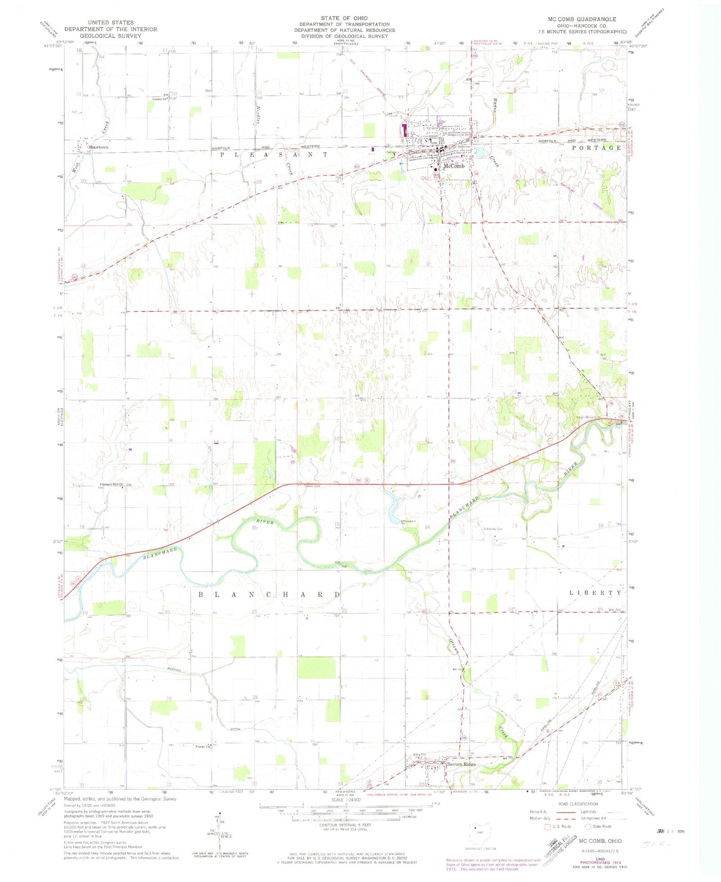
Classic USGS McComb Ohio 7.5'x7.5' Topo Map
Couldn't load pickup availability
Historical USGS topographic quad map of McComb in the state of Ohio. Map scale may vary for some years, but is generally around 1:24,000. Print size is approximately 24" x 27"
This quadrangle is in the following counties: Hancock.
The map contains contour lines, roads, rivers, towns, and lakes. Printed on high-quality waterproof paper with UV fade-resistant inks, and shipped rolled.
Contains the following named places: Benton Post Office, Benton Ridge, Benton Ridge Cemetery, Benton Ridge Station, Blanchard Township Volunteer Fire Department, Center Church, Dukes Cemetery, Hillside Pines Mobile Home Park, Horn Family Cemetery, Indian Grove Cemetery, Knepper Cemetery, Lewisville, Litzenberg Memorial Woods, McComb, Mccomb Fire Department, McComb High School, Mccomb Police Department, McComb Post Office, McComb Union Cemetery, McComb Upground Reservoir Number One, McComb Upground Reservoir Number One Dam, McComb Upground Reservoir Number Two, McComb Upground Reservoir Number Two Dam, Miller Lake, Miller Lake Dam, Moffitt, Moffitt Ditch, Moffitt Post Office, Ottawa Creek, Pickens Run, Pleasant Hill Church, Pleasant Mccomb Portage Joint Ambulance District, Schwartz Cemetery, Shady Acres Golf Course, Shawtown, Shawtown Post Office, Township of Blanchard, Township of Pleasant, Trinity Baptist Church, Village of Benton Ridge, Village of McComb, ZIP Codes: 45816, 45858