MyTopo
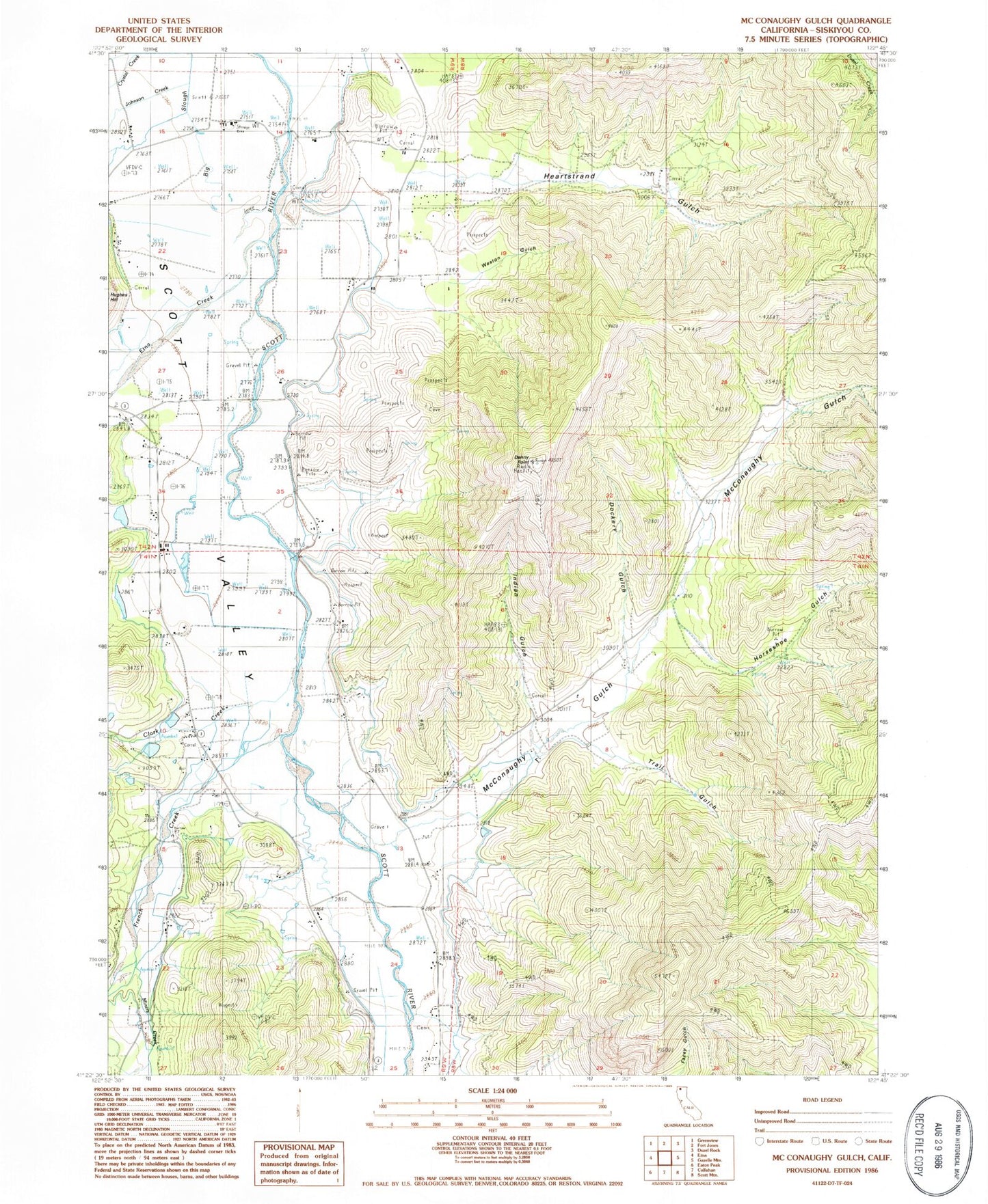
Classic USGS McConaughy Gulch California 7.5'x7.5' Topo Map
Couldn't load pickup availability
Historical USGS topographic quad map of McConaughy Gulch in the state of California. Map scale may vary for some years, but is generally around 1:24,000. Print size is approximately 24" x 27"
This quadrangle is in the following counties: Siskiyou.
The map contains contour lines, roads, rivers, towns, and lakes. Printed on high-quality waterproof paper with UV fade-resistant inks, and shipped rolled.
Contains the following named places: Clark Creek, Denny Point, Dockery Gulch, Douglas School, Etna Creek, Fort Jones Omni Radio Range Station, French Creek, Heartstrand Gulch, Horseshoe Gulch, Indian Gulch, Johnson Creek, McConaughy Gulch, McConnahue School, Miners Creek, Scott Valley Fire Protection District Eastside Road, Scott Valley Fire Protection District French Creek, Trail Gulch, Weston Gulch