MyTopo
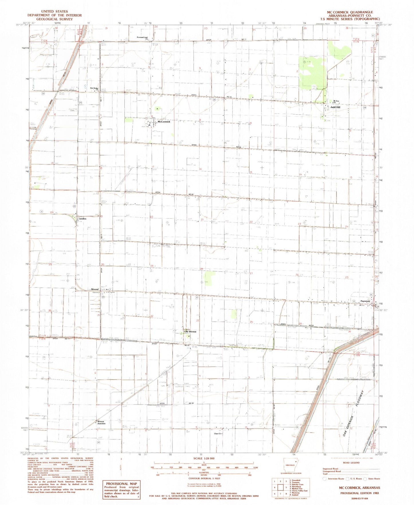
Classic USGS McCormick Arkansas 7.5'x7.5' Topo Map
Couldn't load pickup availability
Historical USGS topographic quad map of McCormick in the state of Arkansas. Map scale may vary for some years, but is generally around 1:24,000. Print size is approximately 24" x 27"
This quadrangle is in the following counties: Poinsett.
The map contains contour lines, roads, rivers, towns, and lakes. Printed on high-quality waterproof paper with UV fade-resistant inks, and shipped rolled.
Contains the following named places: Centerview Church, Chudy Grove Church, Ditch Number 10, Ditch Number 103, Ditch Number 11, Ditch Number 18, Ditch Number 19, Ditch Number 20, Ditch Number 21, Ditch Number 23, Ditch Number 24, Ditch Number 25, Ditch Number 26, Ditch Number 36, Ditch Number 38, Ditch Number 39, Ditch Number 77, Ditch Number 81, Engman, Glaze Church, Judd Hill, Judd Hill School, Landers, McCormick, McCormick Baptist Church, Mount Zion Church, Oak Donnick Floodway, Old Weona, Payneway, Payneway Census Designated Place, Perkins School, Promised Land Church, Red Bridge Church, South McCormick Church, Township of Lunsford, Weona, Weona Junction, ZIP Code: 72472