MyTopo
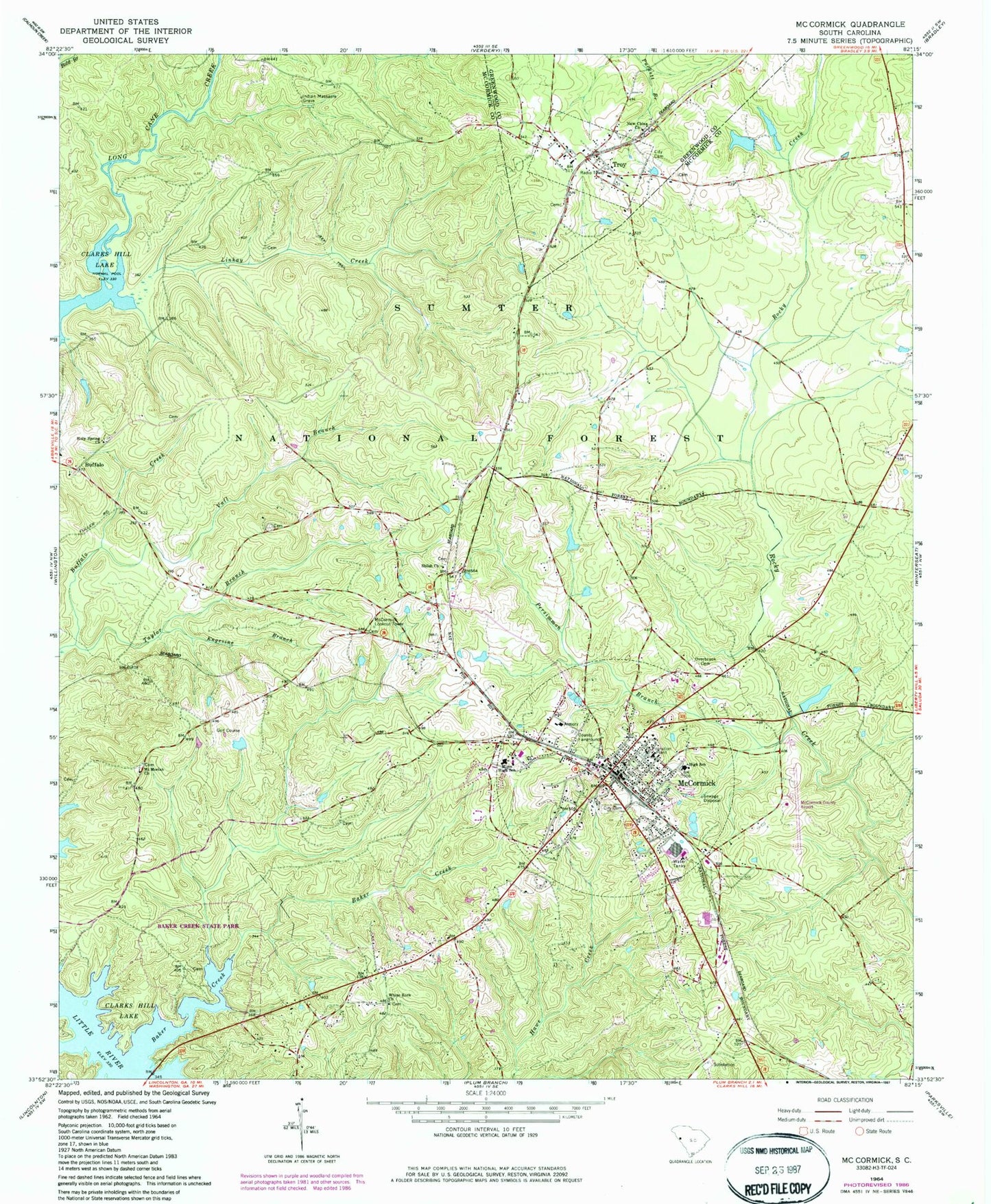
Classic USGS McCormick South Carolina 7.5'x7.5' Topo Map
Couldn't load pickup availability
Historical USGS topographic quad map of McCormick in the state of South Carolina. Map scale may vary for some years, but is generally around 1:24,000. Print size is approximately 24" x 27"
This quadrangle is in the following counties: Greenwood, McCormick.
The map contains contour lines, roads, rivers, towns, and lakes. Printed on high-quality waterproof paper with UV fade-resistant inks, and shipped rolled.
Contains the following named places: Baker Creek, Baker Creek State Park, Buffalo, Buffalo Baptist Church, Buffalo Cemetery, Buffalo School, Cedar Hill, Chesnut Ridge School, Dorn Gold Mine, Engevine Branch, First Baptist Church, Holy Spring Church, Holy Springs School, Indian Massacre Grave, Linkay Creek, Long Cane Academy, Long Cane Creek, McCormick, McCormick Airport, McCormick City Cemetery, McCormick Correctional Institution, McCormick County, McCormick County Airport, McCormick County Emergency Medical Services, McCormick County Fairground, McCormick Elementary School, McCormick Fire Department, McCormick Lookout Tower, McCormick Middle School, McCormick United Methodist Church, Mims High School, Mount Moriah Church, Mount Moriah School, New China Church, Old McCormick Town Reservoir, Old Troy School, Overbrook Cemetery, Patterson Bridge, Persimmon Branch, Pioneer Gold Mine, Rock Hill School, Rosenwold School, Shiloh Church, South Carolina Noname 35001 D-0642 Dam, South Carolina Noname 35005 D-0640 Dam, South Carolina Noname 35006 D-0639 Dam, Taylor Branch, Town of McCormick, Town of Troy, Troy, Troy Fire Department - Station 10, Vall Branch, White Rock Church, Wideman - Harris - Wilks Cemetery, Wideman Cemetery, Wideman School, Youngs School, Zion Chapel, ZIP Codes: 29835, 29899