MyTopo
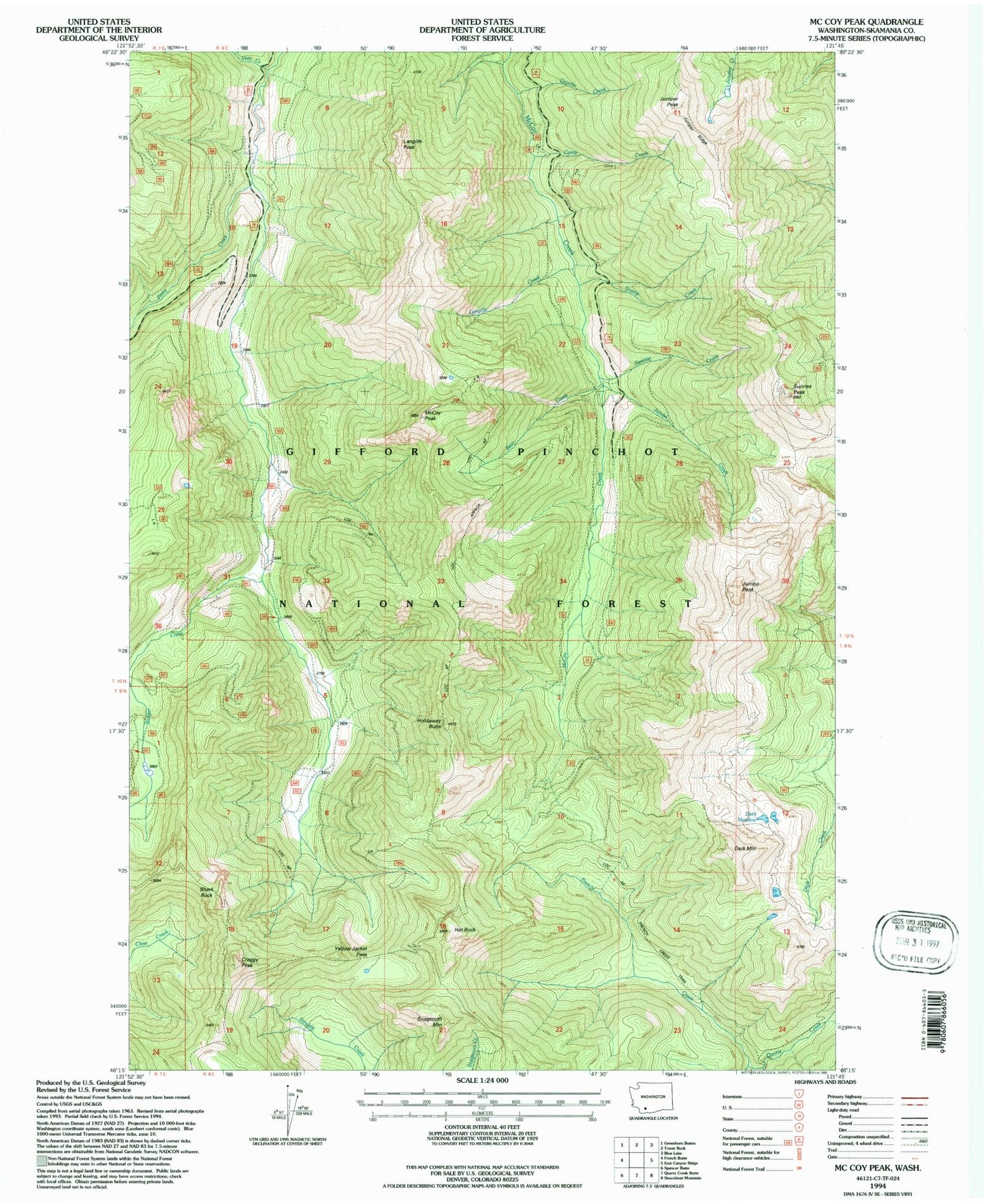
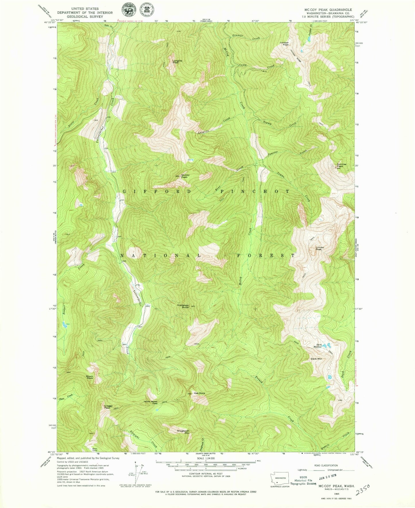
Classic USGS McCoy Peak Washington 7.5'x7.5' Topo Map
Couldn't load pickup availability
Historical USGS topographic quad map of McCoy Peak in the state of Washington. Typical map scale is 1:24,000, but may vary for certain years, if available. Print size: 24" x 27"
This quadrangle is in the following counties: Skamania.
The map contains contour lines, roads, rivers, towns, and lakes. Printed on high-quality waterproof paper with UV fade-resistant inks, and shipped rolled.
Contains the following named places: Badger Creek, Bear Creek, Camp Creek, Craggy Peak, Dark Meadow, Dark Mountain, French Creek, Granite Creek, Hat Rock, Holdaway Butte, Jumbo Creek, Jumbo Peak, Juniper Peak, Juniper Ridge, Langille Creek, Langille Peak, McCoy Peak, Pinto Creek, Scamp Creek, Shark Rock, Snagtooth Mountain, Sunrise Creek, Sunrise Peak, Veta Creek, Yellow Jacket Pass, French Creek Trail, Sunrise Peak Lookout, McCoy Peak Lokout