MyTopo
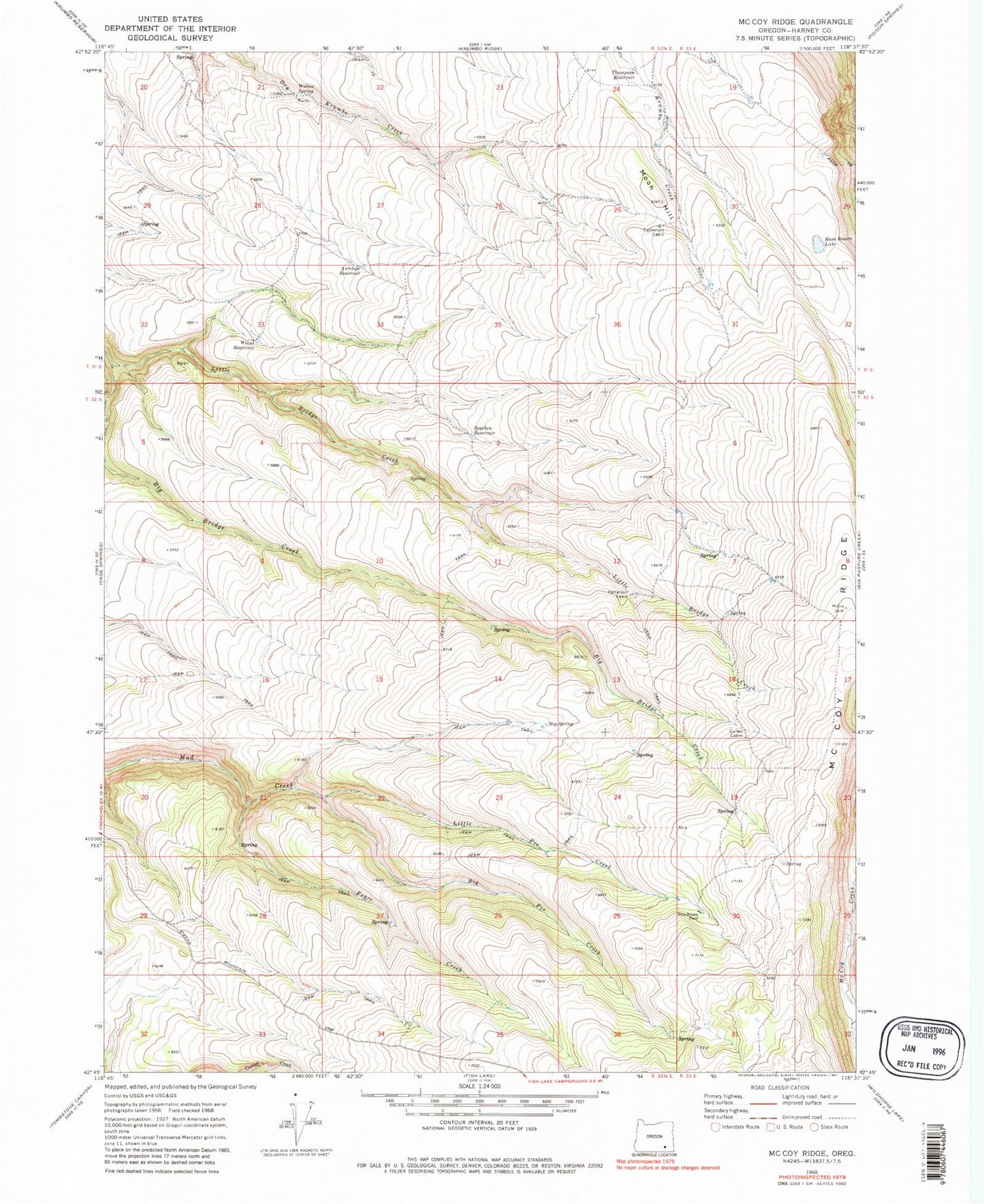
Classic USGS McCoy Ridge Oregon 7.5'x7.5' Topo Map
Couldn't load pickup availability
Historical USGS topographic quad map of McCoy Ridge in the state of Oregon. Map scale may vary for some years, but is generally around 1:24,000. Print size is approximately 24" x 27"
This quadrangle is in the following counties: Harney.
The map contains contour lines, roads, rivers, towns, and lakes. Printed on high-quality waterproof paper with UV fade-resistant inks, and shipped rolled.
Contains the following named places: Antelope Reservoir, Antelope Spring Road Reservoir, Big Bridge Creek, Big Fir Creek, Big Spring, Catherson Cabin, Cold Spring Creek, Cullen Cabin, D Hammond Place, Dingle Creek, Fence Creek, Gil Thompson Reservoir, Glen Brown Place, Ham Brown Lake, Horseshoe Spring, Knob Spring Reservoir, Little Bridge Creek, Little Fir Creek, McCoy Ridge, Middle Reservoir, Moon Hill, Mud Spring, Patterson Cabin, Rock Creek Reservoir, Sagehen Reservoir, Thompson Reservoir, Willow Spring, Witzel Reservoir