MyTopo
Classic USGS McCurtain SW Oklahoma 7.5'x7.5' Topo Map
Regular price
$16.95
Regular price
Sale price
$16.95
Unit price
per
Couldn't load pickup availability
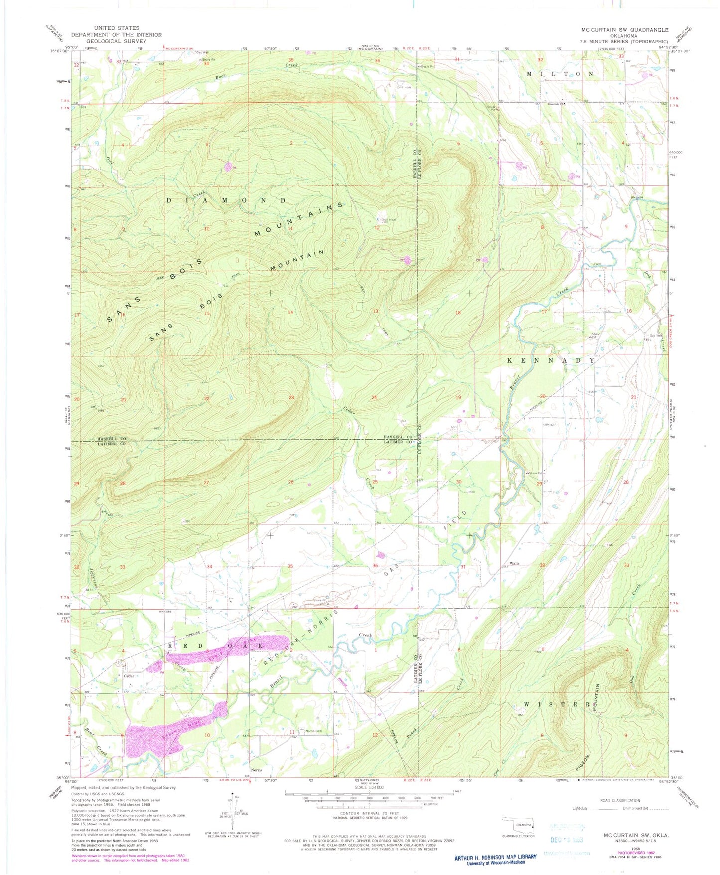
Historical USGS topographic quad map of McCurtain SW in the state of Oklahoma. Map scale may vary for some years, but is generally around 1:24,000. Print size is approximately 24" x 27"
This quadrangle is in the following counties: Haskell, Latimer, Le Flore.
The map contains contour lines, roads, rivers, towns, and lakes. Printed on high-quality waterproof paper with UV fade-resistant inks, and shipped rolled.
Contains the following named places: Bear Creek, Cedar, Cedars Cemetery, Dog Creek, Jefferson Creek, Norris Cemetery, Peach Creek, Pigeon Mountain, Red Oak-Norris Gas Field, Rosedale Church, Sans Bois Mountain, Walls