MyTopo
Classic USGS McDonald Mountain Arizona 7.5'x7.5' Topo Map
Couldn't load pickup availability
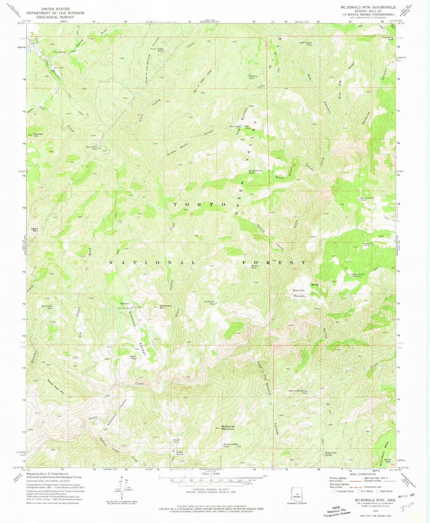
Historical USGS topographic quad map of McDonald Mountain in the state of Arizona. Map scale may vary for some years, but is generally around 1:24,000. Print size is approximately 24" x 27"
This quadrangle is in the following counties: Gila.
The map contains contour lines, roads, rivers, towns, and lakes. Printed on high-quality waterproof paper with UV fade-resistant inks, and shipped rolled.
Contains the following named places: Agate Mountain, Big Canyon, Blue Dog Ridge, Brush Corral Canyon, Brush Corral Tank, Brushy Basin Canyon, Butte Tank, Cottonwood Spring, Cottonwood Tank, Cypress Hill, Derrick Canyon, Derrick Pocket, Dry Pocket Tank, Dry Pocket Wash, Goswick Canyon, Green Valley Creek, Green Valley Tank, Hellsgate Wilderness, Holding Tank, Hole in the Ground Canyon, Hole in the Ground Tank, Houston Pocket, Lion Spring, Lion Spring Draw, Lower Corral, Lower Corral Tank, Lower Corral Tank Number Two, Martin Tank, McDonald Mountain, McDonald Mountain Tank, McDonald Pocket, Neal Cabin, Needed Tank, Number One Dam, Old Rock House, Picket Pen Tank, Pocket Spring, Pocket Tank, Power Line Tank, Rim of Green Valley, Soldier Camp Creek, Spring Creek, Squaw Nest Mountain, Stewart Creek, Still Canyon Tank, Sweetwater Tank, The Buttes, Wolverton Mountain