MyTopo
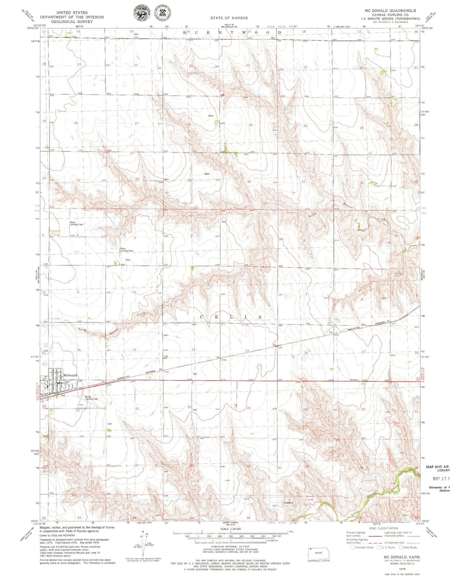
Classic USGS McDonald Kansas 7.5'x7.5' Topo Map
Couldn't load pickup availability
Historical USGS topographic quad map of McDonald in the state of Kansas. Map scale may vary for some years, but is generally around 1:24,000. Print size is approximately 24" x 27"
This quadrangle is in the following counties: Rawlins.
The map contains contour lines, roads, rivers, towns, and lakes. Printed on high-quality waterproof paper with UV fade-resistant inks, and shipped rolled.
Contains the following named places: Black Airport, Briney Landing Field, Celia, City of McDonald, Jack Poore Airport, McDonald Co - Operative Equity Mercantile Exchange Grain Elevator Number 1, McDonald Fire Department, McDonald Post Office, McDonald Wastewater Plant, Rawlins County Fire District 3 McDonald, Township of Racewood, Township of Rocewood, ZIP Code: 67745