MyTopo
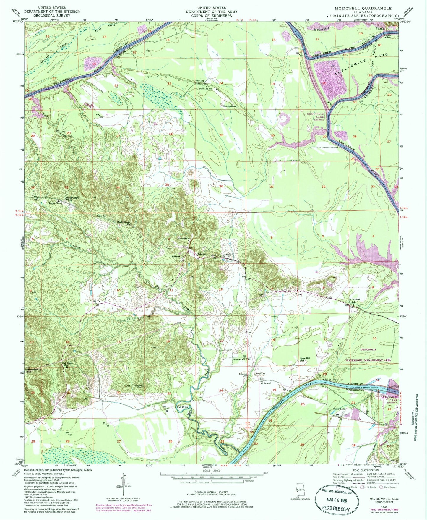
Classic USGS McDowell Alabama 7.5'x7.5' Topo Map
Couldn't load pickup availability
Historical USGS topographic quad map of McDowell in the state of Alabama. Map scale may vary for some years, but is generally around 1:24,000. Print size is approximately 24" x 27"
This quadrangle is in the following counties: Greene, Marengo, Sumter.
The map contains contour lines, roads, rivers, towns, and lakes. Printed on high-quality waterproof paper with UV fade-resistant inks, and shipped rolled.
Contains the following named places: Armstrong Hill, Arringtons Bar, Belmont, Belmont Church, Belmont Division, Belmont High School, Belmont Hunting Club, Belmont Public Use Area, Belmont Volunteer Fire Department, Besteda Bar, Big Foot Hunting Club, Bottom Creek, Brasfield Landing, Brownstown, Bucks Chapel Elementary School, Bucks Chapel Methodist Church, Charleston Swamp, Cobb Branch, Davidson Cemetery, Demopolis Lock and Dam, Demopolis State Wildlife Management Area, Flemings Landing, Forkland Bar, Gardners Bluff, Greens Bar, Greens Landing, Hall Creek, Hall Creek School, Hayes Creek, Houpt Cemetery, Lake Demopolis, Log Landing, Malakoff Landing, McComico Bar, McConnico Creek, McDowell, McDowell Ferry, McDowells Landing, Mount Carmel Church, Mussel Shoals Bar, Oak Grove Baptist Church, Oak Grove School, Palestine Baptist Church, Palestine Cemetery, Pine Top School, Pinetop Baptist Church, Pinetop Cemetery, Prouts Lake, Rattlesnake Bar, Rattlesnake Bend, Rider Branch, Ruzic Hunting Club, Saint Michael Baptist Church, Saint Michael School, Shady Grove Church, Smiths Landing, Snow Hill School, Spring Bluff Bar, Strawberry Hill Plantation, Taylor Branch, Taylor Cemetery, The Ravine, Thompsons Island, Trinity Church, Twelvemile Bend, Whiteheads Landing