MyTopo
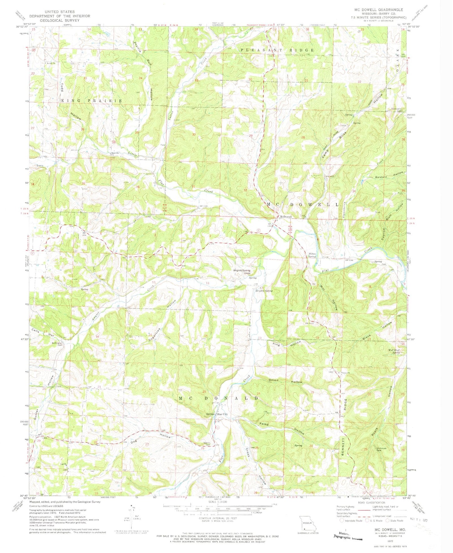
Classic USGS McDowell Missouri 7.5'x7.5' Topo Map
Couldn't load pickup availability
Historical USGS topographic quad map of McDowell in the state of Missouri. Map scale may vary for some years, but is generally around 1:24,000. Print size is approximately 24" x 27"
This quadrangle is in the following counties: Barry.
The map contains contour lines, roads, rivers, towns, and lakes. Printed on high-quality waterproof paper with UV fade-resistant inks, and shipped rolled.
Contains the following named places: Baldwin Hollow, Bennett Ridge, Bethel Church, Bethel School, Brights Spring, Brights Spring Knoll, Bullington Cemetery, Calls Hollow, Calton Creek, Camp Bliss Hollow, Cedar Bluff School, Cross Hollow, Dog Hollow, Easyville Church, Gunter Creek, Gunter Hollow, Hilton Spring, Kemp Hollow, King Hollow, Little Flat Creek, Log Church, Lone Hill School, Marbut School, McDowell, McDowell Post Office, McDowell School, Mill Hollow, Onion Hollow, Prairie Run Hollow, Sparks Cemetery, Sparks School, Stansberry Creek, Star City, Star School, Sugartree Hollow, Swallow Bluff Hollow, Todd Hollow, Township of McDonald, Township of McDowell, Victory Church, Victory School, Wall Bluff Spring