MyTopo
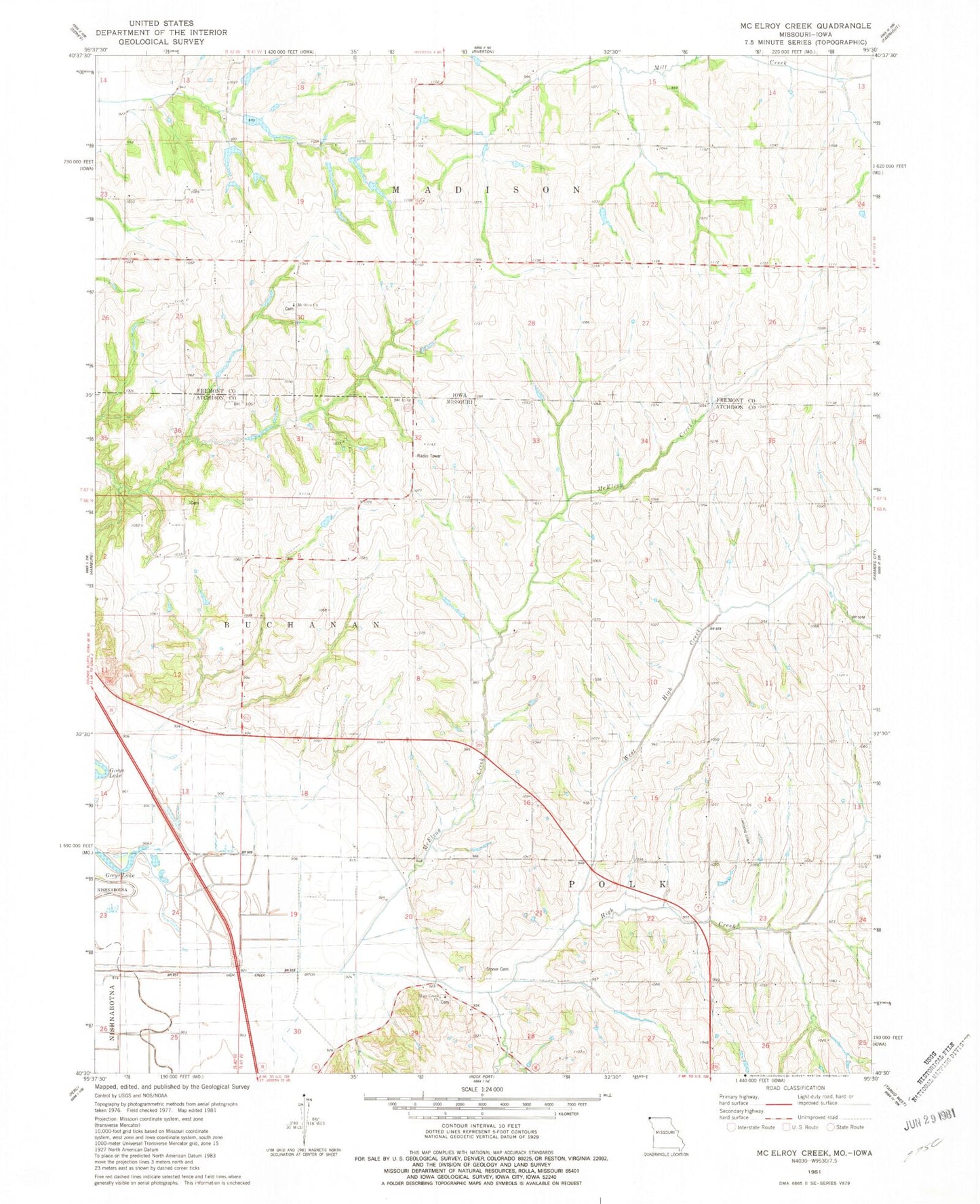
Classic USGS McElroy Creek Missouri 7.5'x7.5' Topo Map
Couldn't load pickup availability
Historical USGS topographic quad map of McElroy Creek in the states of Missouri, Iowa. Map scale may vary for some years, but is generally around 1:24,000. Print size is approximately 24" x 27"
This quadrangle is in the following counties: Atchison, Fremont.
The map contains contour lines, roads, rivers, towns, and lakes. Printed on high-quality waterproof paper with UV fade-resistant inks, and shipped rolled.
Contains the following named places: Beehive Cemetery, Columbia and French Cemetery, High Creek Cemetery, High Creek Church, High Creek Ditch, High Creek School, Highland School, Lone Chapel, Mayflower School, McElroy Creek, McKissacks Grove, McKissacks Grove Post Office, Miller School, Mount Olive Cemetery, Mount Olive Church, Shiloh School, Star School, Stoner Cemetery, Sunny Slope School, Township of Madison, Township of Polk, Union School