MyTopo
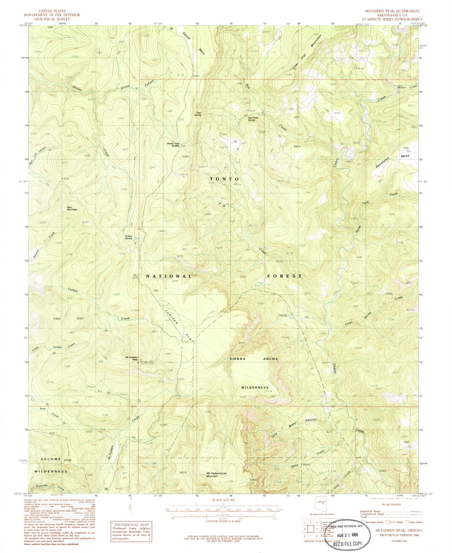
Classic USGS McFadden Peak Arizona 7.5'x7.5' Topo Map
Couldn't load pickup availability
Historical USGS topographic quad map of McFadden Peak in the state of Arizona. Typical map scale is 1:24,000, but may vary for certain years, if available. Print size: 24" x 27"
This quadrangle is in the following counties: Gila.
The map contains contour lines, roads, rivers, towns, and lakes. Printed on high-quality waterproof paper with UV fade-resistant inks, and shipped rolled.
Contains the following named places: Gunsight Tank, Ash Creek, Board Tree Saddle, China Spring Creek, Circle Ranch, Cow Flat Mountain, Horse Tank Creek, Juniper Flat, McFadden Peak, P B Creek, P B Ranch, Pine Mountain, Turkey Spring, Wilson Creek, Ash Creek Corral Spring, Ash Creek Spring, Billy Lawrence Canyon, Billy Lawrence Creek, Board Tree Saddle Tank, Board Tree Spring, China Spring Tank, Chinaman Tank, Cold Water Canyon, Dads Tank, Deep Creek, East Spear Creek, Gold Creek, Horse Mountain Tank, Juniper Flat Tank, McFadden Horse Mountain, McFadden Peak Lookout, Olliger Mesa Tank, P B Spring, Park Tank, Paul Tank, Reg Tank, Cow Flat Tank, Pendleton Tank, Elephant Rock, Rhinehart Tank