MyTopo
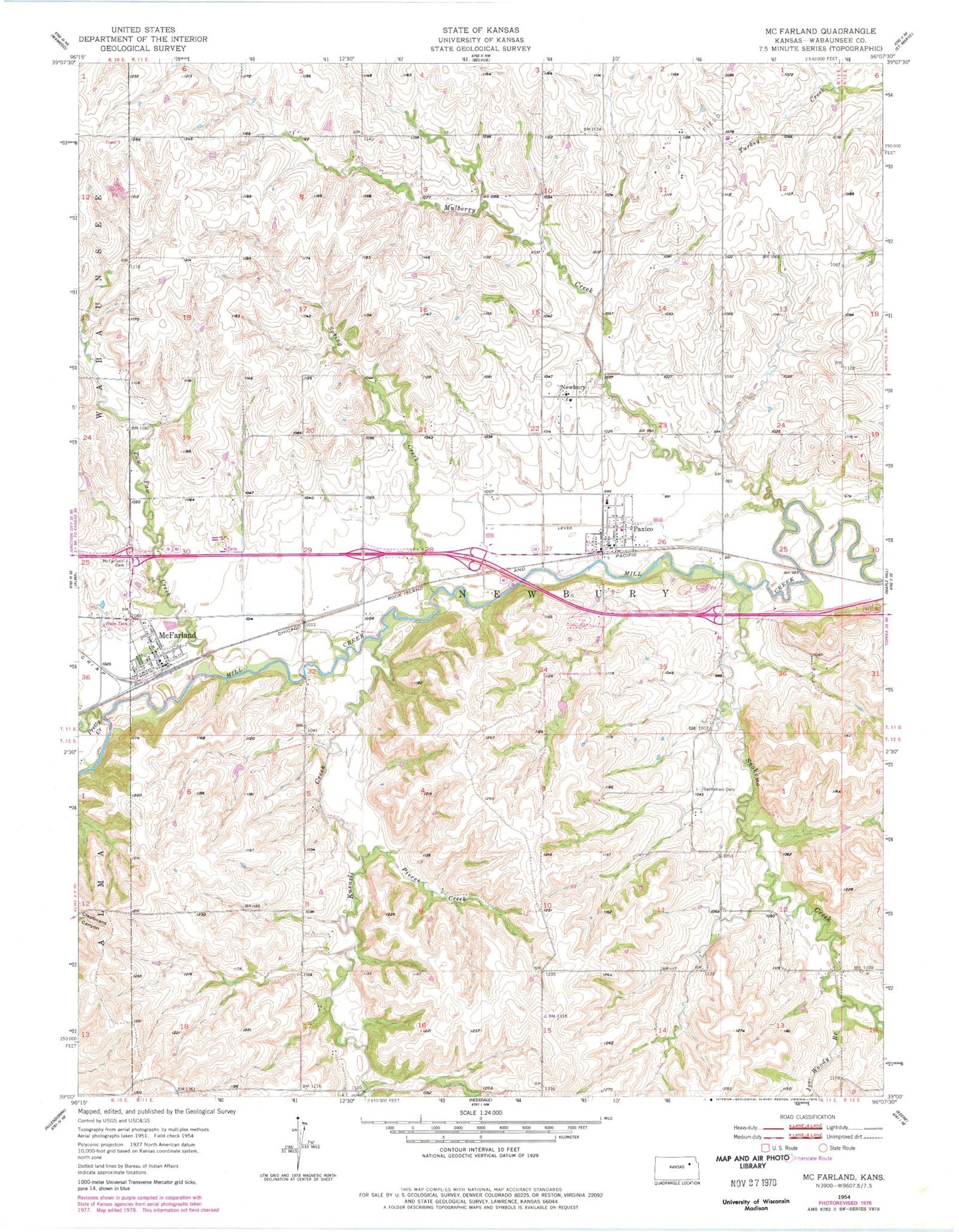
Classic USGS McFarland Kansas 7.5'x7.5' Topo Map
Couldn't load pickup availability
Historical USGS topographic quad map of McFarland in the state of Kansas. Map scale may vary for some years, but is generally around 1:24,000. Print size is approximately 24" x 27"
This quadrangle is in the following counties: Wabaunsee.
The map contains contour lines, roads, rivers, towns, and lakes. Printed on high-quality waterproof paper with UV fade-resistant inks, and shipped rolled.
Contains the following named places: Bethlehem Cemetery, City of McFarland, City of Paxico, Joe Woody Branch, Kuenzli Creek, McFarland, McFarland Cemetery, McFarland City Hall, McFarland Detention Dam, McFarland Post Office, McFarland Sewer Treatment Plant, Mill Creek Baptist Church, Mill Creek Campground and Recreational Vehicle Park, Mill Creek Valley Junior High School, Mill Creek Valley Middle School, Mulberry Creek, Newbury, Newbury Census Designated Place, Paw Paw Creek, Paxico, Paxico Post Office, Paxico Sewer Treatment Plant, Paxico United Methodist Church, Pierce Creek, Pretty Creek, Sacred Heart Catholic Church, Snokomo Creek, Spring Creek, Township of Newbury, Trinity Lutheran Church, Wabaunsee County Fire District 7, Wabaunsee County Sewer District Number 1 Wastewater Treatment Plant, ZIP Codes: 66501, 66526