MyTopo
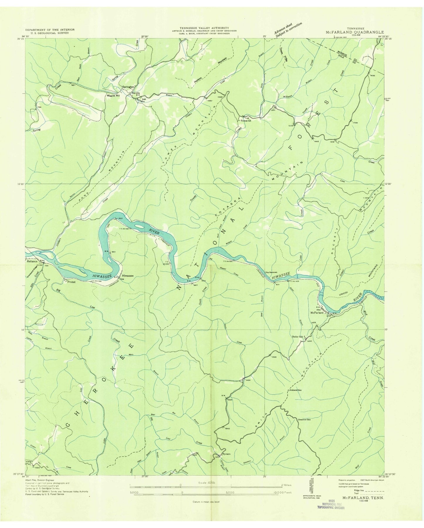
Classic USGS McFarland Tennessee 7.5'x7.5' Topo Map
Couldn't load pickup availability
Historical USGS topographic quad map of McFarland in the state of Tennessee. Typical map scale is 1:24,000, but may vary for certain years, if available. Print size: 24" x 27"
This quadrangle is in the following counties: Monroe, Polk.
The map contains contour lines, roads, rivers, towns, and lakes. Printed on high-quality waterproof paper with UV fade-resistant inks, and shipped rolled.
Contains the following named places: Carden Branch, Smith Branch, Smith Creek, Servilla, Springtown Branch, Stephens Cemetery, Sulphur Springs Branch, Switch Branch, The Narrows, Tinker Branch, Towee Church, Towee Creek, Towee Mountain, Towee Ridge, Wallace Creek, West Fork Butler Branch, West Fork Wolf Creek, White Oak Mountain, Wildcat Creek, Witt Cemetery, Wolf Creek, Wolf Pit, Woody Island, Apalachia Powerhouse, Beach Bottom Branch, Bearpen Branch, Bearpen Lead, Big Hollow, Big Hopper Camp Branch, Big Island, Big Lost Creek, Big Rock Island, Boring Branch, Burchfield Cemetery, Butler Branch, Butler Cemetery, Campground Cemetery, Cane Island, Cappy Branch, Chestnut Gap, Chestnut Gap Branch, Childers Creek, Coker Creek, Corinth Church, Dark Hollow, Deep Branch, Ellis Creek, Finger Board Ridge, Flint Ridge, Hampton Cemetery, Hankins Mountain, Hicks Branch, Hiwassee, Jones Ridge, Kirkland Gap, Laurel Branch, Lindner Cemetery, Little Branch, Little Hopper Camp Branch, Little Lost Creek, Little Rock Island, Long Ford, Loss Creek, Lower Jobe Patch Branch, Maggies Mill, Mary Branch, McCulley Mountain, McFarland, Morgan Cemetery, Perrys Branch, Piney Flats Branch, Plum Branch, Pond Mountain, Probst, Puncheon Camp Branch, Reliance, Rock Island Branch, Rymer Camp Branch, Butler School (historical), Rymers (historical), Hiwassee State Scenic River, Tennessee State Boating Site, Springtown Baptist Church, Big Bend Recreation Area, John Muir National Recreation Trail, Lost Creek Recreation Area, Powerhouse Recreation Area, Smith Mountain Trail, Towee, Towee Recreation Area, John Muir Trailhead, Long Ford Bridge, Spring Creek Shooting Range, Springtown Fire Station, Carden Branch, Smith Branch, Smith Creek, Servilla, Springtown Branch, Stephens Cemetery, Sulphur Springs Branch, Switch Branch, The Narrows, Tinker Branch, Towee Church, Towee Creek, Towee Mountain, Towee Ridge, Wallace Creek, West Fork Butler Branch, West Fork Wolf Creek, White Oak Mountain, Wildcat Creek, Witt Cemetery, Wolf Creek, Wolf Pit, Woody Island, Apalachia Powerhouse, Beach Bottom Branch, Bearpen Branch, Bearpen Lead, Big Hollow, Big Hopper Camp Branch, Big Island, Big Lost Creek, Big Rock Island, Boring Branch, Burchfield Cemetery, Butler Branch, Butler Cemetery, Campground Cemetery, Cane Island, Cappy Branch, Chestnut Gap, Chestnut Gap Branch, Childers Creek, Coker Creek, Corinth Church, Dark Hollow, Deep Branch, Ellis Creek, Finger Board Ridge, Flint Ridge, Hampton Cemetery, Hankins Mountain, Hicks Branch, Hiwassee, Jones Ridge, Kirkland Gap, Laurel Branch, Lindner Cemetery, Little Branch, Little Hopper Camp Branch, Little Lost Creek, Little Rock Island, Long Ford, Loss Creek, Lower Jobe Patch Branch, Maggies Mill, Mary Branch, McCulley Mountain, McFarland, Morgan Cemetery, Perrys Branch, Piney Flats Branch, Plum Branch, Pond Mountain, Probst, Puncheon Camp Branch, Reliance, Rock Island Branch, Rymer Camp Branch, Butler School (historical), Rymers (historical), Hiwassee State Scenic River, Tennessee State Boating Site, Springtown Baptist Church, Big Bend Recreation Area, John Muir National Recreation Trail, Lost Creek Recreation Area, Powerhouse Recreation Area, Smith Mountain Trail, Towee, Towee Recreation Area, John Muir Trailhead, Long Ford Bridge, Spring Creek Shooting Range, Springtown Fire Station


