MyTopo
Classic USGS McGee Missouri 7.5'x7.5' Topo Map
Couldn't load pickup availability
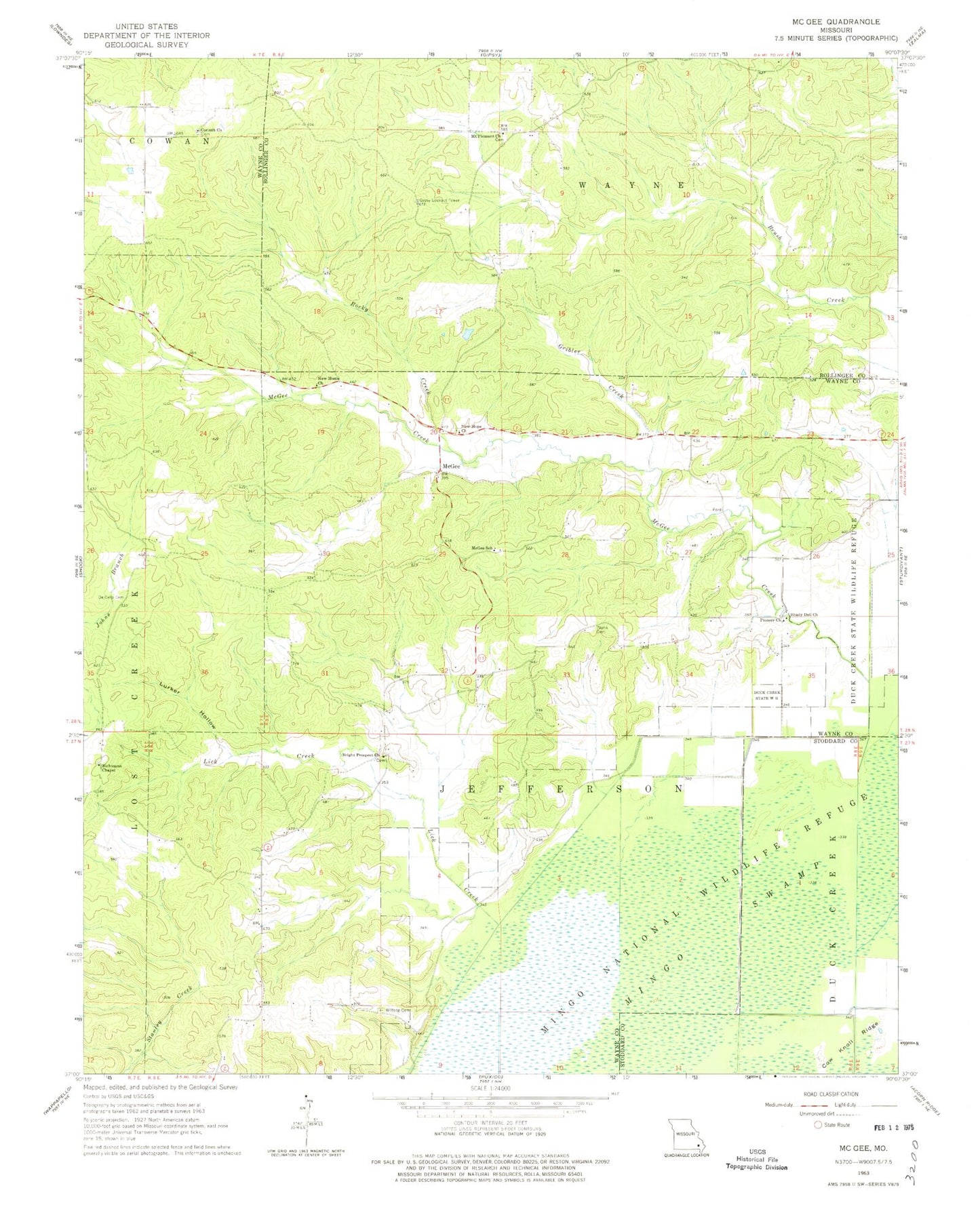
Historical USGS topographic quad map of McGee in the state of Missouri. Map scale may vary for some years, but is generally around 1:24,000. Print size is approximately 24" x 27"
This quadrangle is in the following counties: Bollinger, Stoddard, Wayne.
The map contains contour lines, roads, rivers, towns, and lakes. Printed on high-quality waterproof paper with UV fade-resistant inks, and shipped rolled.
Contains the following named places: Bright Prospect Church, Corinth Church, De Celis Cemetery, DeCelis Branch, Ditch Number 2, Ditch Number 3, Ditch Number 4, Drum Dam, Drum Lake, Fish School, Flatwood School, Fox Pond, Fry School, Frye Church, Gribler Creek, Gumstump Pool, Gypsy Lookout Tower, Horsehead Knoll, Johns Branch, Lick Creek, Lurker Hollow, Manning Cabin Hollow, May Pond, McGee, McGee Creek, McGee Gate Hunters Entrance, McGee School, Mingo Refuge Fox Pond Dam, Mingo Swamp, Monopoly Marsh, Mount Pleasant Church, Mulenex Lake, Mulenex Lake Dam, New Home Church, New Hope Church, Pioneer Church, Puxico Quad Number 1 Dam, Richmann Cemetery, Richmann Chapel, Rocky Creek, Shady Dell Church, Stilts Branch, Stilts School, Sweet Asylum Hollow Dam, Sweet Asylum Hollow Lake, Township of Jefferson, Wilfong Cemetery, ZIP Codes: 63763, 63787