MyTopo
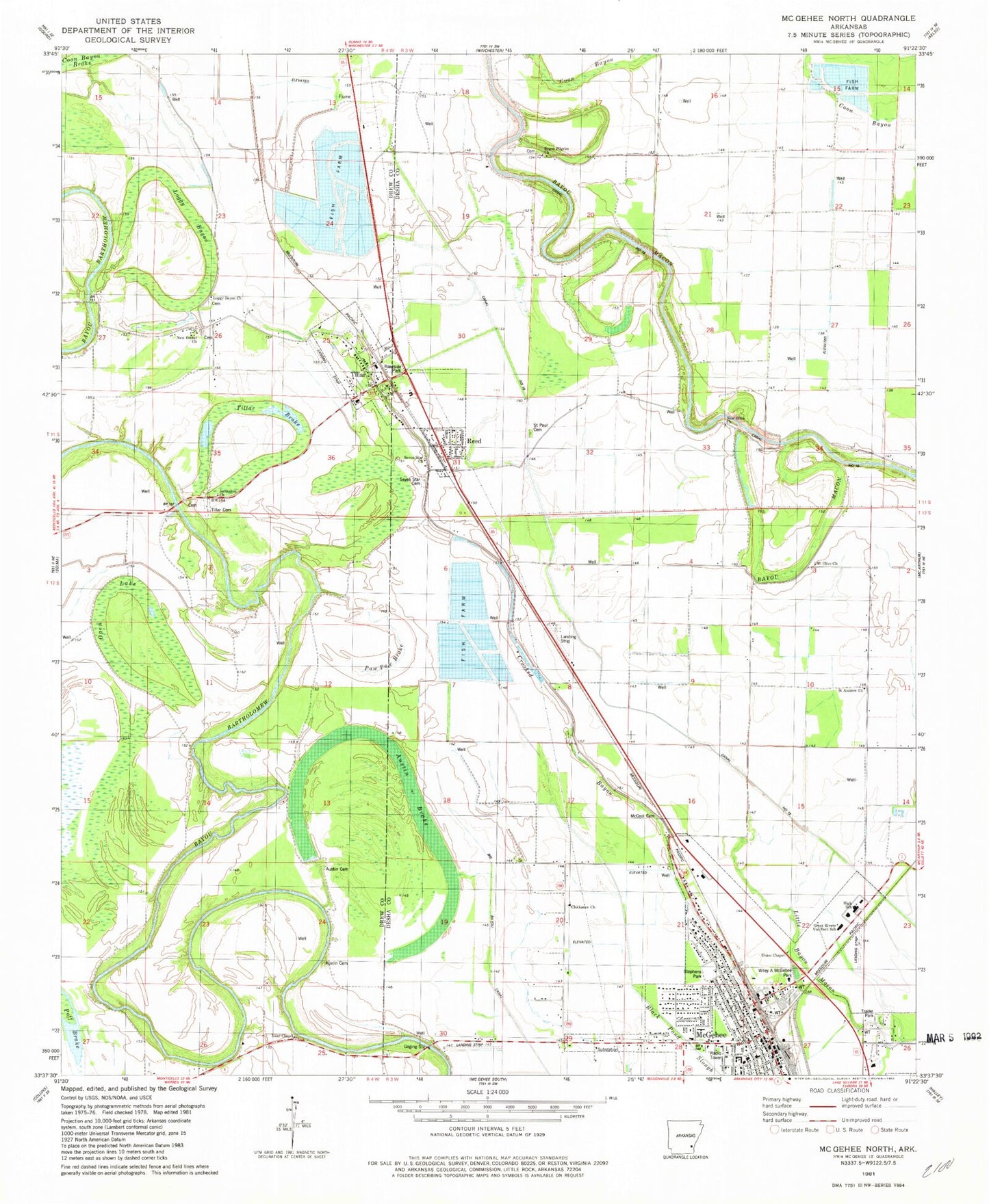
Classic USGS McGehee North Arkansas 7.5'x7.5' Topo Map
Couldn't load pickup availability
Historical USGS topographic quad map of McGehee North in the state of Arkansas. Map scale may vary for some years, but is generally around 1:24,000. Print size is approximately 24" x 27"
This quadrangle is in the following counties: Desha, Drew.
The map contains contour lines, roads, rivers, towns, and lakes. Printed on high-quality waterproof paper with UV fade-resistant inks, and shipped rolled.
Contains the following named places: Austin Brake, Austin Cemetery, B C Prewitt Elementary School, Bailey Chapel Baptist Church, Bailey School, Bogue Pilgrim Cemetery, Bogue Pilgrim Church, Bogue Pilgrim School, Chickasaw Baptist Church, City of McGehee, City of Tillar, Cypress Brake, First Baptist Church, Flying G Ranch Airport, Great Rivers Voc-Tech School, Isaac Chapel Baptist Church, Jerden Brake, Jerusalem Baptist Church, Little Bayou Macon, Loggy Bayou, Loggy Bayou Baptist Church, Loggy Bayou Cemetery, Loggy Bayou School, Mc Gehee High School, McCool Cemetery, McGehee, McGehee Elementary School, McGehee Fire Department, McGehee Fire Department Ambulance, McGehee Police Department, McGehee Post Office, Mount Olive Church, New Bethel Baptist Church, New Hope Church, New Hope School, New Salem Church, Open Lake, Paw Paw Brake, Reed, Reed Police Department, Reed Volunteer Fire Department, Saint Andrew Church, Saint Paul Cemetery, Seven Star Cemetery, Seven Star Church, Stephens Park, Tillar, Tillar Airport, Tillar Baptist Church, Tillar Brake, Tillar Cemetery, Tillar Fire Department Main Station, Tillar Fire Department Substation, Tillar Post Office, Tillar United Methodist Church, Town of Reed, Union Chapel, Wiley A McGehee Park, ZIP Code: 71670