MyTopo
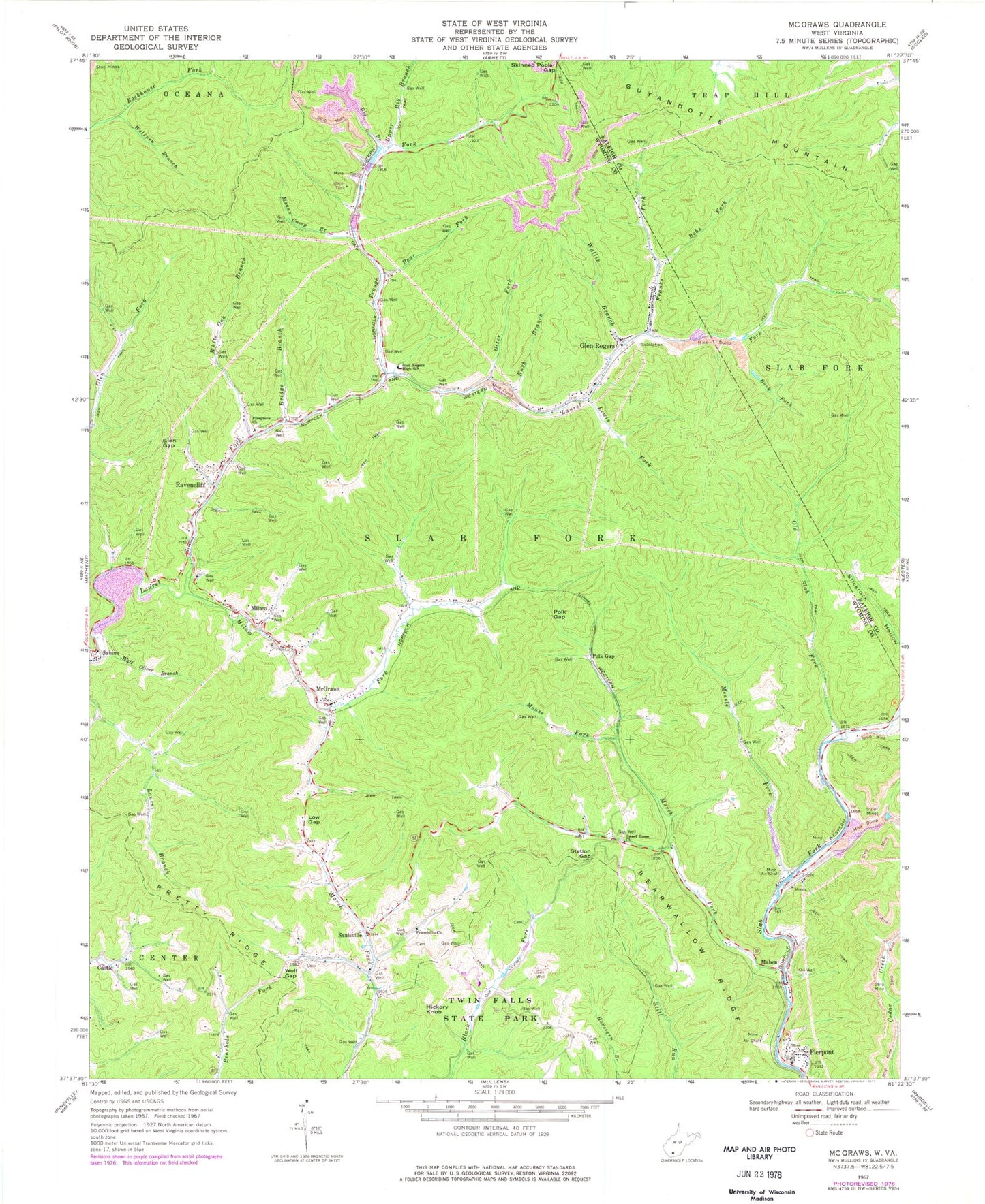
Classic USGS McGraws West Virginia 7.5'x7.5' Topo Map
Couldn't load pickup availability
Historical USGS topographic quad map of McGraws in the state of West Virginia. Map scale may vary for some years, but is generally around 1:24,000. Print size is approximately 24" x 27"
This quadrangle is in the following counties: Raleigh, Wyoming.
The map contains contour lines, roads, rivers, towns, and lakes. Printed on high-quality waterproof paper with UV fade-resistant inks, and shipped rolled.
Contains the following named places: Bear Fork, Bearwallow Ridge, Big Branch, Bobs Fork, Bridge Branch, Buck Fork, Buck Fork Dam, Buck Fork Lake, Castle, Franks Fork, Friendship Church, Frye Cemetery, Glen Gap, Glen Rogers, Glen Rogers Grade School, Glen Rogers High School, Glen Rogers Post Office, Hickory Knob, James Brooks Spring, Lewis Fork, Low Gap, Maben, Maben Post Office, Manns Camp Branch, Marsh Fork, McGraws, McGraws Post Office, Measle Fork, Milam, Milam Fork, Mouse Fork, Old Slab Fork, Otter Fork, Pierpoint Freewill Baptist Church, Pierpont, Pinegrove Church, Polk Gap, Pretty Ridge, Ravencliff, Ravencliff Post Office, Rush Branch, Saulsville, Saulsville Baptist Church, Skinned Poplar Gap, Station Gap, Sweet Home Church, Tilley-Tolliver Cemetery, Trough Fork, Twin Falls Resort State Park Golf Course, Twin Falls State Park, Upper Big Branch, Upper Laurel Volunteer Fire and Ambulance Service, Wallis Branch, Watt Oliver Branch, White Oak Branch, Wolf Gap, Wolfpen Branch, ZIP Codes: 25848, 25870, 25875, 25876, 25882, 25913, 25916