MyTopo
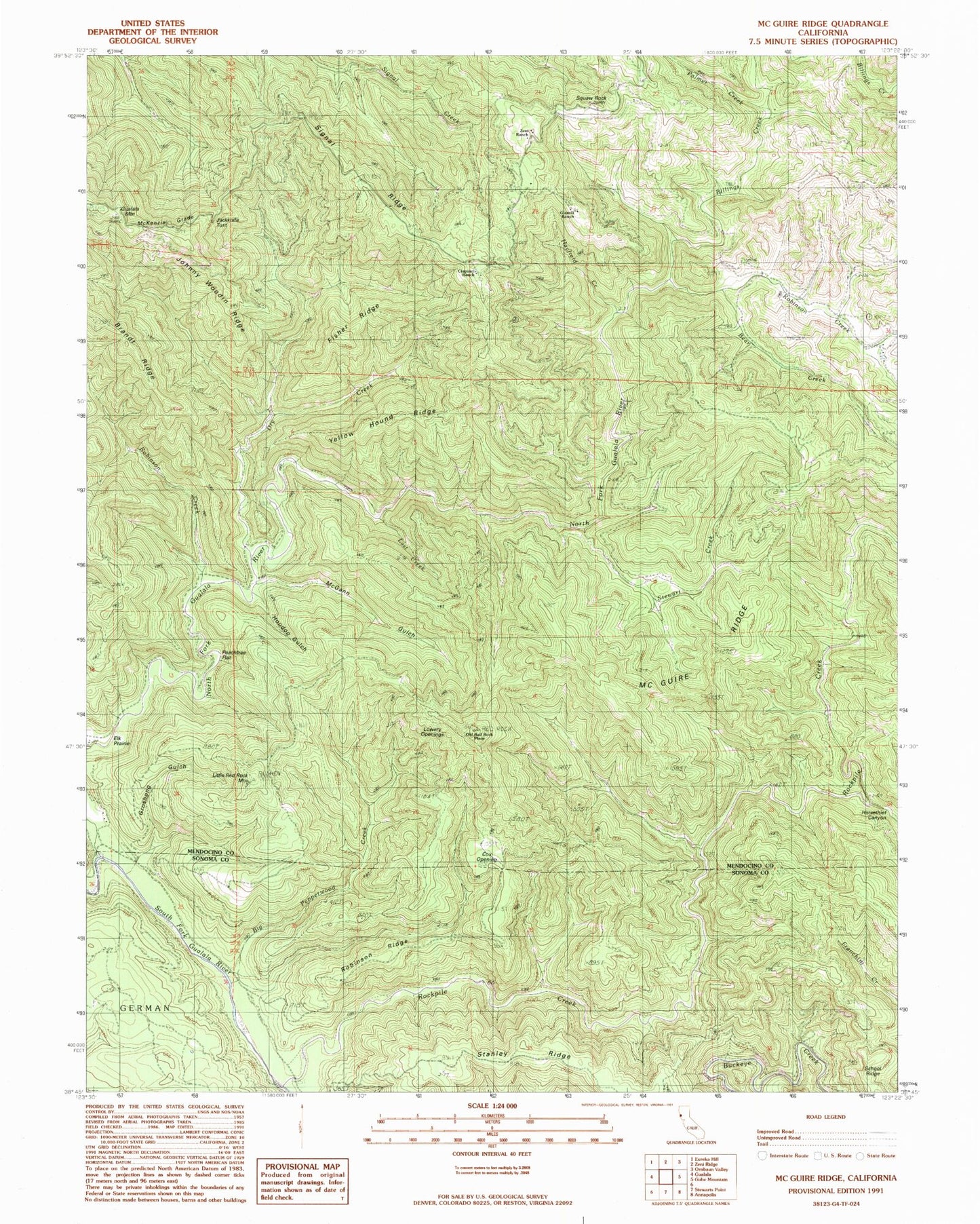
Classic USGS McGuire Ridge California 7.5'x7.5' Topo Map
Couldn't load pickup availability
Historical USGS topographic quad map of McGuire Ridge in the state of California. Map scale may vary for some years, but is generally around 1:24,000. Print size is approximately 24" x 27"
This quadrangle is in the following counties: Mendocino, Sonoma.
The map contains contour lines, roads, rivers, towns, and lakes. Printed on high-quality waterproof paper with UV fade-resistant inks, and shipped rolled.
Contains the following named places: Bear Creek, Big Pepperwood Creek, Billings Creek, Ciapusci Ranch, Cox Opening, Dry Creek, Fisher Ridge, Gianoli Ranch, Groshong Gulch, Hayfield Creek, Hoodoo Gulch, Horsethief Canyon, Jackknife Tunnel, Jackknife Turn, Johnny Woodin Ridge, Little Red Rock Mountain, Log Cabin Ranch, Lowrey Openings, McGann Gulch, McGuire Ridge, McKenzie Grade, North Fork Gualala River, Old Red Rock Place, Palmer Creek, Peachtree Flat, Rickard Ranch, Robinson Creek, Robinson Ridge, Rockpile Creek, School Ridge, Signal Ridge, South Fork Gualala River, Squaw Rock, Stanley Ridge, Stewart Creek, Tindall Camp, Y Ranch, Yellow Hound Ridge, Zeni Ranch, ZIP Code: 95445