MyTopo
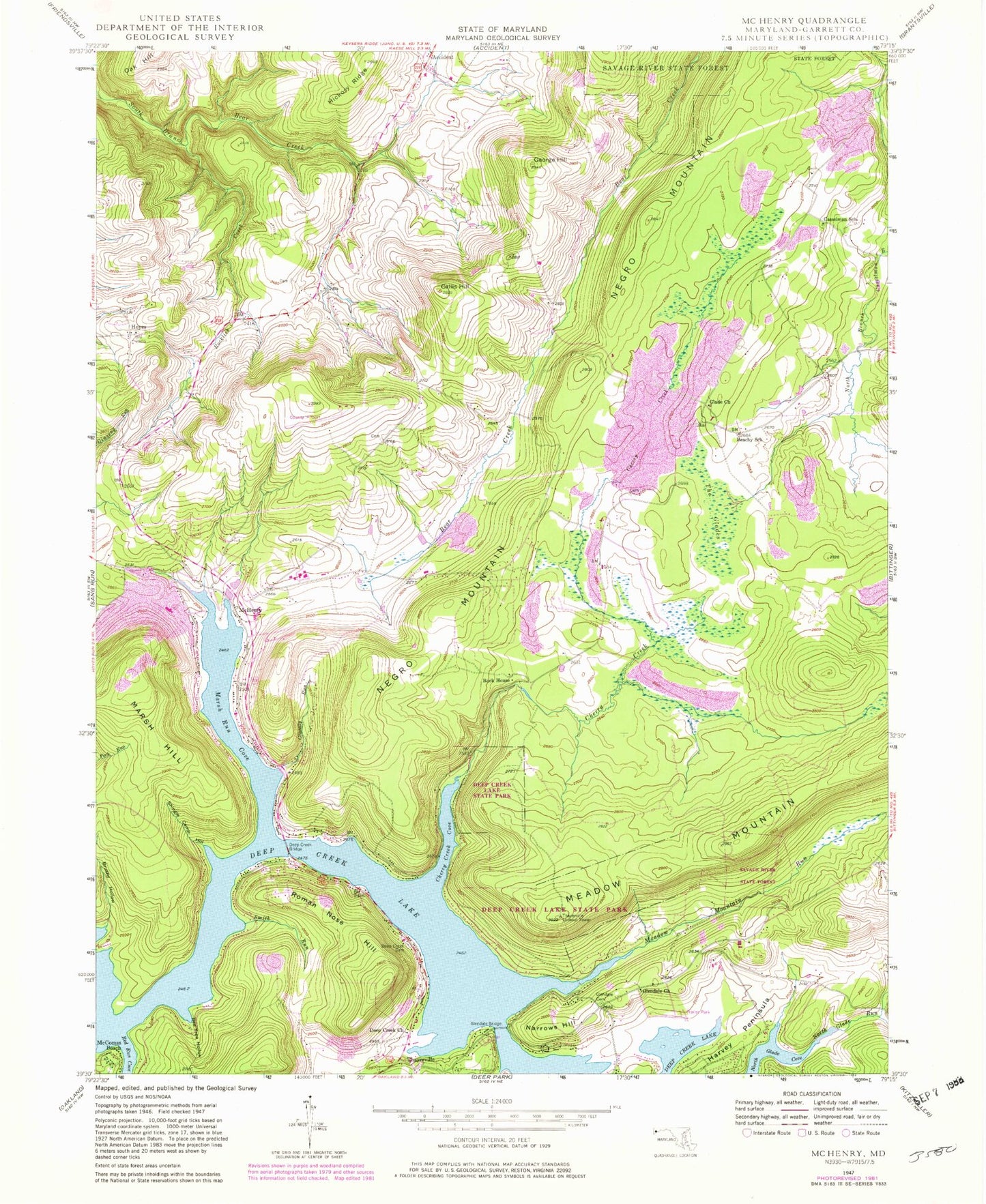
Classic USGS McHenry Maryland 7.5'x7.5' Topo Map
Couldn't load pickup availability
Historical USGS topographic quad map of McHenry in the state of Maryland. Typical map scale is 1:24,000, but may vary for certain years, if available. Print size: 24" x 27"
This quadrangle is in the following counties: Garrett.
The map contains contour lines, roads, rivers, towns, and lakes. Printed on high-quality waterproof paper with UV fade-resistant inks, and shipped rolled.
Contains the following named places: Beachy School, Bee Tree Hollow, Brushy Hollow, Callis Hill, Casselman School, Cherry Creek, Cherry Creek Cove, Deep Creek Bridge, Deep Creek Cemetery, Deep Creek Church, George Hill, Glade Church, Glendale Bridge, Glendale Cemetery, Glendale Church, Gravelly Run, Harvey Peninsula, Hickory Ridge, Marsh Run Cove, McHenry, Meadow Mountain Run, North Glade Run, Pleasant Valley Run, Red Run Cove, Rock House, Rocklick Creek, Shingle Camp Hollow, Smith Run, Thayer State Game Refuge, The Glades, Hoyes, Marsh Hill, McComas Beach, Narrows Hill, Roman Nose Hill, Thayerville, Thayerville Lookout Tower, Garrett County Airport, Garrett County, Garrett College, Hoyes Cemetery, Hoyes United Methodist Church, McHenry Post Office, District 6 Sang Run, Deep Creek Volunteer Fire Department, Deep Creek Volunteer Fire Company Station 30, Northern Garrett County Rescue Squad Station 2, Maryland State Police - Barrack W McHenry, Arrowhead Run, Meshach Run