MyTopo
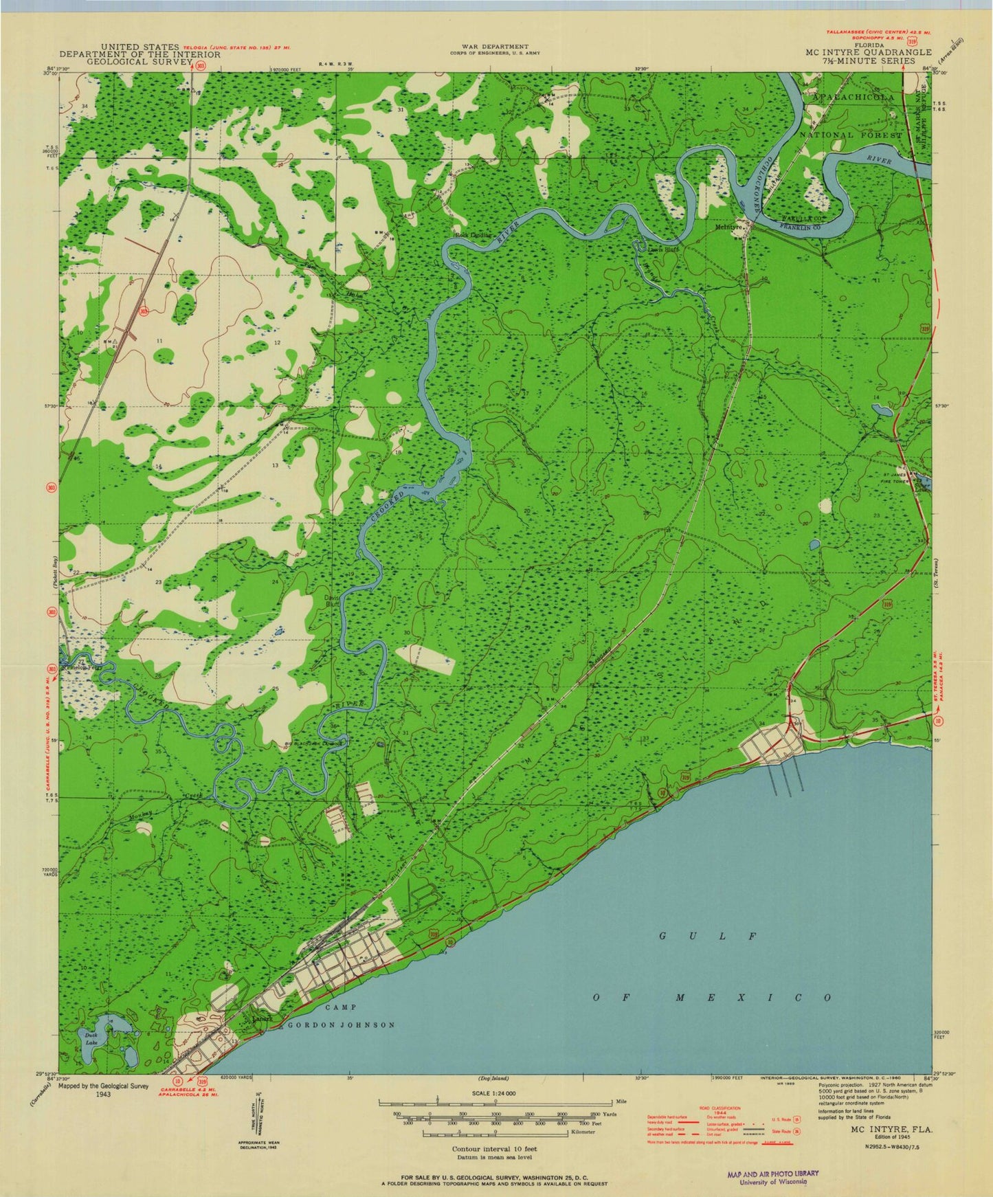
Classic USGS McIntyre Florida 7.5'x7.5' Topo Map
Couldn't load pickup availability
Historical USGS topographic quad map of McIntyre in the state of Florida. Map scale may vary for some years, but is generally around 1:24,000. Print size is approximately 24" x 27"
This quadrangle is in the following counties: Franklin, Wakulla.
The map contains contour lines, roads, rivers, towns, and lakes. Printed on high-quality waterproof paper with UV fade-resistant inks, and shipped rolled.
Contains the following named places: Big Blackjack Landing, Brandy Creek, Davis Bluff, Duck Lake, E L Moore Bridge, Lanark Village, Lewis Bluff, McIntyre, Monkey Creek, Pine Log, Pine Log Bridge, Pine Log Creek, Pinelog Ferry, Rock Landing, Saint James - Lanark Volunteer Fire Department, Saint James Fire Tower, Saint James Island, Tom Hahn Creek, Weems Memorial Hospital Ambulance Service Franklin County, ZIP Codes: 32322, 32323