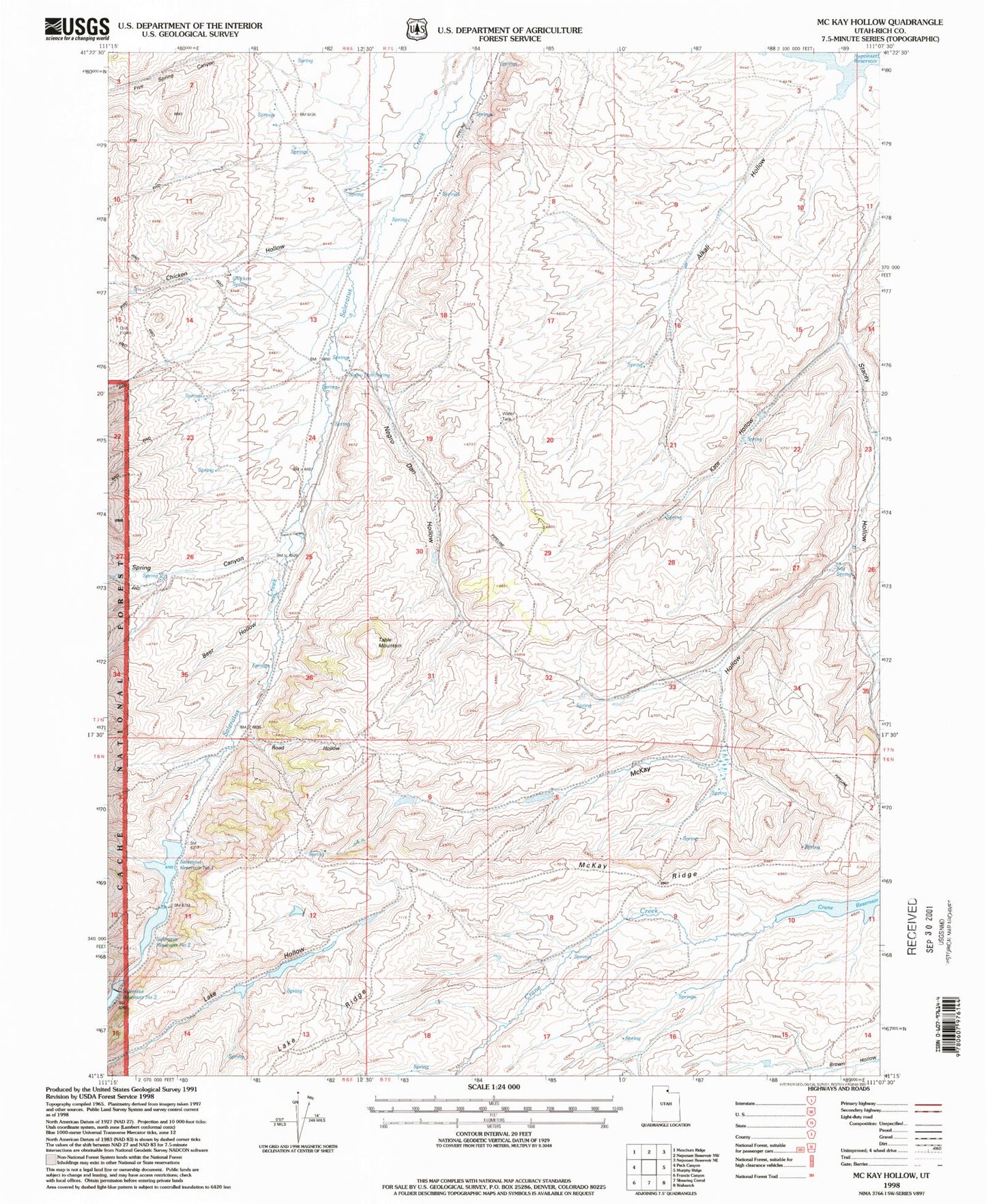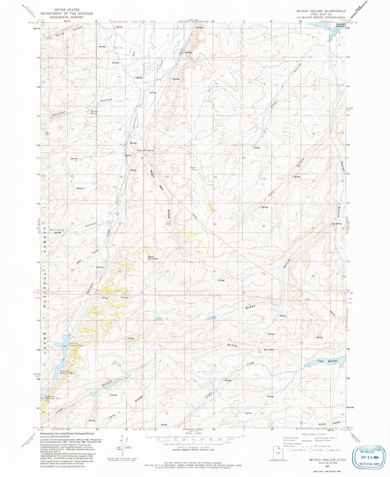
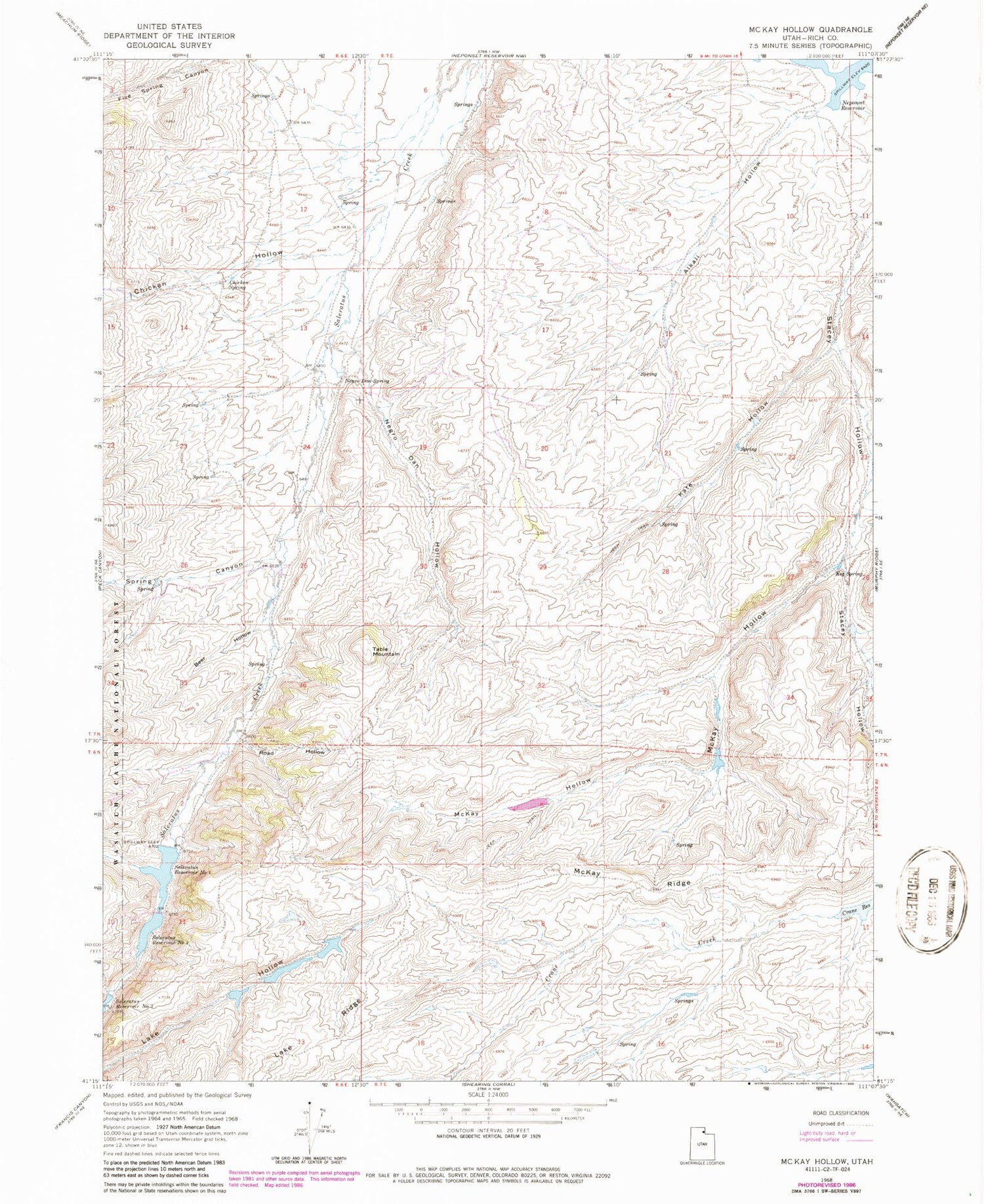
MyTopo
Classic USGS McKay Hollow Utah 7.5'x7.5' Topo Map
Regular price
$16.95
Regular price
Sale price
$16.95
Unit price
per
Couldn't load pickup availability
Historical USGS topographic quad map of McKay Hollow in the state of Utah. Map scale may vary for some years, but is generally around 1:24,000. Print size is approximately 24" x 27"
This quadrangle is in the following counties: Rich.
The map contains contour lines, roads, rivers, towns, and lakes. Printed on high-quality waterproof paper with UV fade-resistant inks, and shipped rolled.
Contains the following named places: Alkali Hollow, Beer Hollow, Chicken Hollow, Chicken Spring, Five Spring Canyon, Kate Hollow, Keg Spring, McKay Hollow, McKay Ridge, Negro Dan Hollow, Negro Dan Spring, Road Hollow, Saleratus Reservoir Number 1, Saleratus Reservoir Number 2, Spring Canyon, Spring Creek, Table Mountain