
MyTopo
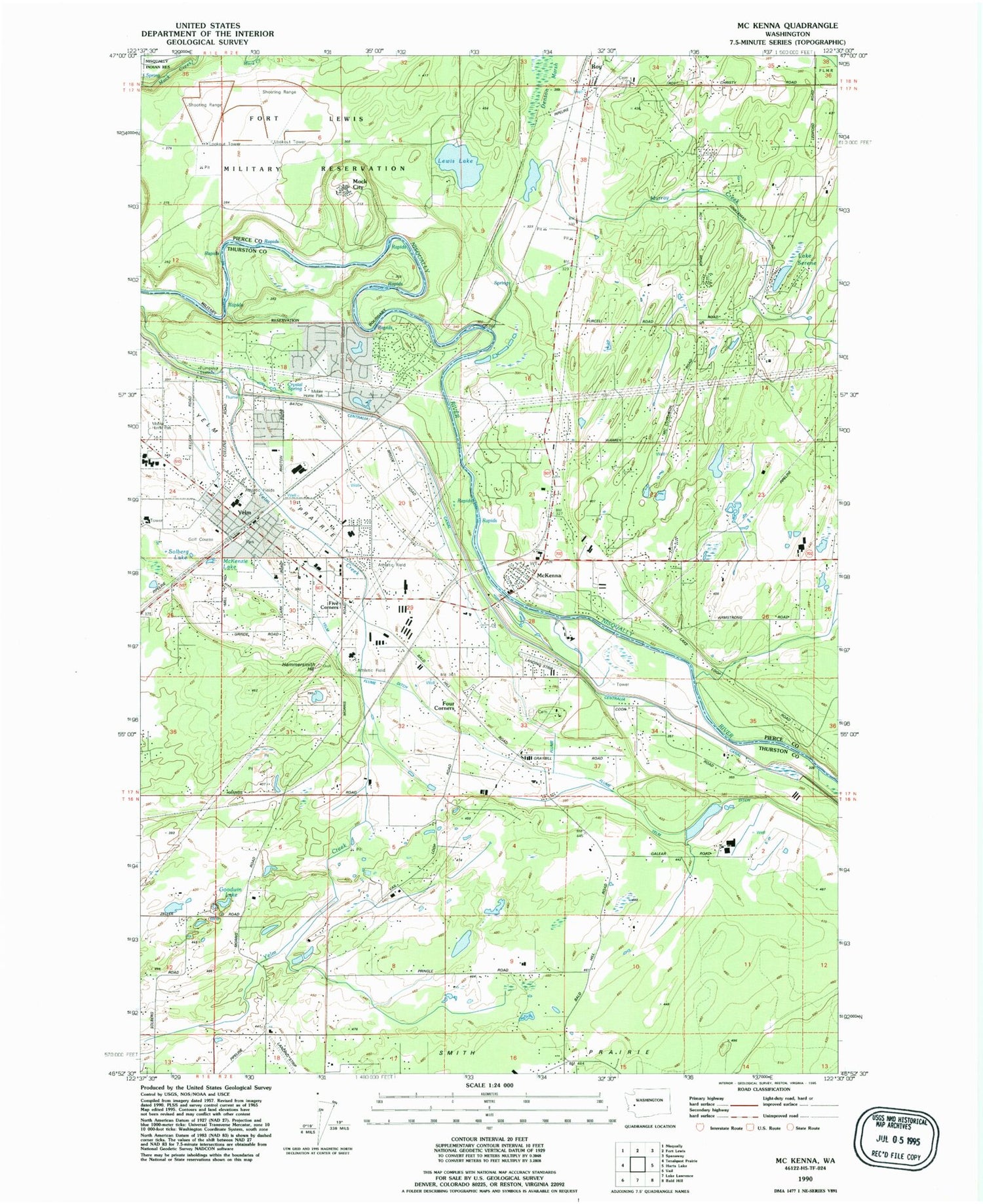
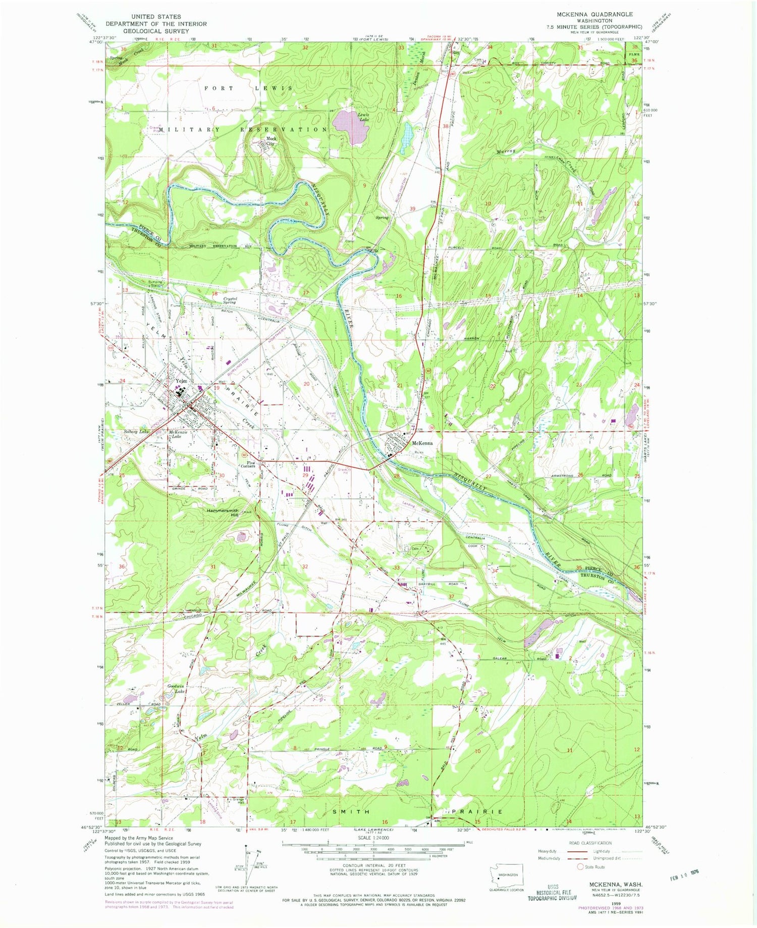
Classic USGS McKenna Washington 7.5'x7.5' Topo Map
Couldn't load pickup availability
Historical USGS topographic quad map of McKenna in the state of Washington. Map scale may vary for some years, but is generally around 1:24,000. Print size is approximately 24" x 27"
This quadrangle is in the following counties: Pierce, Thurston.
The map contains contour lines, roads, rivers, towns, and lakes. Printed on high-quality waterproof paper with UV fade-resistant inks, and shipped rolled.
Contains the following named places: Centralia Canal, City of Roy, Crystal Spring, Denton Marsh, Five Corners, Flying B Airport, Fort Stevens Elementary School, Four Corners, Goodwin Lake, Hammersmith Hill, Jack Travis Estates Mobile Home Park, Lake Serene, Lewis Lake, McKenna, McKenna Census Designated Place, McKenna Elementary School, McKenna Heights Mobile Home Park, McKenna Post Office, McKenzie Lake, Mock City, Murray Creek, North Yelm, North Yelm Census Designated Place, Our Redeemer Lutheran School, Prairie Elementary School, Royal Oak Mobile Home Park, Serene Lake Dam, Solberg Lake, South Pierce Fire and Rescue Station 174, Southeast Thurston Fire Authority Station 21 Main, Tender Moments Daycare Center, Western Airpark, Yelm, Yelm Ditch, Yelm Extension School, Yelm Intermediate School, Yelm Middle School, Yelm Police Department, Yelm Post Office, Yelm Prairie, Yelm Seventh Day Adventist School, Yelm Sewage Treatment Plant, ZIP Codes: 98558, 98580


