MyTopo
Classic USGS McKenzie Creek Montana 7.5'x7.5' Topo Map
Regular price
$16.95
Regular price
Sale price
$16.95
Unit price
per
Couldn't load pickup availability
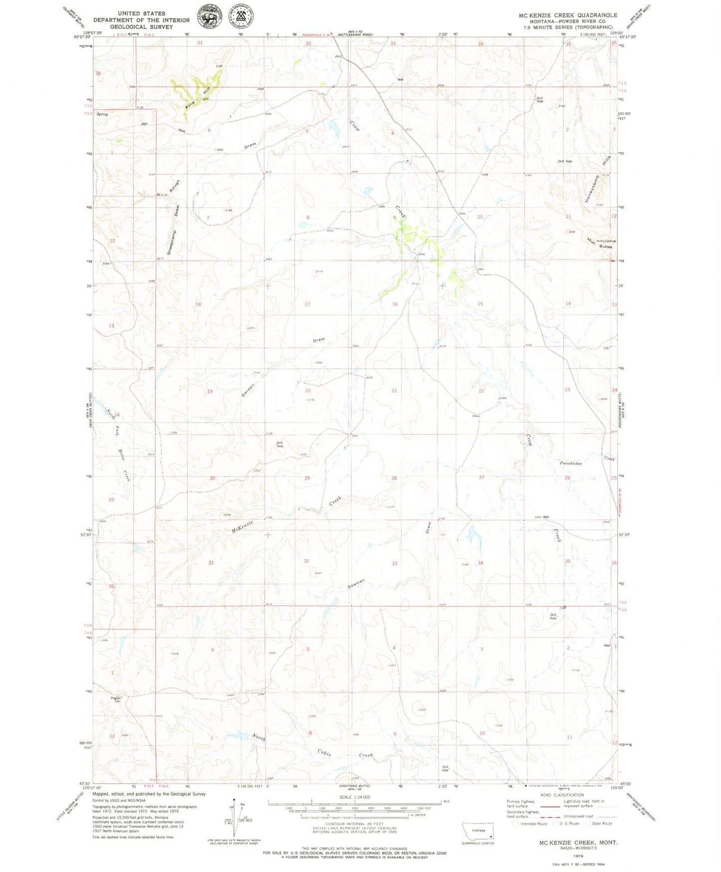
Historical USGS topographic quad map of McKenzie Creek in the state of Montana. Map scale may vary for some years, but is generally around 1:24,000. Print size is approximately 24" x 27"
This quadrangle is in the following counties: Powder River.
The map contains contour lines, roads, rivers, towns, and lakes. Printed on high-quality waterproof paper with UV fade-resistant inks, and shipped rolled.
Contains the following named places: 02S54E32CDB_01 Well, 02S54E35ADD_01 Well, 03S54E04DC__01 Well, 03S54E09DCC_02 Well, 03S54E20BDDB01 Well, 03S54E34BBDD01 Well, Garden Draw, Honeycomb Hills, McKenzie Creek, Mud Buttes, Pine Hill, Pocochichee Creek, Rough Draw, Seaman Draw, Sheepcamp Draw