MyTopo
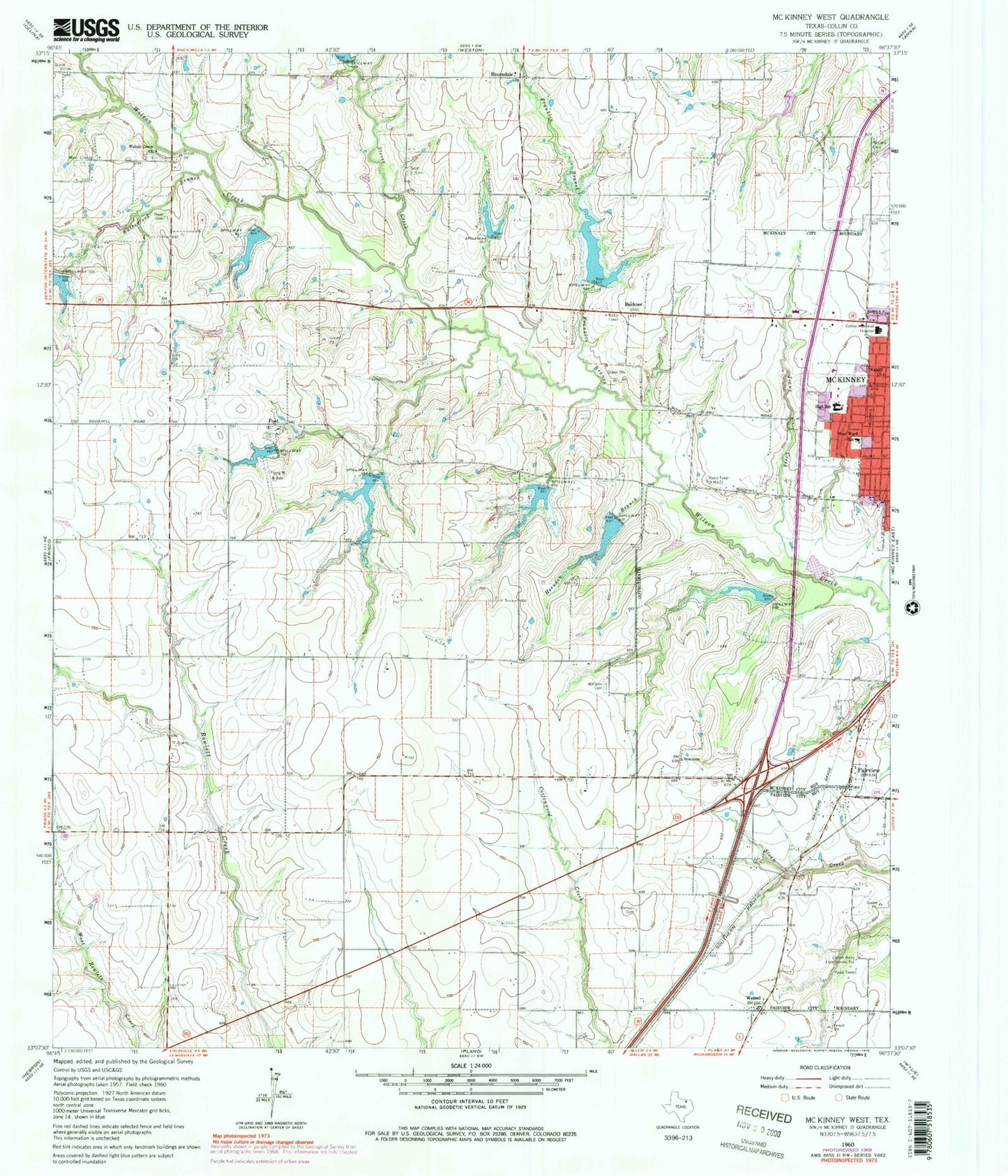
Classic USGS McKinney West Texas 7.5'x7.5' Topo Map
Couldn't load pickup availability
Historical USGS topographic quad map of McKinney West in the state of Texas. Map scale may vary for some years, but is generally around 1:24,000. Print size is approximately 24" x 27"
This quadrangle is in the following counties: Collin.
The map contains contour lines, roads, rivers, towns, and lakes. Printed on high-quality waterproof paper with UV fade-resistant inks, and shipped rolled.
Contains the following named places: A G Wilson House, A M Scott House, Aero Country Airport, Barksdale Creek, Baylor Medical Center at McKinney, Ben Hill House, Bloomdale, Buckner, Burks Elementary School, Burrus-Finch House, C T Eddins Elementary School, Church of Christ, City of McKinney, Cline-Bass House, Collin County Constable's Office Precinct 1, Collin County Farm Museum, Collin County Jail, Collin County Sheriff's Office, Collins Radio Experimental Station, Dobransky Airport, Dowell Middle School, Fairview, Fairview Fire Station 1, Foot, Franklin Branch, Gentle Creek, Glen Oaks Elementary School, Gouch-Hughston House, Herndon Branch, Hunt Cemetery, J H Taylor House, Kittyhawk Airport, Linkside Park Post Office, Lions Stadium, McKinney Division, McKinney Fire Department Station 2, McKinney Fire Department Station 3, McKinney Fire Department Station 5, McKinney Fire Department Station 6, McKinney Independent School District Stadium, McKinney Police Department, McKinney Post Office, McLarry Cemetery, Medical Center of McKinney, Medical Center of McKinney Wysong Campus, Methodist McKinney Hospital, Moran Hill House, Murphy Park, Parkway Baptist Church, R F Newsome House, Ridgeview Memorial Park, Rutherford Branch, S H Fox House, Saint Michaels Catholic Church, Sam Neathery House, Scott Cemetery, Slaughter Elementary School, Soil Conservation Service Site 17 Dam, Soil Conservation Service Site 17 Reservoir, Soil Conservation Service Site 1a Dam, Soil Conservation Service Site 1a Reservoir, Soil Conservation Service Site 1b Dam, Soil Conservation Service Site 1b Reservoir, Soil Conservation Service Site 2a Dam, Soil Conservation Service Site 2a Reservoir, Soil Conservation Service Site 2b Dam, Soil Conservation Service Site 2b Reservoir, Soil Conservation Service Site 3a Dam, Soil Conservation Service Site 3a Reservoir, Soil Conservation Service Site 3b Dam, Soil Conservation Service Site 3b Reservoir, Soil Conservation Service Site 3c Dam, Soil Conservation Service Site 3c Reservoir, Soil Conservation Service Site 3d Dam, Soil Conservation Service Site 3d Reservoir, Soil Conservation Service Site 3e Dam, Soil Conservation Service Site 3e Reservoir, Soil Conservation Service Site 4 Dam, Soil Conservation Service Site 4 Reservoir, Soil Conservation Service Site 5a Dam, Soil Conservation Service Site 5a Reservoir, Stimson Cemetery, Stonebridge Drive Baptist Church, Stover Creek, Thompson House, Valley Creek Elementary School, Waddill Church, Walnut Grove Church, Ware Cemetery, West Ward School, Wetsel, Williams Cemetery, ZIP Codes: 75070, 75071