MyTopo
Classic USGS McKinney Arkansas 7.5'x7.5' Topo Map
Couldn't load pickup availability
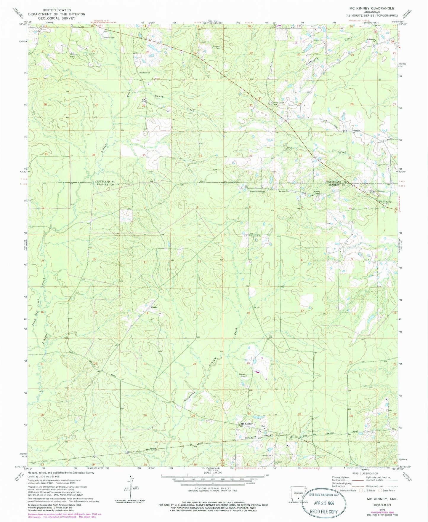
Historical USGS topographic quad map of McKinney in the state of Arkansas. Map scale may vary for some years, but is generally around 1:24,000. Print size is approximately 24" x 27"
This quadrangle is in the following counties: Bradley, Cleveland.
The map contains contour lines, roads, rivers, towns, and lakes. Printed on high-quality waterproof paper with UV fade-resistant inks, and shipped rolled.
Contains the following named places: Bethel Cemetery, Bethel Church, Bradley Creek, Caney Creek, Center Point School, County Line Volunteer Fire Department, County Line Volunteer Fire Station 1, Draper, Garrison Cemetery, Good Hope Methodist Church, Good Hope Methodist Church Cemetery, Greenland Church, Harmony Baptist Church, Hopewell Baptist Church, Irish Bill Creek, Lacy, Macedonia Church, McKinney, McKinney Cemetery, Mobley Branch, Moseley Cemetery, Moseley Chapel, Oakdale School, Orlando, Parnell Springs, Reaves Cemetery, Rocky Branch, Saint John Cemetery, Sanctified Church, Shady Grove Cemetery, Weeks, Wheeler Springs Cemetery, Wheeler Springs Methodist Episcopal Church