
MyTopo
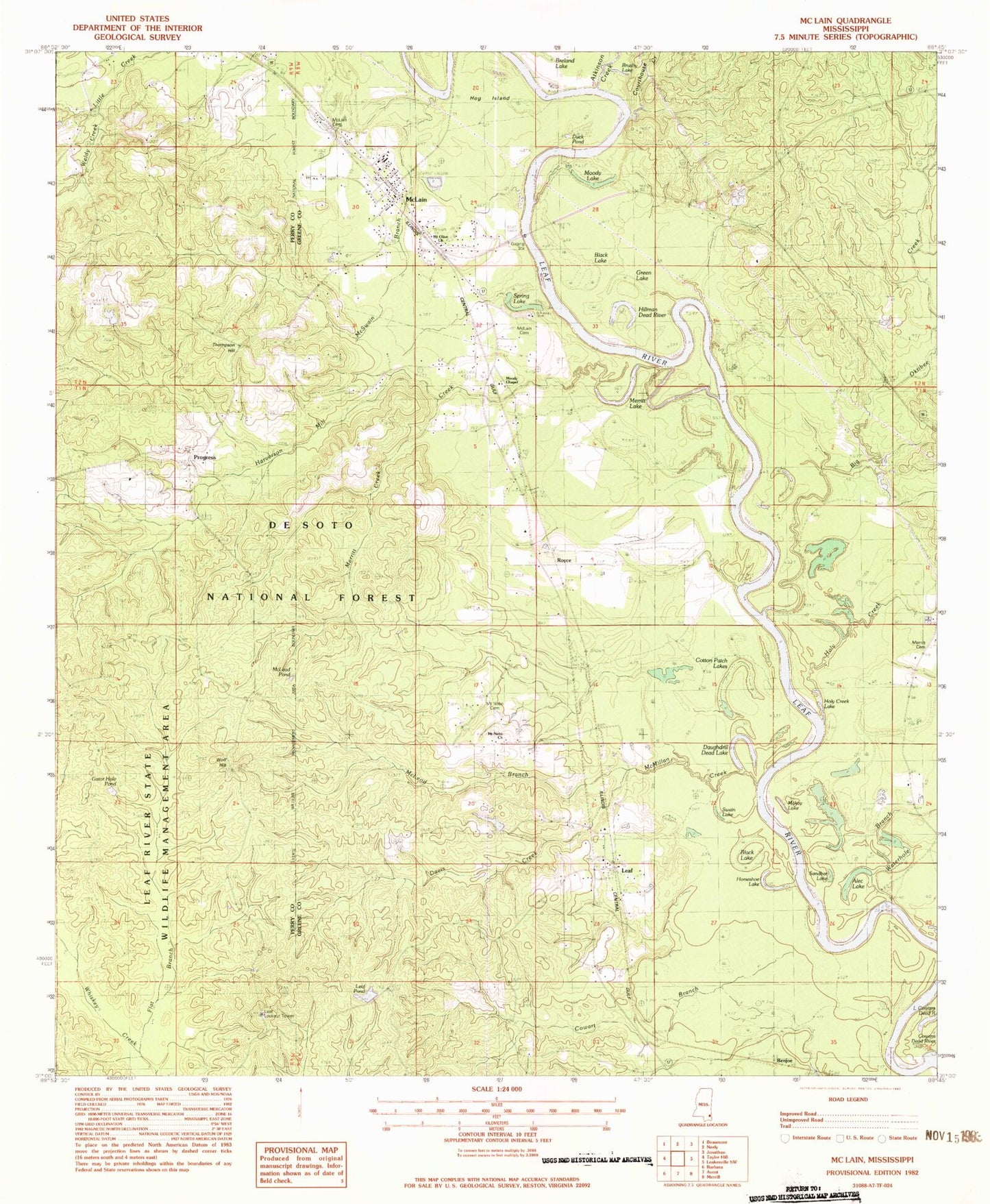
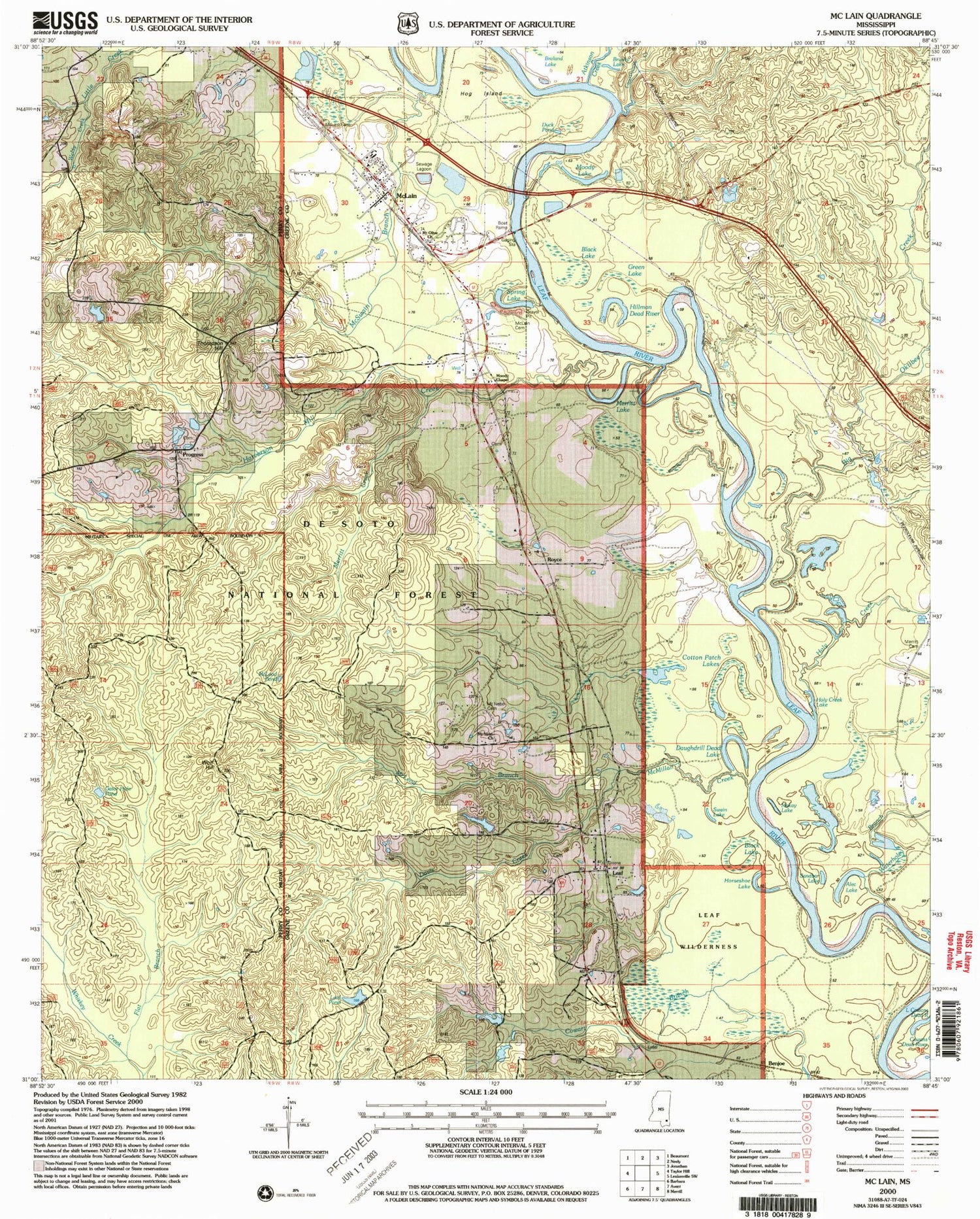
Classic USGS McLain Mississippi 7.5'x7.5' Topo Map
Couldn't load pickup availability
Historical USGS topographic quad map of McLain in the state of Mississippi. Map scale may vary for some years, but is generally around 1:24,000. Print size is approximately 24" x 27"
This quadrangle is in the following counties: Greene, Perry.
The map contains contour lines, roads, rivers, towns, and lakes. Printed on high-quality waterproof paper with UV fade-resistant inks, and shipped rolled.
Contains the following named places: Alec Lake, Atkinson Creek, Benjoe, Big Oktibee Creek, Black Lake, Brushy Lake, Cotton Patch Lakes, Courthouse Creek, Cowart Branch, Daughdrill Dead Lake, Davis Creek, Duck Pond, Dunnam Field, First Baptist Church of McLain, First United Pentecostal Church, Flat Branch, Gator Hole Pond, Green Lake, Harverson Mill Creek, Harvison Lake Dam, Hillman Dead River, Hog Island, Holy Creek, Holy Creek Lake, Horseshoe Lake, Leaf, Leaf Cemetery, Leaf Census Designated Place, Leaf Lookout Tower, Leaf Pond, Leaf River Boat Ramp, Leaf Wilderness, Little Cowans Dead River, Makay Lake, Mc Lain Police Department, McLain, McLain Attendance Center, Mclain Cemetery, McLain Cemetery, McLain Church of God, McLain Elementary School, McLain Post Office, McLain Sewage Lagoon Dam, McLain Volunteer Fire Department, McLeod Branch, McLeod Pond, McMillan Creek, McSwain Branch, McSwain School, Merritt Cemetery, Merritt Creek, Merritt Lake, Moody Chapel, Moody Lake, Mount Nebo Cemetery, Mount Nebo Church, Mount Olive Church, Pine Forest Regional Library - McLain Public Library, Progress, Royce, Sandbar Lake, Spring Lake, Swan Lake, Thompson Hill, Town of McLain, Waterhole Branch, Weldy Creek, Wolf Hill, ZIP Code: 39456