MyTopo
Classic USGS McLellan Reservoir Arizona 7.5'x7.5' Topo Map
Couldn't load pickup availability
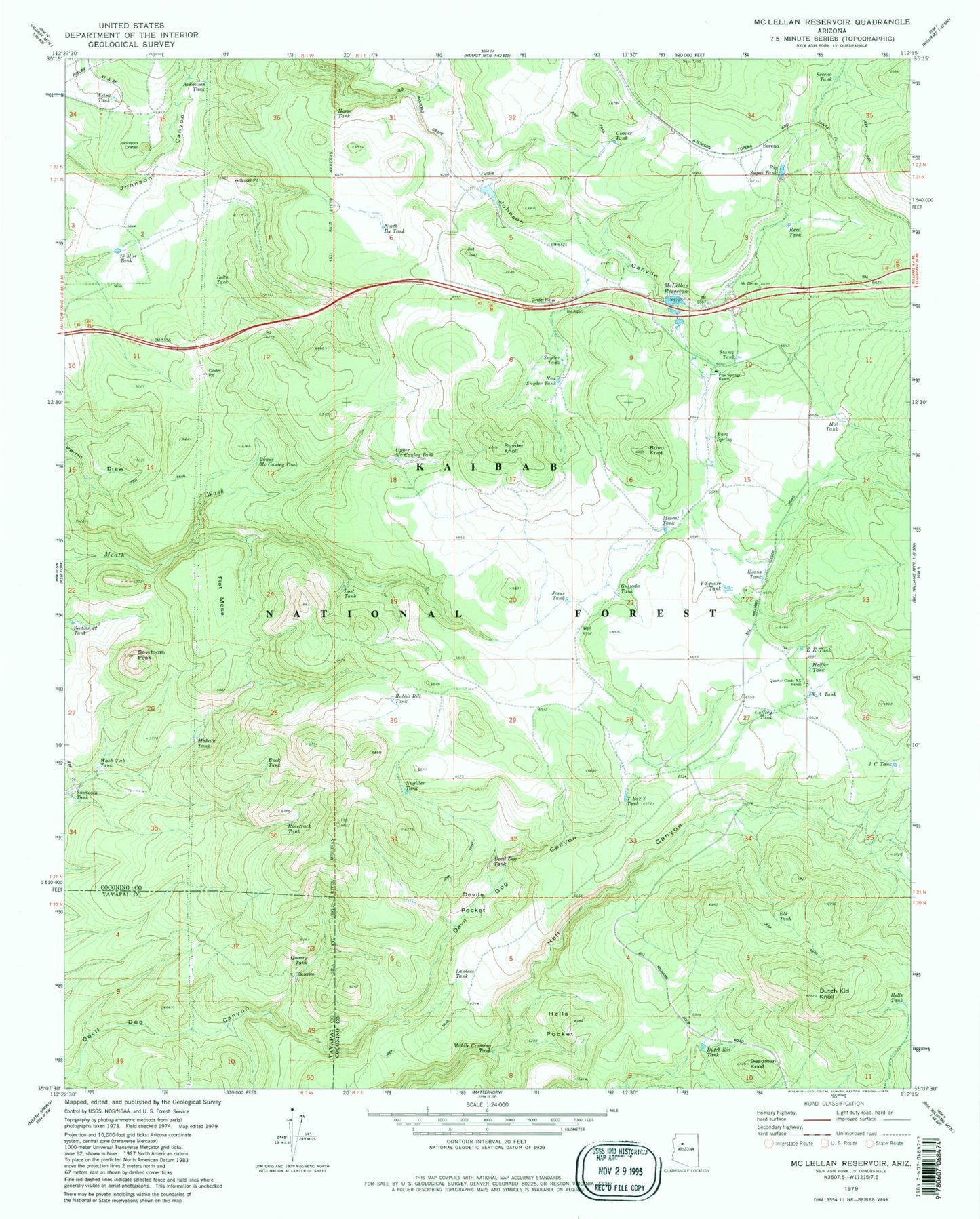
Historical USGS topographic quad map of McLellan Reservoir in the state of Arizona. Map scale may vary for some years, but is generally around 1:24,000. Print size is approximately 24" x 27"
This quadrangle is in the following counties: Coconino, Yavapai.
The map contains contour lines, roads, rivers, towns, and lakes. Printed on high-quality waterproof paper with UV fade-resistant inks, and shipped rolled.
Contains the following named places: Andrews Spring, Arkansas Tank, Bard Spring, Big Supai Tank, Bottom Tank, Boyd Knoll, Buck Tank, Caffrey Tank, Cooper Tank, Deadman Knoll, Delta Tank, Devil Dog Tank, Devil Tank, Devils Pocket, Dutch Kid Knoll, Dutch Kid Tank, E K Tank, Elk Tank, Evans Tank, Flat Mesa, Guijada Tank, Hat Tank, Headquarters Tank, Heiffer Tank, Hells Pocket, Hells Tank, Horse Tank, J C Tank, Jesus Tank, Johnson Crater, Kessler Tank, Lawless Tank, Log Tank, Lost Cow Tank, Lost Tank, Lower Mc Cauley Tank, Mahala Tank, McLellan Dam, McLellan Reservoir, McLellan Siding Tank, Mescal Tank, Middle Crossing Tank, Nagiller Tank, New Synder Tank, North Ike Tank, North Keesler Tank, Pine Springs Ranch, Quarry Tank, Quarter Circle X X Ranch, Rabbit Bill Tank, Racetrack Tank, Reed Tank, Rod Tank, Sawtooth Peak, Sawtooth Tank, Section Twentytwo Tank, Sereno, Sereno Siding, Sereno Spring, Sereno Tank, Snyder Knoll, Snyder Tank, Stevans Tank, Stump Tank, T Bar Y Tank, Thirteen Mile Tank, T-Square Tank, Upper McCauley Tank, Wash Tub Tank, Welch Tank, X A Tank