MyTopo
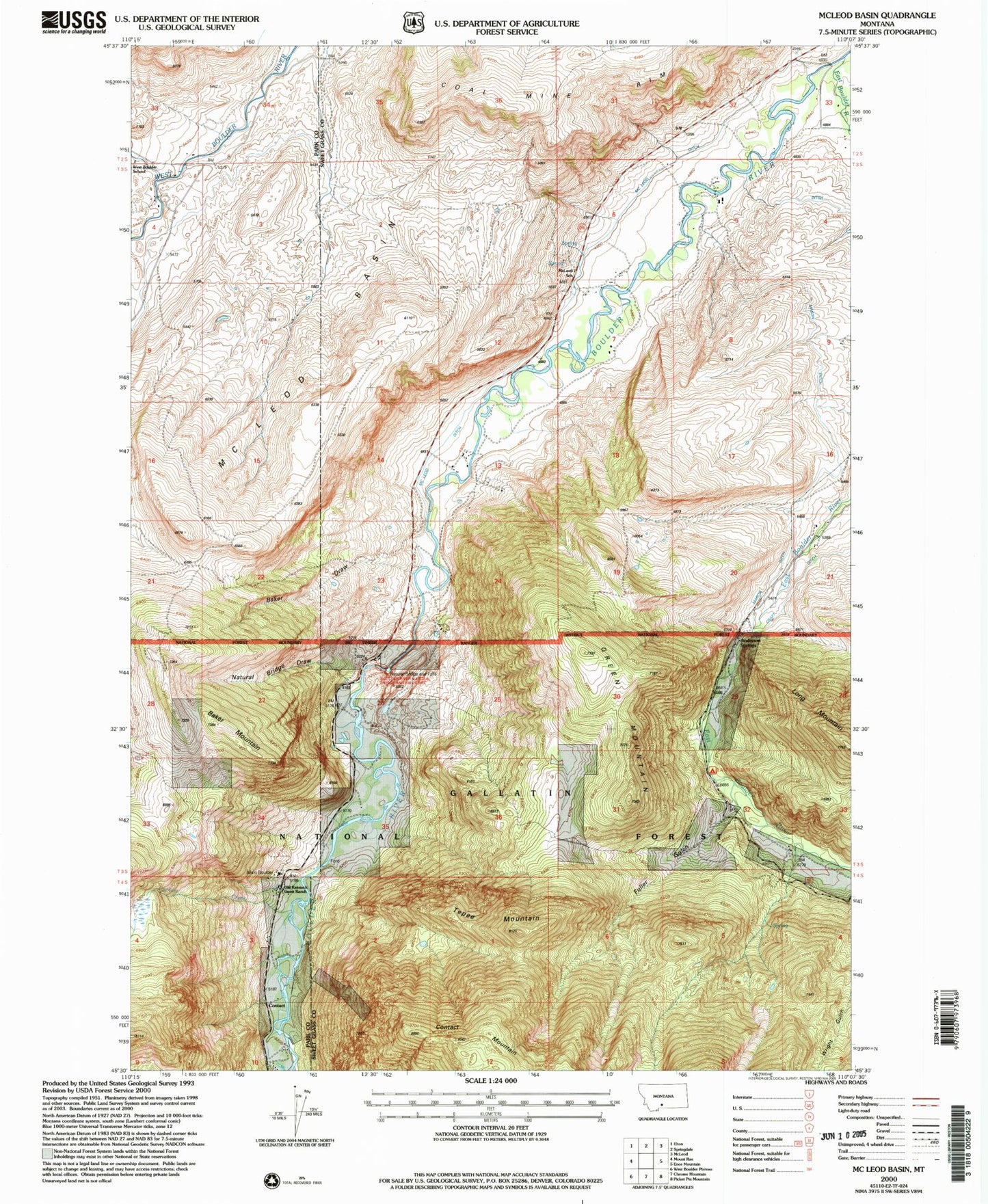
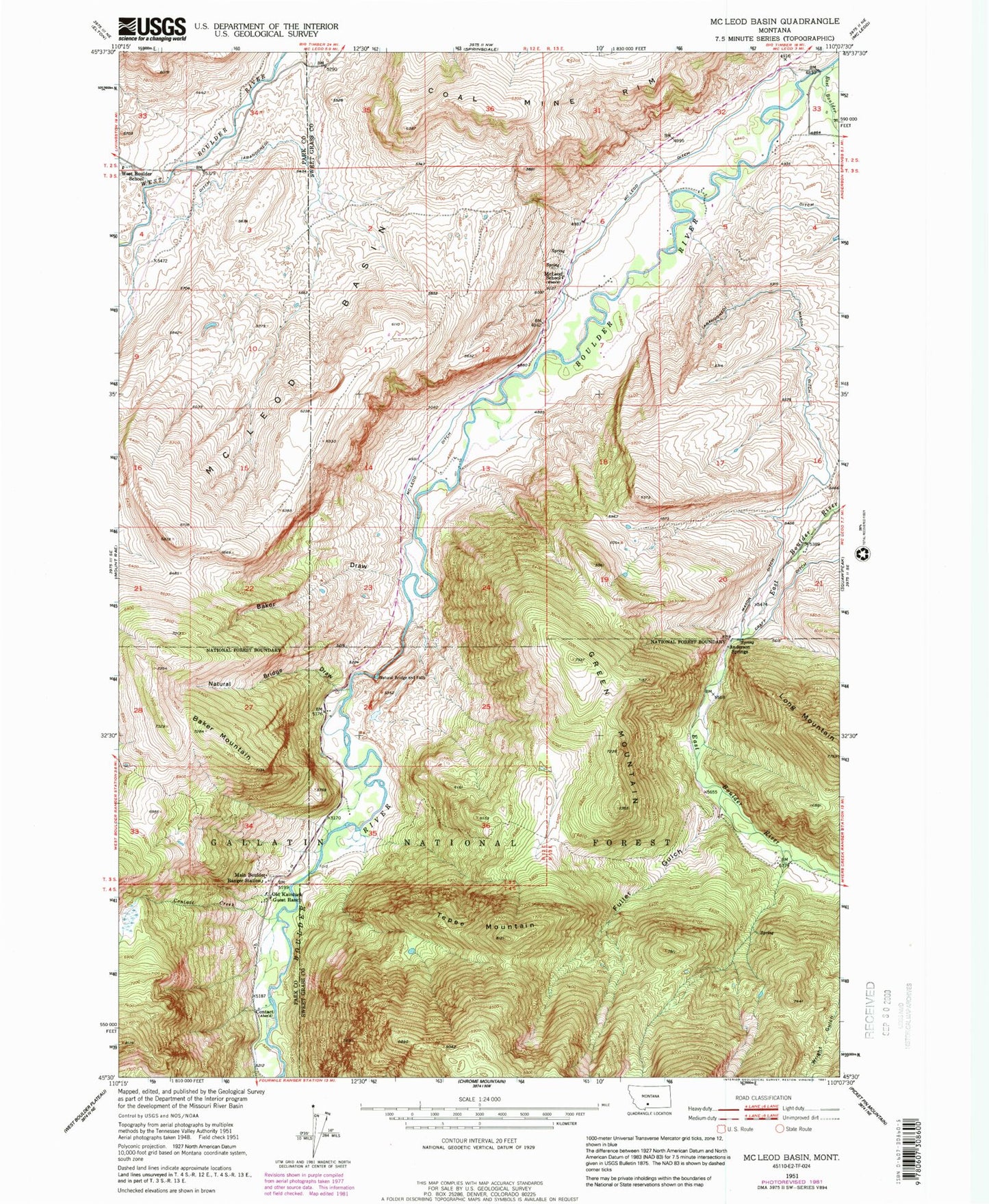
Classic USGS McLeod Basin Montana 7.5'x7.5' Topo Map
Couldn't load pickup availability
Historical USGS topographic quad map of McLeod Basin in the state of Montana. Map scale may vary for some years, but is generally around 1:24,000. Print size is approximately 24" x 27"
This quadrangle is in the following counties: Park, Sweet Grass.
The map contains contour lines, roads, rivers, towns, and lakes. Printed on high-quality waterproof paper with UV fade-resistant inks, and shipped rolled.
Contains the following named places: 02S13E33CDAD01 Well, 03S12E12DACA01 Well, 03S12E13BCDA01 Well, 03S12E13CBBA01 Well, 03S13E05BACD01 Well, 03S13E05CBBB01 Well, 03S13E07BABD01 Well, 03S13E21BABB01 Spring, 03S13E21BCBA01 Spring, 03S13E29ABAB01 Spring, 04S13E05ADBD01 Spring, Anderson Springs, Baker Draw, Baker Mountain, Coal Mine Rim, Contact, Contact Creek, Contact Post Office, Contact School, East Boulder Campground, East Boulder River, Fuller Gulch, Green Mountain, Hubble Post Office, Main Boulder Ranger Station, Mason Ditch, McLeod Basin, McLeod Ditch, McLeod School, Natural Bridge Draw, Natural Bridge Point of Interest, Natural Bridge State Park, Old Kaintuck Guest Ranch, Tepee Mountain