MyTopo
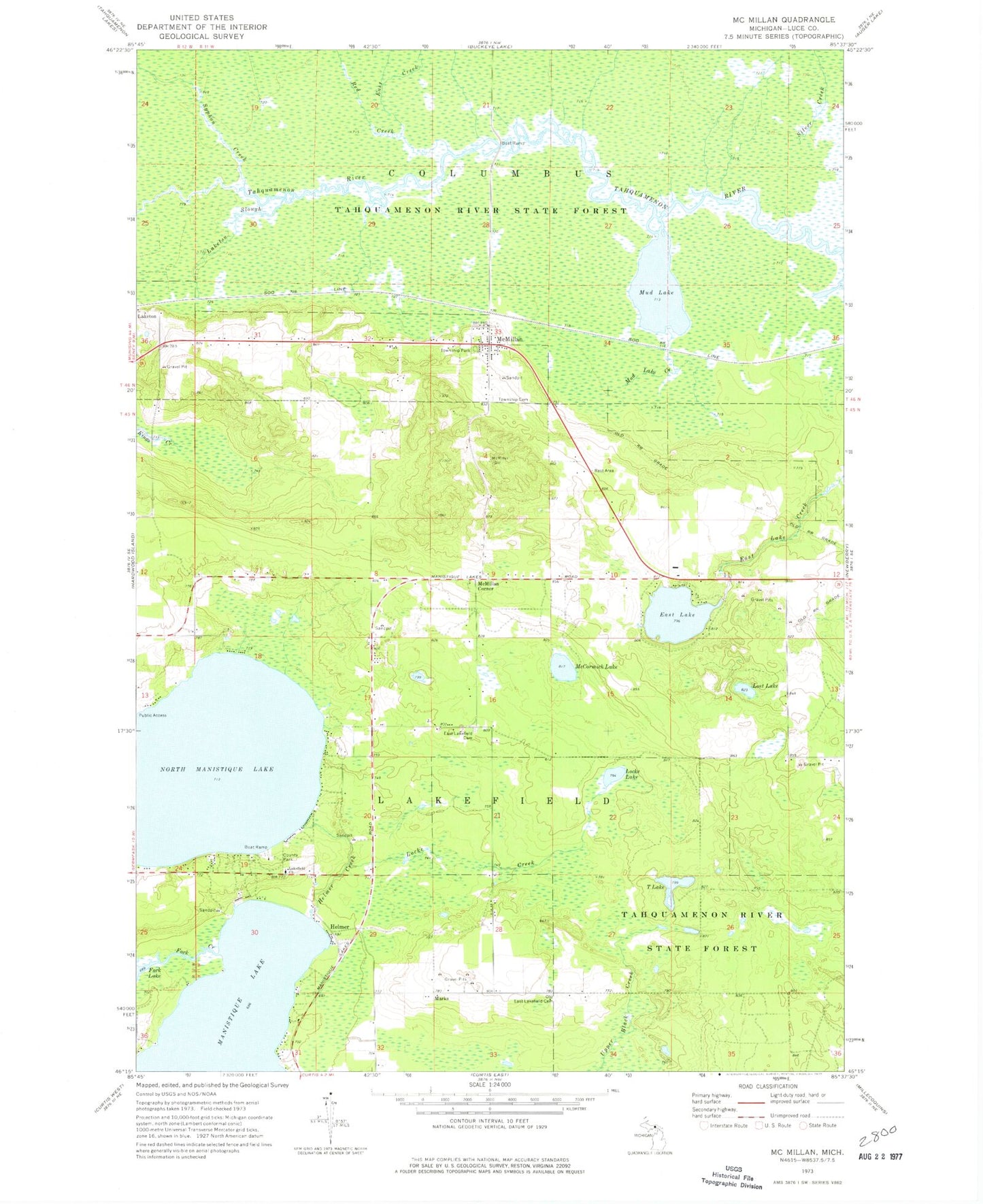
Classic USGS McMillan Michigan 7.5'x7.5' Topo Map
Couldn't load pickup availability
Historical USGS topographic quad map of McMillan in the state of Michigan. Map scale may vary for some years, but is generally around 1:24,000. Print size is approximately 24" x 27"
This quadrangle is in the following counties: Luce.
The map contains contour lines, roads, rivers, towns, and lakes. Printed on high-quality waterproof paper with UV fade-resistant inks, and shipped rolled.
Contains the following named places: Big Lake Campground, Columbus Township Cemetery, Columbus Township Park, Columbus Township Volunteer Fire Department, East Creek, East Lake, East Lakefield Cemetery, Fork Creek, Helmer, Helmer Creek, Helmer House Inn Historical Marker, Helmer Post Office, Lakefield Church, Laketon, Laketon Post Office, Laketon Slough, Laketon Station, Locke Creek, Locke Lake, Lost Lake, Marks, McCormick Lake, McMillan, McMillan Corner, McMillan Post Office, McMillan Station, McMillan United Methodist Church, Mud Lake, Mud Lake Creek, North Manistique Lake, Northstar Baptist Church, Northstar Christian Academy, Old East Lakefield Cemetery, Red Creek, Seventh-Day Adventist Church, Silver Creek, Syphon Creek, T Lake, Teaspoon Creek, Township of Lakefield