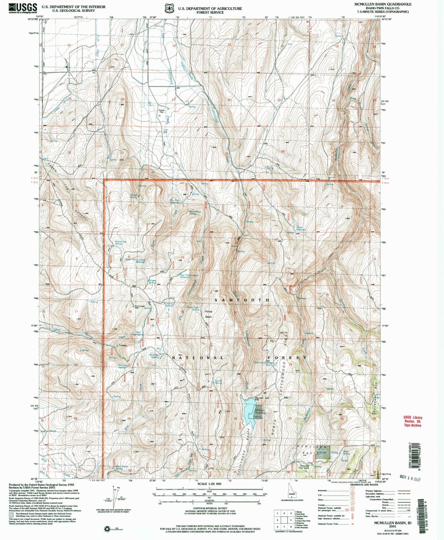
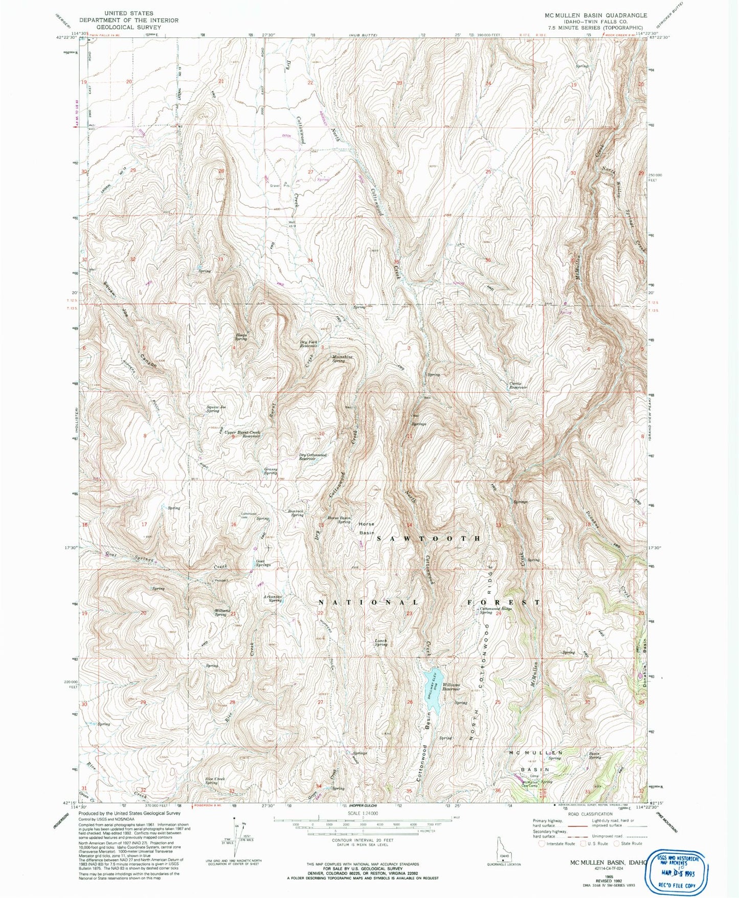
MyTopo
Classic USGS McMullen Basin Idaho 7.5'x7.5' Topo Map
Couldn't load pickup availability
Historical USGS topographic quad map of McMullen Basin in the state of Idaho. Map scale may vary for some years, but is generally around 1:24,000. Print size is approximately 24" x 27"
This quadrangle is in the following counties: Twin Falls.
The map contains contour lines, roads, rivers, towns, and lakes. Printed on high-quality waterproof paper with UV fade-resistant inks, and shipped rolled.
Contains the following named places: Arkansas Spring, Basin Spring, Burnt Creek, Cottonwood Basin, Cottonwood Ridge Spring, Curtis Reservoir, Donahue Creek, Dry Cottonwood Reservoir, Dry Fork Reservoir, Goat Springs, Grassy Spring, Hoops Spring, Horse Basin, Horse Basin Spring, Lunch Spring, McMullen Basin, McMullen Cow Camp, Moonshine Spring, North Cottonwood Ridge, North Willow Springs Creek, Rice Creek Spring, Rimrock Spring, Squaw Joe Spring, Upper Burnt Creek Reservoir, Williams Dam, Williams Reservoir, Williams Spring