
MyTopo
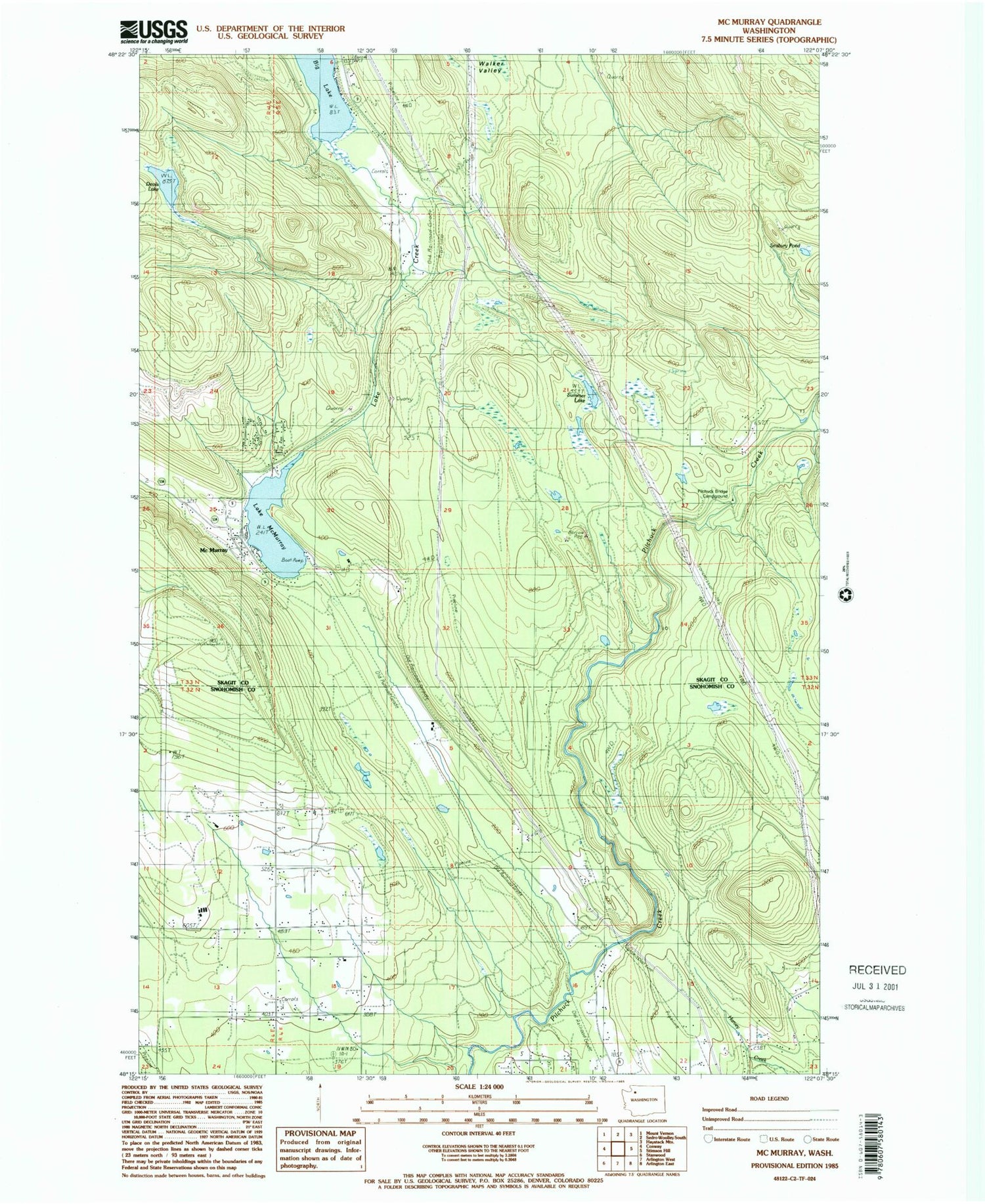
Classic USGS McMurray Washington 7.5'x7.5' Topo Map
Couldn't load pickup availability
Historical USGS topographic quad map of McMurray in the state of Washington. Map scale may vary for some years, but is generally around 1:24,000. Print size is approximately 24" x 27"
This quadrangle is in the following counties: Skagit, Snohomish.
The map contains contour lines, roads, rivers, towns, and lakes. Printed on high-quality waterproof paper with UV fade-resistant inks, and shipped rolled.
Contains the following named places: Crane Creek, Devils Lake, Ehrlich, Lake Creek, Lake McMurray, Lake McMurray Census Designated Place, McMurray, Pilchuck, Pilchuck Bridge Campground, Pilchuck Creek Bridge, Rainbow Bridge Farm, S and S Farms, Seabury Pond, Skagit County Fire District 15 Lake McMurray Fire Department, Skagit County Fire District 9 Big Lake Fire Department Station 2 Ehrlich, Summer Lake, ZIP Code: 98274


