MyTopo
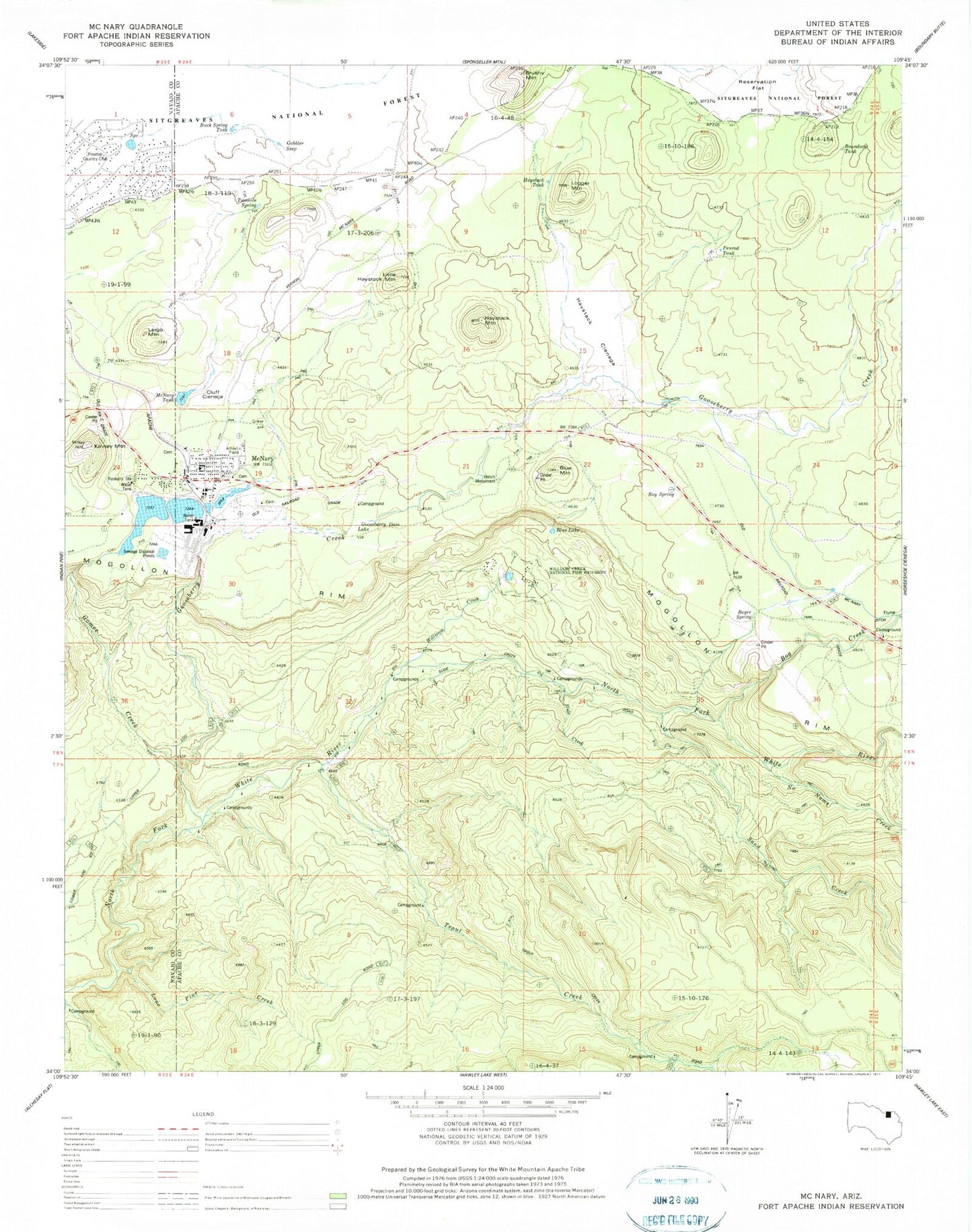
Classic USGS McNary Arizona 7.5'x7.5' Topo Map
Couldn't load pickup availability
Historical USGS topographic quad map of McNary in the state of Arizona. Map scale may vary for some years, but is generally around 1:24,000. Print size is approximately 24" x 27"
This quadrangle is in the following counties: Apache, Navajo.
The map contains contour lines, roads, rivers, towns, and lakes. Printed on high-quality waterproof paper with UV fade-resistant inks, and shipped rolled.
Contains the following named places: Blue Lake, Blue Lake Recreation Site, Blue Mountain, Bog Creek, Boundary Tank, Boy Creek Campground, Boy Spring, Boyce Spring, Buck Spring Tank, Club Tank, Cluff Cienega, Cyclone Dam, Gobbler Seep, Gomez Creek, Gooseberry Creek, Gooseberry Dam Lake, Haystack Cienega, Haystack Mountain, Haystack Tank, Kinney Mountain, Largo Mountain, Little Haystack Mountain, Logger Mountain, Lone Pine Creek, McNary, McNary Annex School, McNary Apache Baptist Church, McNary Census Designated Place, McNary Elementary School, McNary High School, McNary Post Office, McNary Railroad Station, McNary Tank, No Name Creek, Penrod Tank, Pinetop Country Club, Reservation Flat, Sand Creek, Slide Creek, Trout Creek, Twomile Spring, Twomile Spring Tank, Williams Creek, Williams Creek National Fish Hatchery