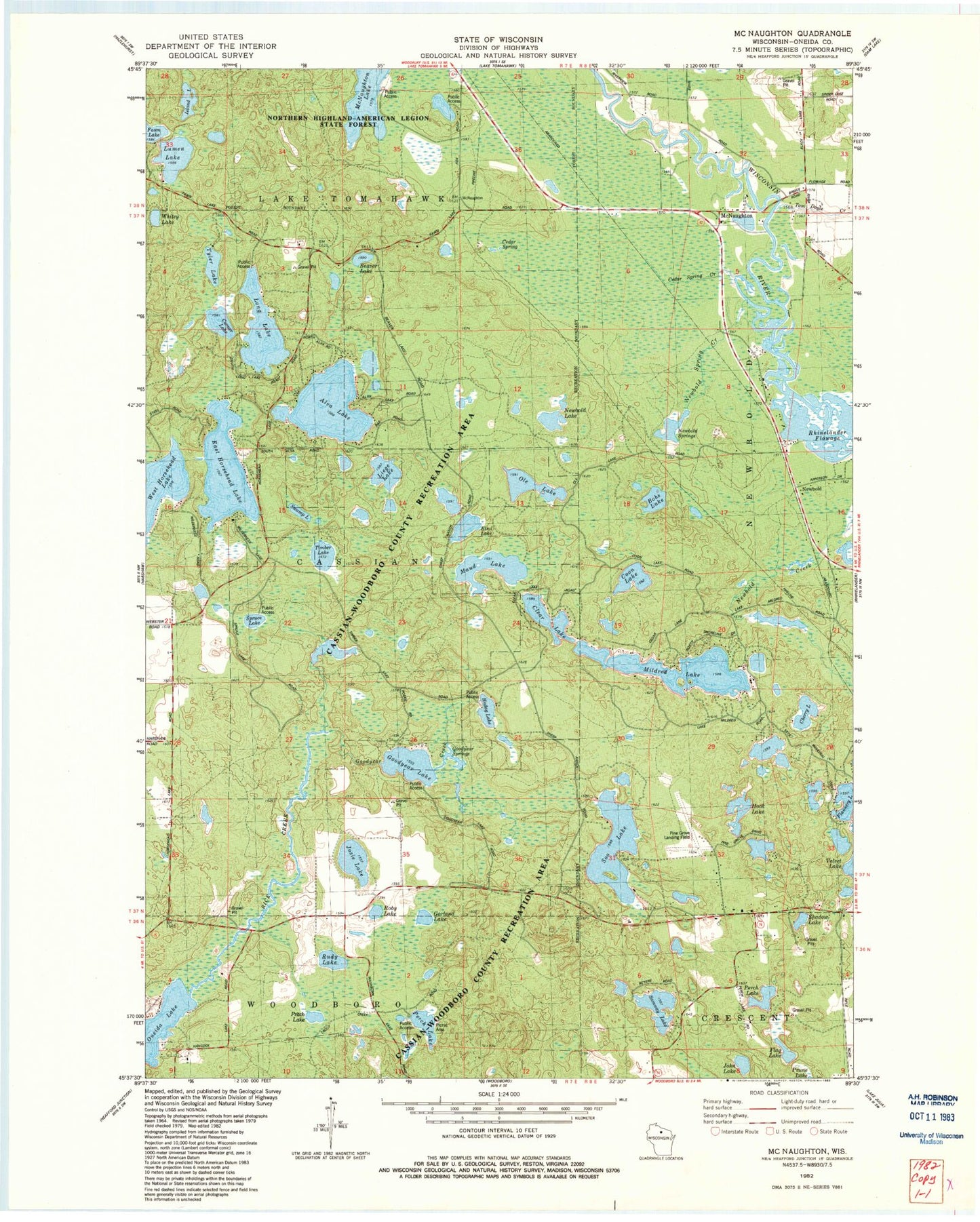
MyTopo
Classic USGS McNaughton Wisconsin 7.5'x7.5' Topo Map
Couldn't load pickup availability
Historical USGS topographic quad map of McNaughton in the state of Wisconsin. Map scale may vary for some years, but is generally around 1:24,000. Print size is approximately 24" x 27"
This quadrangle is in the following counties: Oneida.
The map contains contour lines, roads, rivers, towns, and lakes. Printed on high-quality waterproof paper with UV fade-resistant inks, and shipped rolled.
Contains the following named places: Alva Lake, Beaver Lake, Beaver Lake School, Bobs Lake, Cassian-Woodboro County Recreation Area, Cedar Spring, Cedar Spring Creek, Cherry Lake, Clear Lake, Coon Lake, Corner Lake, East Horsehead Lake, Elna Lake, Flag Lake, Garland Lake, Germain Hemlocks State Natural Area, Goodyear Creek, Goodyear Lake, Goodyear Springs, Hodag Lake, Hook Lake, Island Lake, John Lake, Josie Lake, Lake Samway, Liege Lake, Long Lake, Lorraine Lake, Lumen Lake, Lyle Lake, Maud Lake, McNaughton, McNaughton Lake, Mildred Lake, Newbold, Newbold Lake, Newbold Spring Creek, Newbold Springs, Ole Lake, Oneida County, Perch Lake, Pine Grove Airport, Pritch Lake, Roby Lake, Rudy Lake, Shadow Lake, Soo Lake, Spruce Lake, Spruce Lake E1176.2 Dam, Swamp Lake, Thoreau Lake, Timber Lake, Tyler Lake, West Horsehead Lake, Whitey Lake