MyTopo
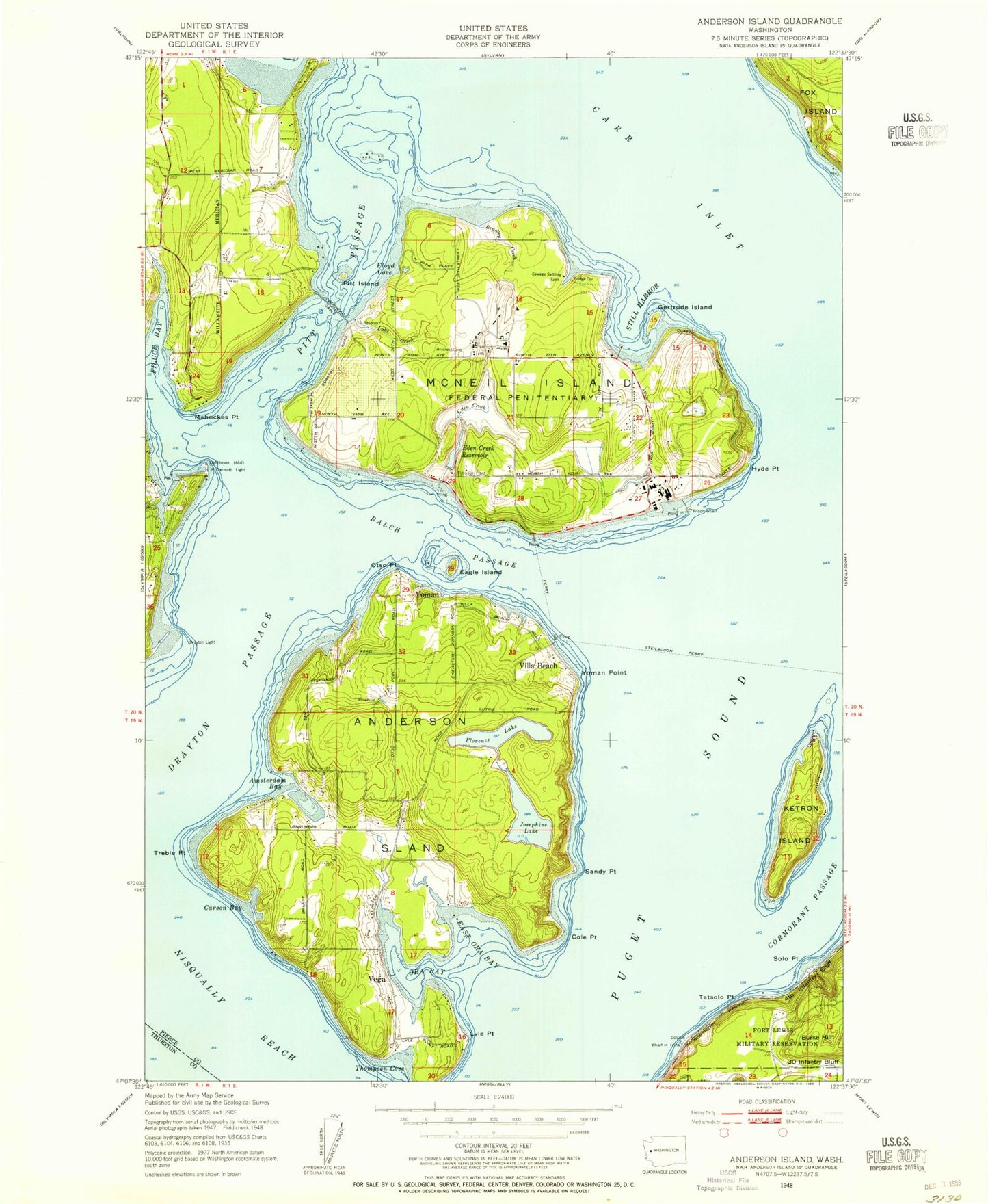
Classic USGS McNeil Island Washington 7.5'x7.5' Topo Map
Couldn't load pickup availability
Historical USGS topographic quad map of McNeil Island in the state of Washington. Typical map scale is 1:24,000, but may vary for certain years, if available. Print size: 24" x 27"
This quadrangle is in the following counties: Pierce, Thurston.
The map contains contour lines, roads, rivers, towns, and lakes. Printed on high-quality waterproof paper with UV fade-resistant inks, and shipped rolled.
Contains the following named places: Amsterdam Bay, Anderson Island, Anderson Island Cemetery, Balch Passage, Baldwin Point, Bradley Creek, Butterworth Dam, Butterworth Reservoir, Cole Point, Cormorant Passage, Drayton Light, Drayton Passage, Eagle Island, East Oro Bay, Filucy Bay, Floyd Cove, Gertrude Island, Hillcrest Cemetery, Hogan Point, Hyde Point, Ketron Island, Luhr Creek, Lyle Point, Mahnckes Point, McDermott Point Lighthouse, McNeil Island, Nisqually Reach, Oro Bay, Otso Point, Pitt Island, Pitt Passage, Sandy Point, Solo Point, Still Harbor, Tatsolo Point, Thompson Cove, Treble Point, Villa Beach, Yoman Point, Yoman, Eagle Island State Marine Park, Johnson Landing, Burke Hill, Yoman Dock, Florence Lake, Josephine Lake, Luhr Creek Reservoir, Anderson Pond, Eden Creek Reservoir, Floyd Cove Reservoir, Samego Point, Tiye Point, Harriet Taylor Elementary School, McDermott Point, Wycoff Shoal, Gertrude, Bee, Meridian, Eden Creek Dam, Kaelin Dam, Luhr Creek Dam, Floyd Cove Dam, Bradley Creek Dam, Milewa Creek Dam, Anderson Pond Dam, Prison Farm Sewage Lagoon Dam, Prison Farm Sewage Lagoon, Carlson Bay, Fox Island Census Designated Place, Anderson Island Elementary School, Anderson Island Census Designated Place, Ketron Island Census Designated Place, Anderson Island Ferry Landing, Johnson Farm Museum, Fort Lewis Solo Point Wastewater Treatment Plant, McNeil Island Sewage Treatment Plant, Pierce County Fire Protection District 27, Mcneil Island Fire Department, Anderson Island Post Office, Amsterdam Bay, Anderson Island, Anderson Island Cemetery, Balch Passage, Baldwin Point, Bradley Creek, Butterworth Dam, Butterworth Reservoir, Cole Point, Cormorant Passage, Drayton Light, Drayton Passage, Eagle Island, East Oro Bay, Filucy Bay, Floyd Cove, Gertrude Island, Hillcrest Cemetery, Hogan Point, Hyde Point, Ketron Island, Luhr Creek, Lyle Point, Mahnckes Point, McDermott Point Lighthouse, McNeil Island, Nisqually Reach, Oro Bay, Otso Point, Pitt Island, Pitt Passage, Sandy Point, Solo Point, Still Harbor, Tatsolo Point, Thompson Cove, Treble Point, Villa Beach, Yoman Point, Yoman, Eagle Island State Marine Park, Johnson Landing, Burke Hill, Yoman Dock, Florence Lake, Josephine Lake, Luhr Creek Reservoir, Anderson Pond, Eden Creek Reservoir, Floyd Cove Reservoir, Samego Point, Tiye Point, Harriet Taylor Elementary School, McDermott Point, Wycoff Shoal, Gertrude, Bee, Meridian, Eden Creek Dam, Kaelin Dam, Luhr Creek Dam, Floyd Cove Dam, Bradley Creek Dam, Milewa Creek Dam, Anderson Pond Dam, Prison Farm Sewage Lagoon Dam, Prison Farm Sewage Lagoon, Carlson Bay, Fox Island Census Designated Place, Anderson Island Elementary School, Anderson Island Census Designated Place, Ketron Island Census Designated Place, Anderson Island Ferry Landing, Johnson Farm Museum, Fort Lewis Solo Point Wastewater Treatment Plant, McNeil Island Sewage Treatment Plant, Pierce County Fire Protection District 27, Mcneil Island Fire Department, Anderson Island Post Office


