MyTopo
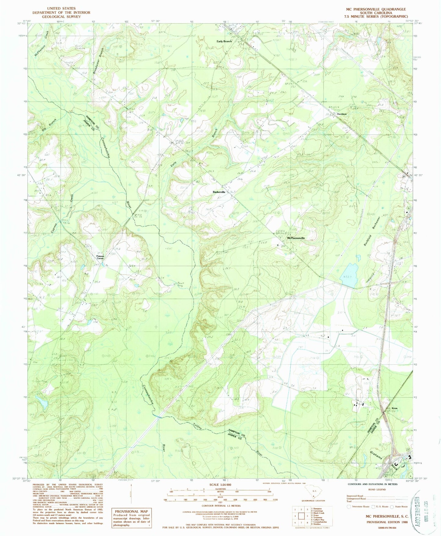
Classic USGS McPhersonville South Carolina 7.5'x7.5' Topo Map
Couldn't load pickup availability
Historical USGS topographic quad map of McPhersonville in the state of South Carolina. Map scale may vary for some years, but is generally around 1:24,000. Print size is approximately 24" x 27"
This quadrangle is in the following counties: Hampton, Jasper.
The map contains contour lines, roads, rivers, towns, and lakes. Printed on high-quality waterproof paper with UV fade-resistant inks, and shipped rolled.
Contains the following named places: Bakersville Church, Barkerville, Big Branch, Broadwater Branch, Buckfield Backwater, Buckfield Plantation, Buckfield Pond, Davidson, Early Branch, Early Branch Post Office, Kress, Kress School, Lowcountry Regional Industrial Park, McPherson Creek, McPhersonville, McPhersonville Church, McPhersonville School, Possum Corner, Possum Corner Bridge, Ridgeville Church, Rock Spring Church, Rock Spring School, South Carolina Noname 25002 D-2602 Dam, Wilkerson Church, Yemassee Division, Zahler Cemetery, ZIP Code: 29916