MyTopo
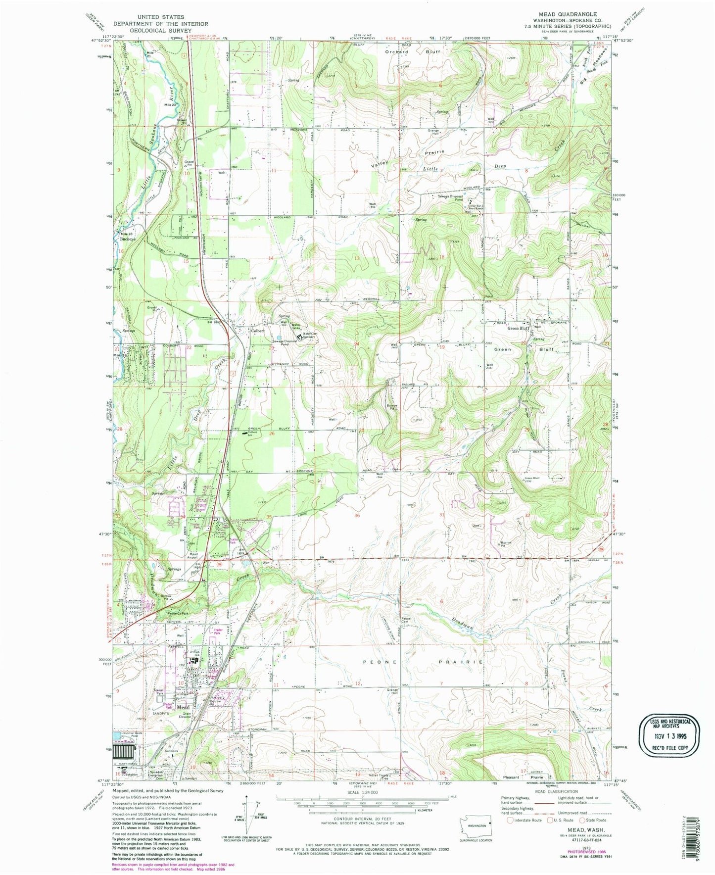
Classic USGS Mead Washington 7.5'x7.5' Topo Map
Couldn't load pickup availability
Historical USGS topographic quad map of Mead in the state of Washington. Map scale may vary for some years, but is generally around 1:24,000. Print size is approximately 24" x 27"
This quadrangle is in the following counties: Spokane.
The map contains contour lines, roads, rivers, towns, and lakes. Printed on high-quality waterproof paper with UV fade-resistant inks, and shipped rolled.
Contains the following named places: Big Meadows, Boyle R & D Airport, Bruce Road Bridge, Buckeye, Circle Bar J Boys Ranch, Colbert, Colbert Elementary School, Colbert Post Office, Colbert Road Bridge, Dean, Faith Christian School, Green Bluff, Green Bluff Census Designated Place, Indian Treaty Tree, Little Spokane Drive Bridge, Mater Cleri Seminary, Mead, Mead Census Designated Place, Mead Flying Service, Mead Junior High School, Mead Post Office, North Fork Little Deep Creek, Pell Creek, Peone Cemetery, Peone Creek, Peone Creek Park, Peone Prairie, South Fork Little Deep Creek, Spokane County Fire District 4 Station 44 Colbert, Spokane County Fire District 4 Station 47 Greenbluff, Spokane County Fire District 9 Station 92, Sunshine Acres Airport, Valley Prairie, Wayside, ZIP Code: 99005