MyTopo
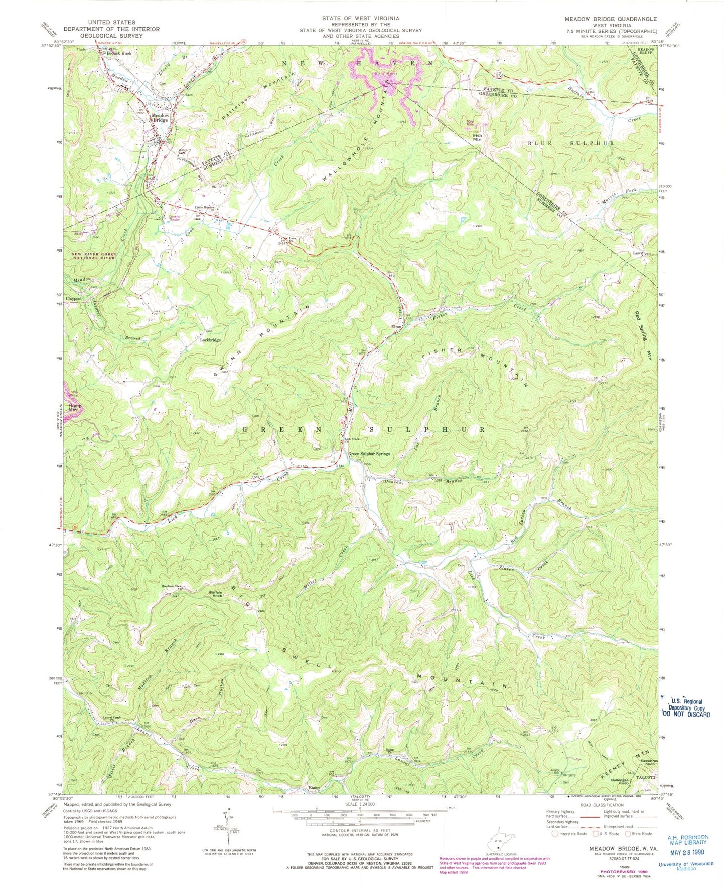
Classic USGS Meadow Bridge West Virginia 7.5'x7.5' Topo Map
Couldn't load pickup availability
Historical USGS topographic quad map of Meadow Bridge in the state of West Virginia. Map scale may vary for some years, but is generally around 1:24,000. Print size is approximately 24" x 27"
This quadrangle is in the following counties: Fayette, Greenbrier, Summers.
The map contains contour lines, roads, rivers, towns, and lakes. Printed on high-quality waterproof paper with UV fade-resistant inks, and shipped rolled.
Contains the following named places: Bachelors Hall School, Beech Grove School, Beelick Knob, Big Swell Mountain, Bragg Cemetery, Buffalo Knob, Buffalo School, Claypool, Claypool Branch, Coon Creek, Cox Branch, Dark Hollow, Duncan Branch, Elton, Elton Post Office, Fisher Creek, Fisher Mountain, Grapevine School, Green Sulphur Spring, Green Sulphur Springs, Green Sulphur Springs Post Office, Gwinn Mountain, Gwinns Siding, Halidon School, Hunley School, Irish Mountain, James Harless Spring, Jones School, Lane School, Lane United Methodist Church, Laurel Branch, Laurel Creek Church, Lawn, Lick Creek Church, Lily School, Little Meadow Church, Lively Branch, Lively School, Lockbridge, Lockbridge Methodist Church, Lockbridge Post Office, Meadow Bridge, Meadow Bridge Elementary School, Meadow Bridge High School, Meadow Bridge Junior-Senior High School, Meadow Bridge Post Office, Meadow Bridge Public Library, Meadow Bridge Volunteer Fire Department, Mill Creek, Miller Creek, Mountain View Church, Mountain View School, Mudlick Branch, New River District, Patterson Mountain, Patterson School, Ramp, Ramp Church, Ramp Holiness Church, Red Spring Branch, Red Spring School, Slater Creek, Springdale School, Tina, Town of Meadow Bridge, Victor School, Wallowhole Mountain, Wickline Cemetery, Willis Branch, ZIP Codes: 25976, 25985