MyTopo
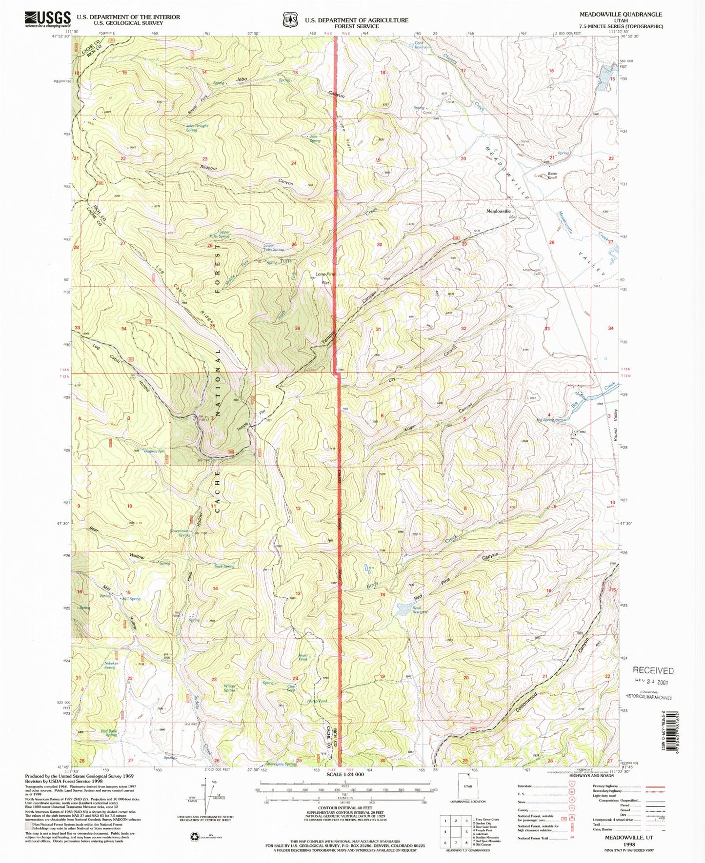
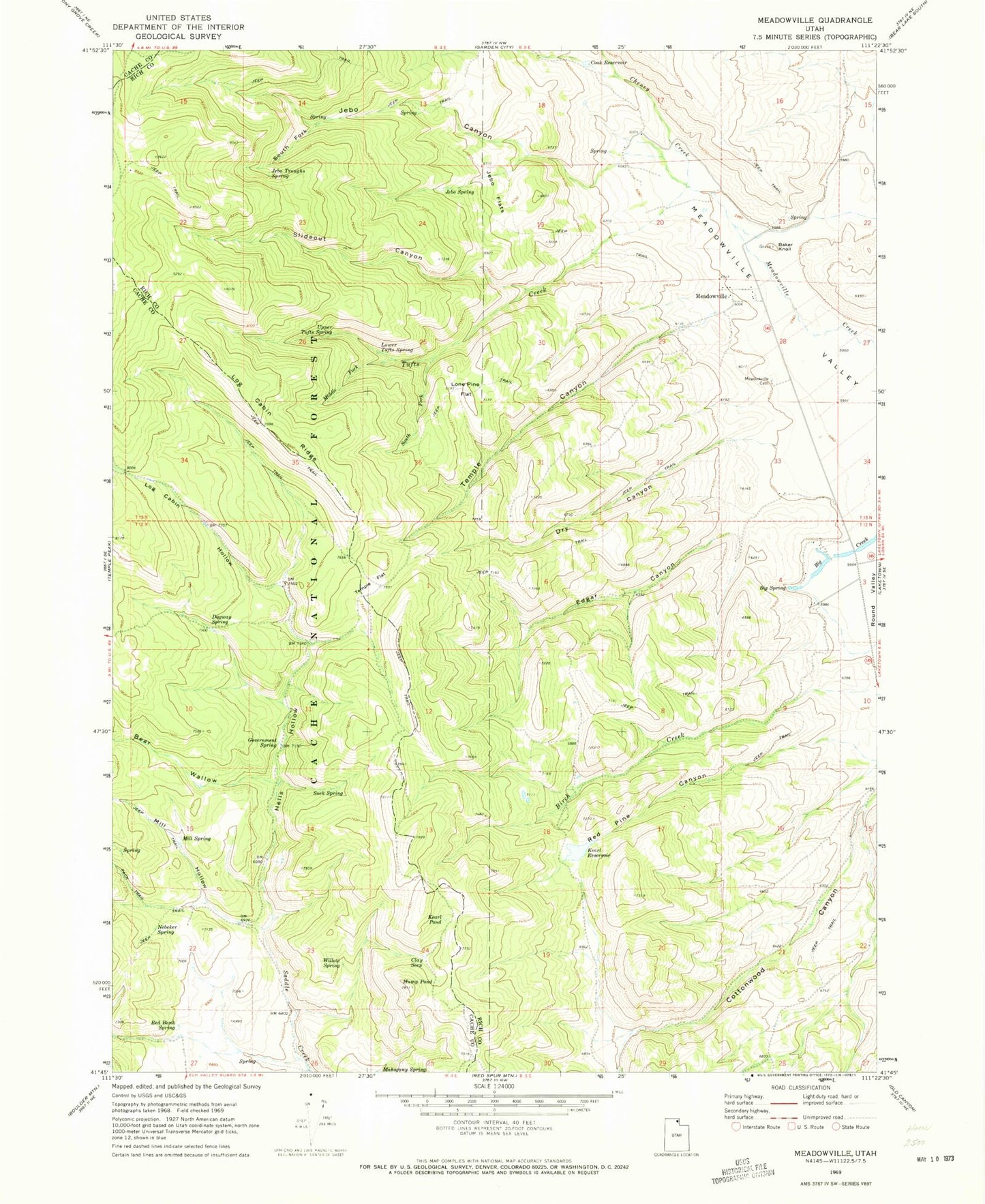
Classic USGS Meadowville Utah 7.5'x7.5' Topo Map
Couldn't load pickup availability
Historical USGS topographic quad map of Meadowville in the state of Utah. Map scale may vary for some years, but is generally around 1:24,000. Print size is approximately 24" x 27"
This quadrangle is in the following counties: Cache, Rich.
The map contains contour lines, roads, rivers, towns, and lakes. Printed on high-quality waterproof paper with UV fade-resistant inks, and shipped rolled.
Contains the following named places: Baker Knoll, Bear Wallow, Big Spring, Birch Creek, Clay Seep, Cook Ranch, Cook Reservoir, Dry Canyon, Dugway Spring, Edgar Canyon, Government Spring, Hells Hollow, Hump Pond, Jebo Canyon, Jebo Flats, Jebo Spring, Jebo Troughs Spring, Kearl Pond, Kearl Reservoir, Log Cabin Hollow, Log Cabin Ridge, Lone Pine Flat, Lower Tufts Spring, Mahogany Spring, Meadowville, Meadowville Cemetery, Middle Fork Tufts Creek, Mill Hollow, Mill Spring, Nebeker Spring, Red Bank Spring, Red Pine Canyon, Slideout Canyon, South Fork Jebo Canyon, South Fork Tufts Creek, Suck Spring, Temple Canyon, Temple Flat, Tufts Creek, Upper Tufts Spring, Willow Spring