MyTopo
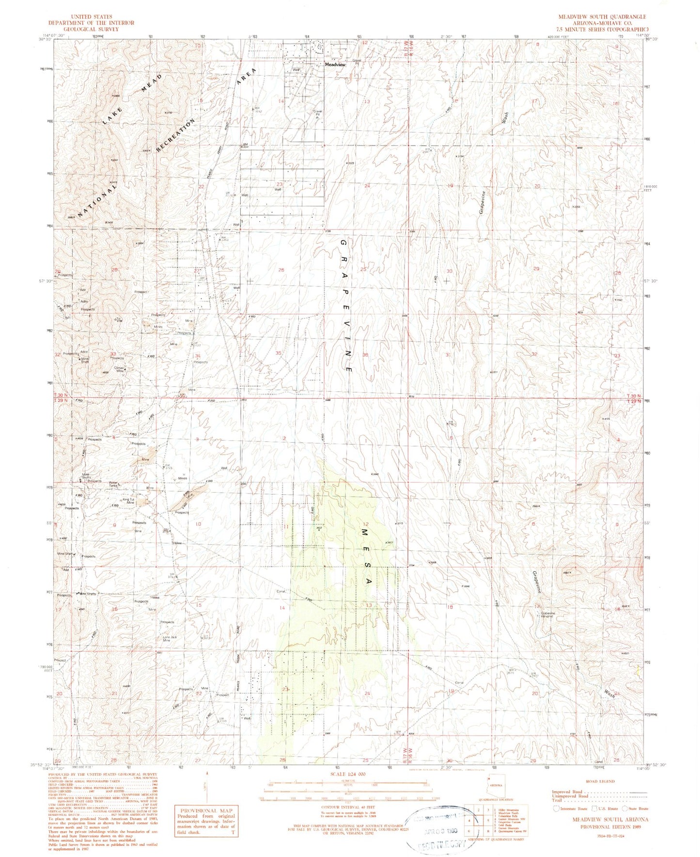
Classic USGS Meadview South Arizona 7.5'x7.5' Topo Map
Regular price
$16.95
Regular price
Sale price
$16.95
Unit price
per
Couldn't load pickup availability
Historical USGS topographic quad map of Meadview South in the state of Arizona. Map scale may vary for some years, but is generally around 1:24,000. Print size is approximately 24" x 27"
This quadrangle is in the following counties: Mohave.
The map contains contour lines, roads, rivers, towns, and lakes. Printed on high-quality waterproof paper with UV fade-resistant inks, and shipped rolled.
Contains the following named places: Carlos Elmer's Joshua View, Climax Mine, Grapevine Well, Grapevine Windmill, King Tut Mine, Lone Jack Placer Mine, Meadview Census Designated Place, ZIP Code: 86444