
MyTopo
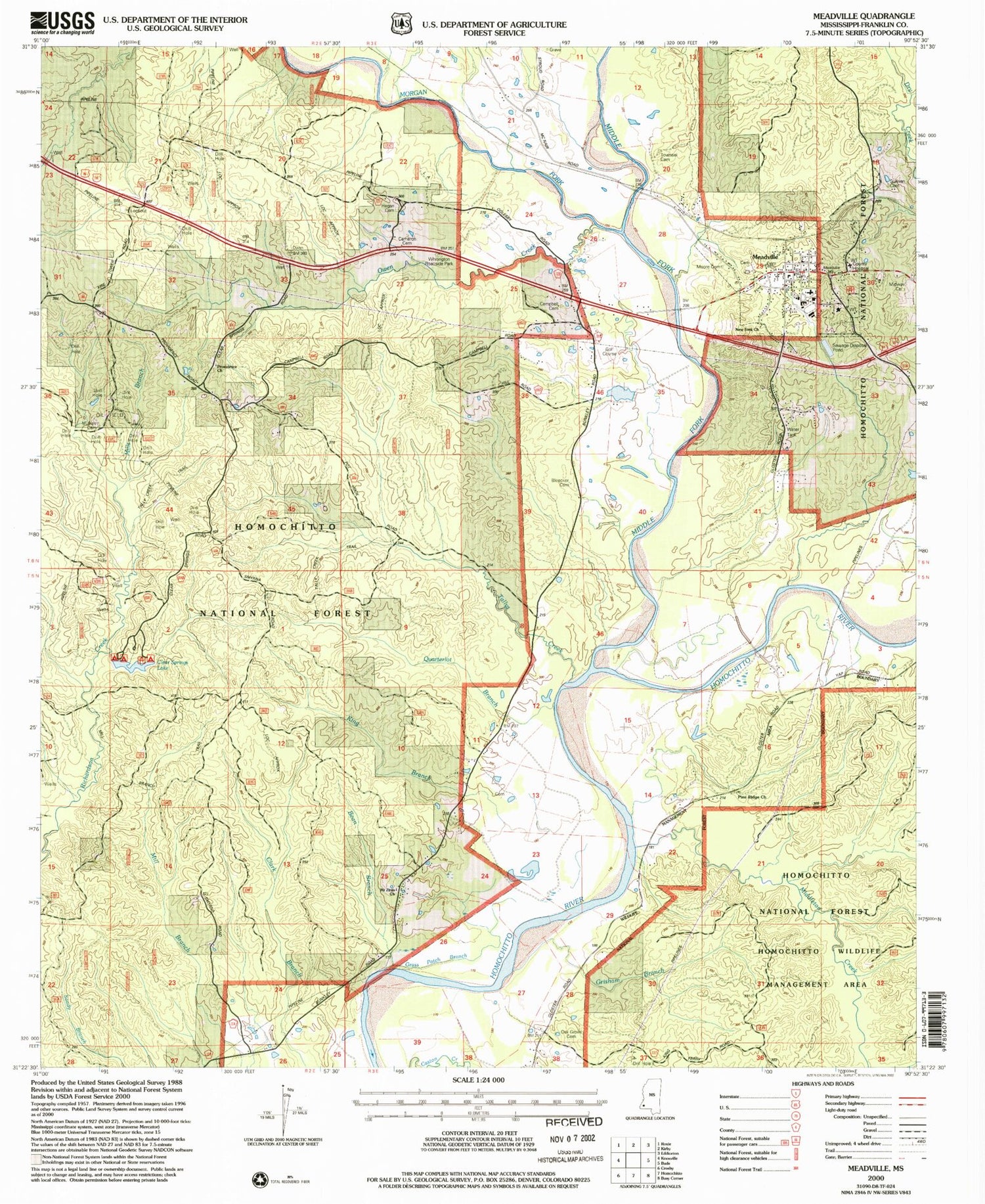
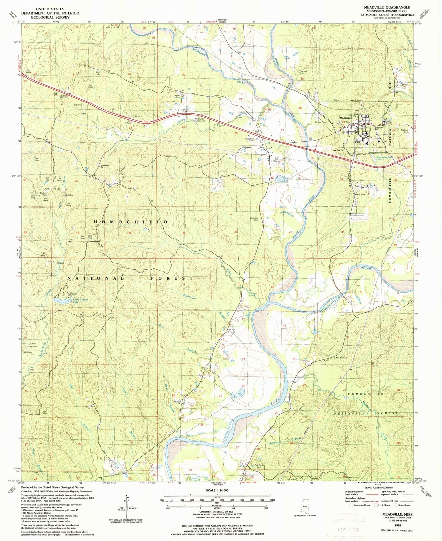
Classic USGS Meadville Mississippi 7.5'x7.5' Topo Map
Couldn't load pickup availability
Historical USGS topographic quad map of Meadville in the state of Mississippi. Typical map scale is 1:24,000, but may vary for certain years, if available. Print size: 24" x 27"
This quadrangle is in the following counties: Franklin.
The map contains contour lines, roads, rivers, towns, and lakes. Printed on high-quality waterproof paper with UV fade-resistant inks, and shipped rolled.
Contains the following named places: Bean Branch, Bleecker Cemetery, Brown Cemetery, Cameron Cemetery, Campbell Cemetery, Clear Springs Lake, Grass Patch Branch, Grisham Branch, Hegan Cemetery, King Branch, Meadville, Middle Fork Homochitto River, Middleton Creek, Midway Cemetery, Mills Branch, Moore Cemetery, Morgan Fork, Mount Pleasant Church, Mount Zinia Church, Mulkey Cemetery, New Fork Church, Oak Grove Cemetery, Owen Creek, Pine Ridge Church, Providence Baptist Church, Quarterlot Branch, Smyrna Cemetery, Sullivan Cemetery, Tallys Creek, Townsel Cemetery, Whitington Roadside Park, Clear Springs Dam, Galverth Lake Dam, Franklin County, Suffolk, Mount Zinia Church, Bunkley Oil Field, Kirby Oil Field, Providence Oil Field, Tallys Creek Oil Field, South Providence Oil Field, Butler (historical), Frankin County Courthouse, Franklin County Memorial Hospital, Frankin Elementary School, Franklin High School, Meadville Cemetery, Providence Cemetery, Franklin Lookout Tower, Clear Springs Recreation Area, Franklin Lookout Tower, Homochitto National Forest, Supervisor District 3, Town of Meadville, Meadville Volunteer Fire Department, Meadville Police Department, Franklin County Sheriff's Office, Meadville Post Office


