MyTopo
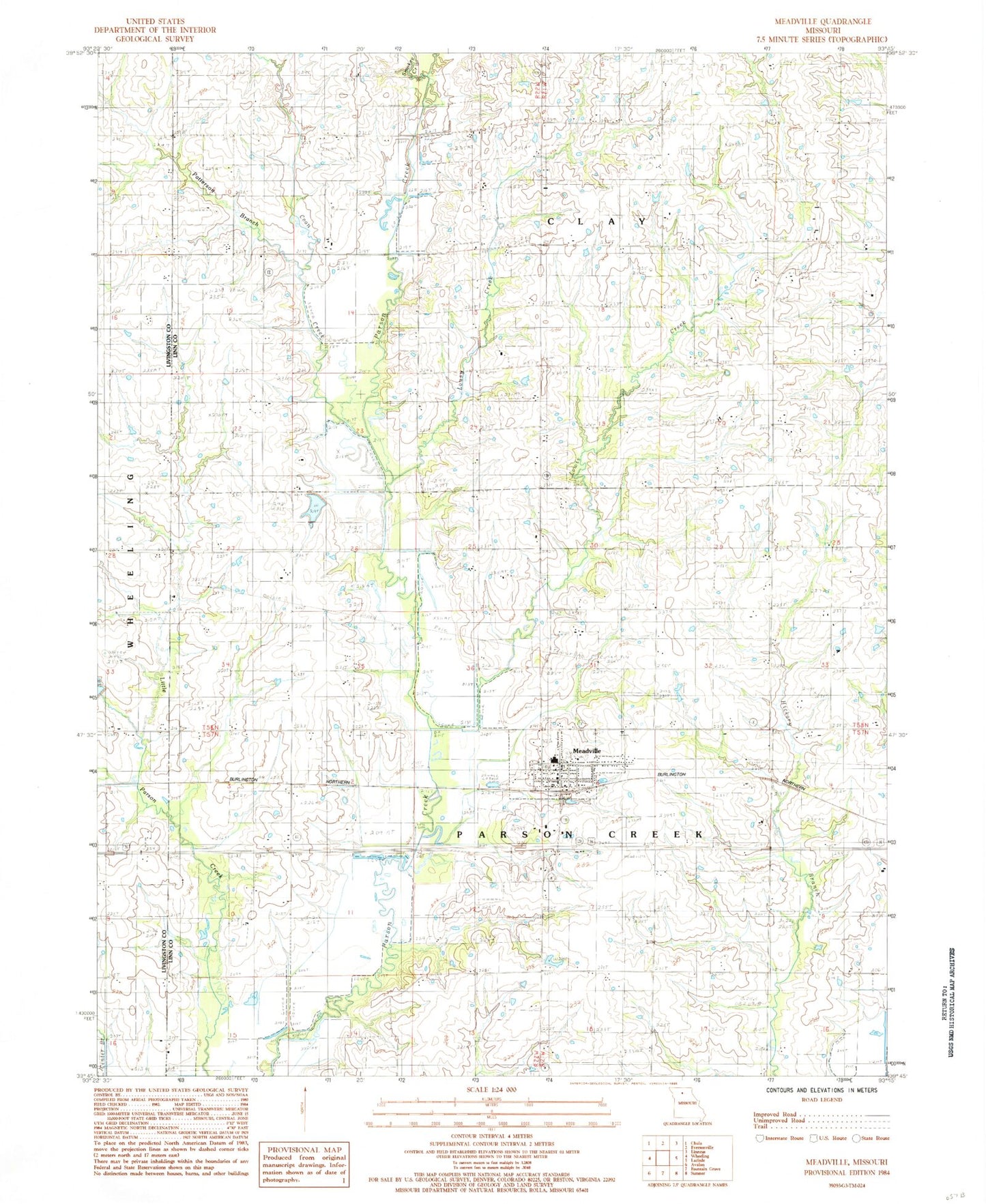
Classic USGS Meadville Missouri 7.5'x7.5' Topo Map
Couldn't load pickup availability
Historical USGS topographic quad map of Meadville in the state of Missouri. Map scale may vary for some years, but is generally around 1:24,000. Print size is approximately 24" x 27"
This quadrangle is in the following counties: Linn, Livingston.
The map contains contour lines, roads, rivers, towns, and lakes. Printed on high-quality waterproof paper with UV fade-resistant inks, and shipped rolled.
Contains the following named places: Belcher School, Bethel Cemetery, Bethel School, Botts Cemetery, Botts School, Centerview School, City of Meadville, Coon Creek, Duncan School, East Point School, Eureka Church, Eureka School, Fairview School, Lewis Creek, Lousy Creek, Lowell, Lowell Post Office, Meadville, Meadville Cemetery, Meadville Community Fire Department, Meadville Post Office, Patterson Branch, Pleasant Point Church, Pleasant Valley School, Smoky Creek, Township of Clay, Township of Parson Creek, ZIP Code: 64659