MyTopo
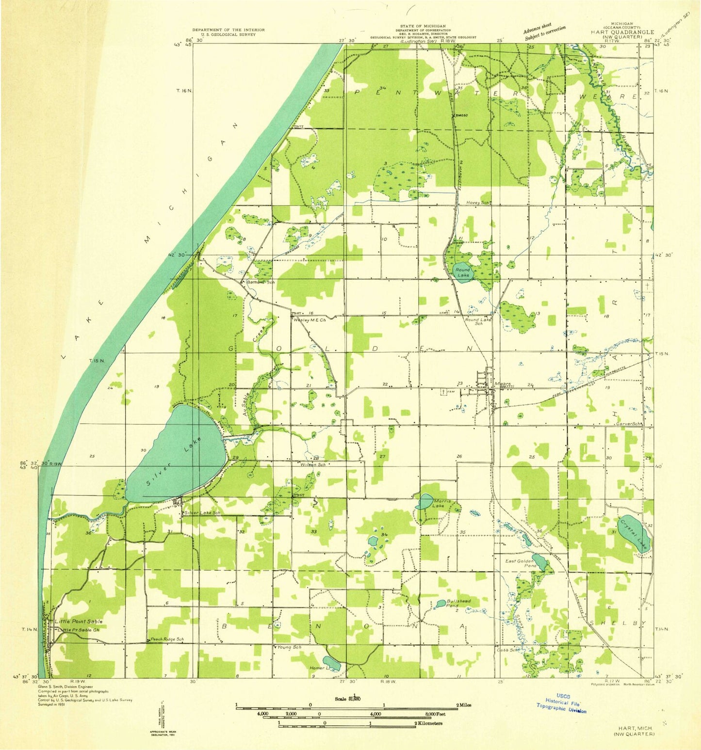
Classic USGS Mears Michigan 7.5'x7.5' Topo Map
Couldn't load pickup availability
Historical USGS topographic quad map of Mears in the state of Michigan. Map scale may vary for some years, but is generally around 1:24,000. Print size is approximately 24" x 27"
This quadrangle is in the following counties: Oceana.
The map contains contour lines, roads, rivers, towns, and lakes. Printed on high-quality waterproof paper with UV fade-resistant inks, and shipped rolled.
Contains the following named places: Au Sable Creek, Bullhead Pond, Cargill Creek, Cedar Point Park, Church of Jesus Christ of Latter Day Saints, Colonial Golf Courses, Cornerstone Community Church, Crystal Lake, East Golden Pond, East Golden Post Office, East Golden Station, First Baptist Church, Garver School, Golden Drainage Ditch, Golden Elementary School, Golden Sands Golf Course, Golding Post Office, Hart Cemetery, Hart Rest Area, Homer Lake, Hovey School, Hunter Creek, Lake Michigan United Methodist Church, Lambricks Creek, Mears, Mears Cemetery, Mears Census Designated Place, Mears Methodist Church, Mears Post Office, Mears Station, Memorial Family Care Center, Mission Covenant Church, Morris Lake, Oceana Christian School, Oceana County Historical Park and Museum, Pines Mobile Home Park, River Farm Campground, Round Lake Cemetery, Round Lake School, Silver City II Campground, Silver Creek RV Resort, Silver Lake Airport, Silver Lake Resort and Campground, Silver Lake State Park Campground, Township of Golden, Upper Silver Lake, West Golden Church, West Golden Wesleyan Church, Wilson School, WSAB-FM (Pentwater), WVKG-FM (Pentwater), Wyckoff Lake, Yogi's Bears Jellystone Park, ZIP Code: 49436