MyTopo
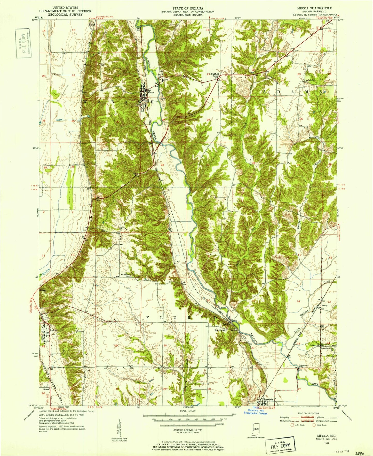
Classic USGS Mecca Indiana 7.5'x7.5' Topo Map
Couldn't load pickup availability
Historical USGS topographic quad map of Mecca in the state of Indiana. Map scale may vary for some years, but is generally around 1:24,000. Print size is approximately 24" x 27"
This quadrangle is in the following counties: Parke.
The map contains contour lines, roads, rivers, towns, and lakes. Printed on high-quality waterproof paper with UV fade-resistant inks, and shipped rolled.
Contains the following named places: Bound Cemetery, Bradfield Corner, Coxville, Daily Chapel, Friendly Grove Church, Harry Evans Covered Bridge, Heaton Private Airport, Hixon Cemetery, Jessup, Jessup Covered Bridge, Liberty Church, Little Raccoon Creek, Lyford, Lyford Dike and Levee Association Ditch, Lyford Volunteer Fire Department, Mecca, Mecca - Wabash Township Volunteer Fire Department, Mecca Bridge, Mecca Elementary School, Mount Pleasant Cemetery, New Bethel Church, Numa, Orlea Cemetery, Red Covered Bridge, Rock Run, Roseville Covered Bridge, Sulphur Branch, Thorpe Ford Covered Bridge, Town of Mecca, Township of Florida, Township of Wabash, Union Cemetery, WAXI-FM (Rockville), Weisner Creek, Zacke Cox Bridge, ZIP Codes: 47860, 47874