MyTopo
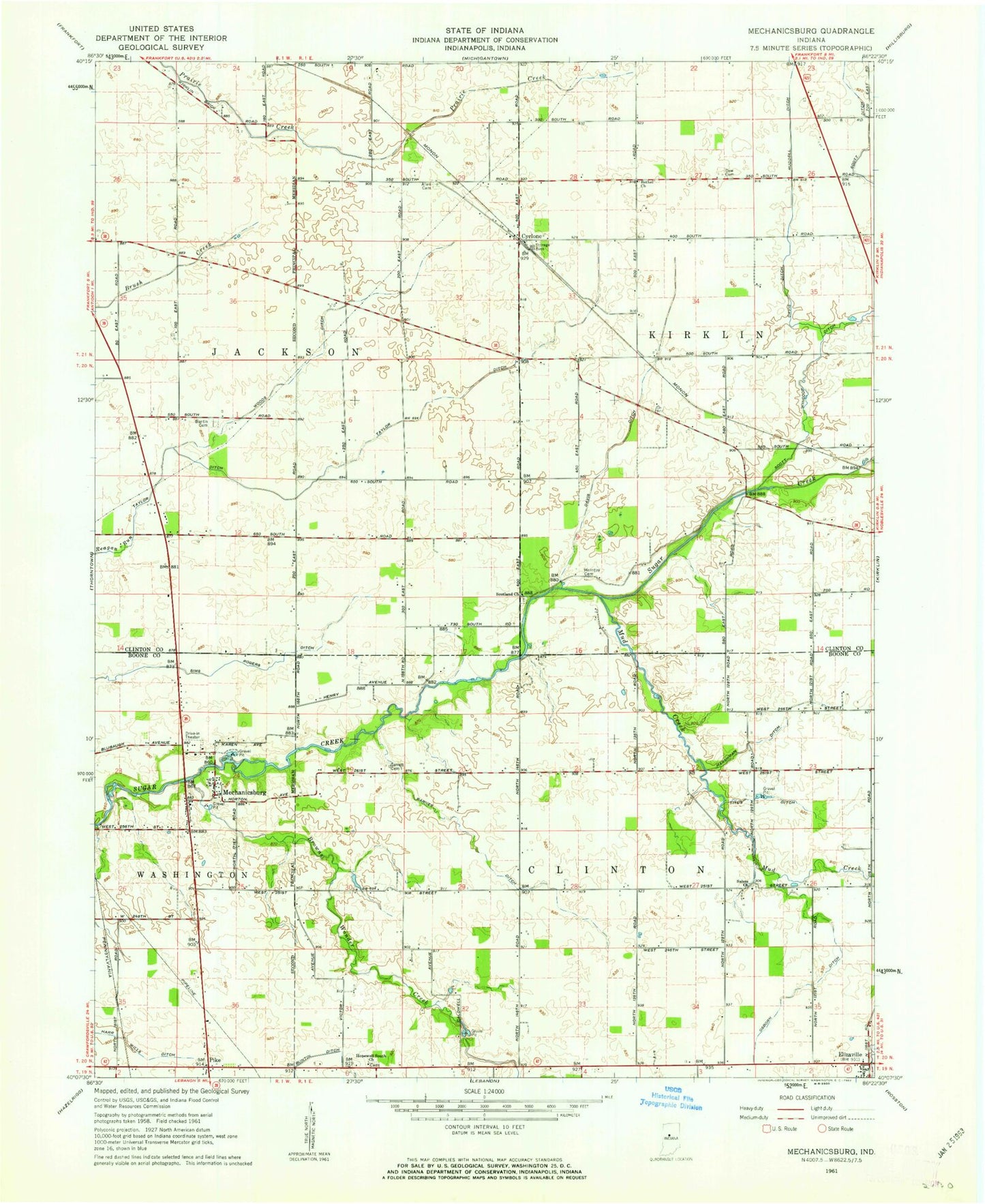
Classic USGS Mechanicsburg Indiana 7.5'x7.5' Topo Map
Couldn't load pickup availability
Historical USGS topographic quad map of Mechanicsburg in the state of Indiana. Map scale may vary for some years, but is generally around 1:24,000. Print size is approximately 24" x 27"
This quadrangle is in the following counties: Boone, Clinton.
The map contains contour lines, roads, rivers, towns, and lakes. Printed on high-quality waterproof paper with UV fade-resistant inks, and shipped rolled.
Contains the following named places: Allen Cemetery, Barnes Ditch, Bethel Church, Browns Wonder Creek, Buntin Cemetery, Cyclone, Davis Ditch, Dew Cemetery, Elizaville, Garrett Cemetery, Harshman Ditch, Hopewell South Church, McIntire Cemetery, Mechanicsburg, Mud Creek, Osborn Ditch, Ruddell Ditch, Salem Church, Scotland Church, Scott Ditch, Scott Wincoop Ditch, Sims Rogers Ditch, Taylor Ditch, Titus Ditch, Township of Clinton, Woods Ditch